

Main Facts
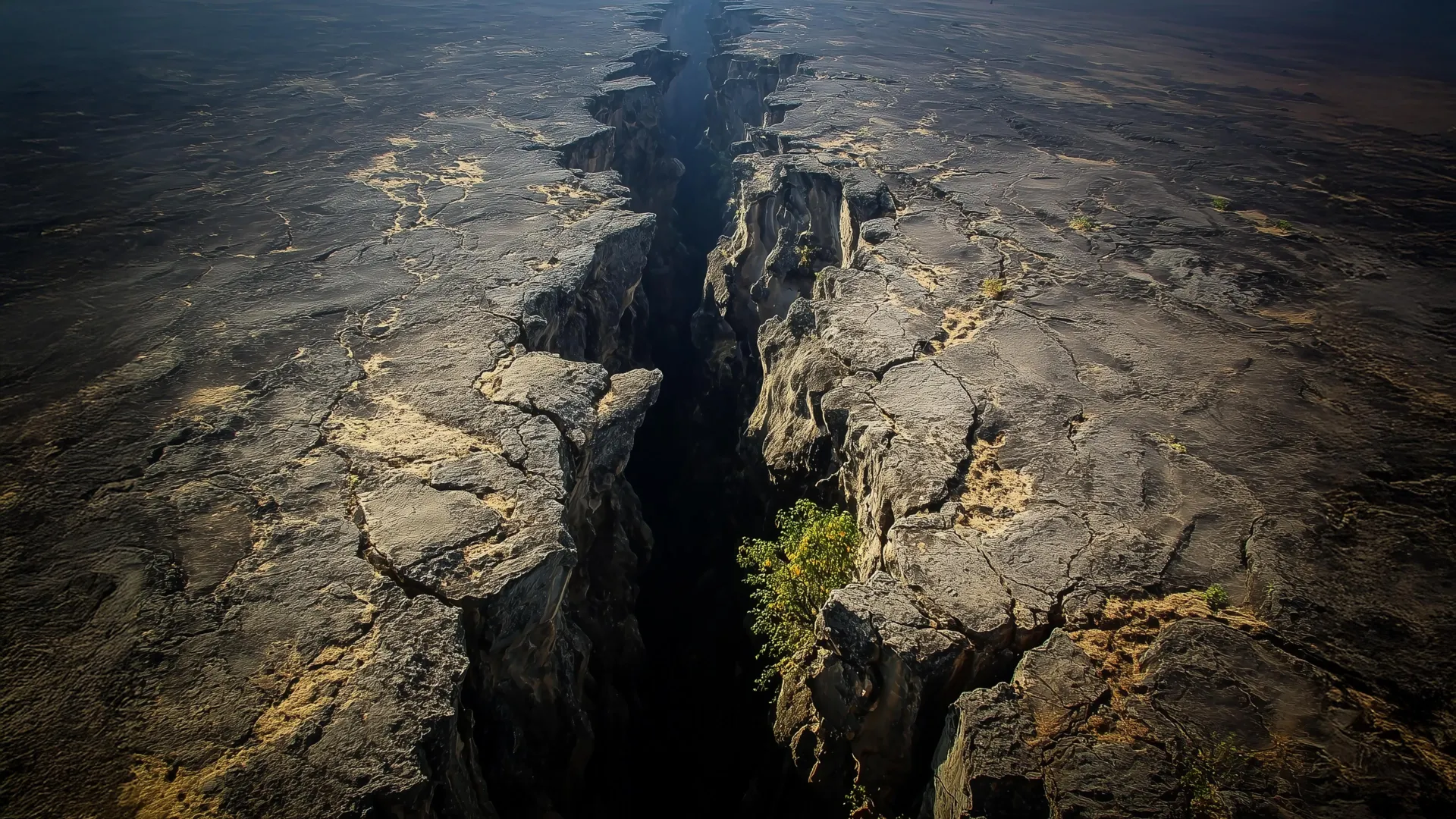
Deep within the Earth’s mantle, a colossal upwelling of superheated rock known as the African Superplume is actively reshaping the surface of the African continent. For over a decade, geoscientists have puzzled over anomalies in tectonic deformation and seismic wave propagation observed across the East African Rift System (EARS)—the largest active continental rift zone on the planet. While textbook models of continental rifting predict that crustal stretching should occur strictly perpendicular to the orientation of a developing rift valley, high-precision global positioning system (GPS) measurements have revealed a striking paradox: parts of the region are actively deforming in a direction perfectly parallel to the rift itself.
Utilizing sophisticated 3D thermomechanical computer simulations, a research team led by Virginia Tech and New Mexico Tech has successfully linked this anomalous motion to the northward trajectory of the African Superplume. This monumental subterranean structure originates deep beneath southwest Africa, angling northeastward and progressively ascending closer to the Earth’s crust.
The new findings, published in the Journal of Geophysical Research, demonstrate that the EARS is not driven by a single geological engine. Instead, continental breakup in East Africa is governed by a complex interplay of two distinct forces operating at vastly different depths:
- Shallow Lithospheric Buoyancy Forces: Driven by variations in crustal density and elevation (such as the towering topography of the African Superswell), these forces govern the conventional, east-west extensional cracking and faulting that tears the crust apart.
- Deep Mantle Traction Forces: Driven by the immense thermal convection of the African Superplume, these subterranean currents exert lateral drag on the rigid tectonic plates above, forcing anomalous northward surface movements and aligning deep-seated minerals to create observed patterns of seismic anisotropy.
This dual-force model bridges a long-standing gap in geophysics, offering unprecedented clarity on how planetary processes spanning thousands of kilometers of depth can directly influence surface earthquakes, faulting, and the eventual birth of new ocean basins.
Chronology of Discovery: Tracking Millimeters Across Decades
To understand how scientists arrived at this breakthrough, one must trace a trail of precise measurements, technological advancements, and persistent scientific curiosity spanning more than twenty years.
Early Observations and the GPS Revolution
The story of this discovery begins around the turn of the century, when geophysicist D. Sarah Stamps—then a postdoctoral researcher—began analyzing spatial data collected by a growing network of continuous GPS stations across East Africa. These stations track signals transmitted from more than 30 satellites orbiting approximately 25,000 kilometers above the Earth.
By filtering atmospheric noise and accounting for orbital variables, Stamps and her colleagues achieved millimeter-scale precision in tracking surface movements. However, as the dataset matured over a 12-year period, the observations stubbornly refused to fit contemporary geological models. While the broader rifting zone exhibited the expected perpendicular pulling apart of the continental crust, localized regions showed undeniable vectors of movement running parallel to the structural grain of the rift.
The 2021 Interplay Hypothesis
Faced with these baffling vectors, Stamps’s research group at the Virginia Tech Geodesy and Tectonophysics Lab set out to test how shallow and deep forces might interact. In a foundational 2021 study, the team deployed preliminary 3D computational simulations to examine whether lithospheric buoyancy forces alone could account for the observations.
Those models yielded a clear verdict: while buoyancy forces successfully reproduced the classic east-west extensional deformation, they were entirely incapable of generating the northward, rift-parallel motion mapped by the GPS arrays. The scientific community was left searching for a deeper, more powerful mechanism capable of dragging the Earth’s rigid shell in an unexpected direction.
The 3D Thermomechanical Breakthrough
Entering the next phase of the investigation, Tahiry Rajaonarison—then a Ph.D. student under Stamps’s supervision at Virginia Tech, and later a postdoctoral researcher at New Mexico Tech—designed an advanced suite of 3D thermomechanical models. Moving beyond simple geometrical simulations, Rajaonarison’s numerical framework factored in thermodynamic properties, temperature-dependent rock viscosities, and mantle flow dynamics.
By isolating the mechanical effects of the African Superplume, the simulations successfully replicated both the anomalous surface velocities and the complex seismic anisotropy measured beneath the rift. Published in the Journal of Geophysical Research, these models transformed a decades-old observational mystery into a cohesive, physically grounded theory of multi-layered tectonic forcing.
Supporting Data and Geophysical Evidence
The credibility of the new thermomechanical model rests on convergence between surface geodesy, numerical simulations, and subterranean seismology.
Millimeter-Scale Geodesy
The empirical foundation of the discovery relies on continuous spatial monitoring. GPS monuments anchored directly into stable bedrock across East Africa recorded localized crustal velocities running parallel to the rift axis. Because these measurements achieve millimeter-level accuracy, researchers were able to rule out instrumental error, localized slope instability, or seasonal groundwater fluctuations as causes for the anomalous motion. The signal was continent-wide, systemic, and deeply rooted.
3D Thermomechanical Simulations
Rajaonarison’s models simulated the thermal and mechanical evolution of the African lithosphere and underlying asthenosphere over geological timescales. By varying parameters such as mantle viscosity, plume buoyancy, and crustal thickness, the team tested how hot, upwelling mantle material would interact with the base of the overriding African plate.
When the northward-migrating thermal flow of the African Superplume was introduced into the simulations, the resulting basal traction forces exerted on the lithosphere precisely matched the vector fields captured by Stamps’s GPS network.
Unlocking Seismic Anisotropy
Further validation came from seismic anisotropy—the phenomenon wherein seismic shear waves travel at different speeds depending on their orientation through subsurface rocks. This directional variation occurs when intense geological stress or flowing mantle currents align crystalline structures (such as olivine minerals) deep within the Earth.
Beneath the East African Rift System, seismologists had previously mapped patterns of seismic anisotropy running parallel to the rift valley. For years, the origin of this alignment was debated. Were the crystals aligned by ancient structural fabrics left over from past continental collisions, or by active mantle flow?
The new models demonstrated that the northward mantle flow of the African Superplume matches the orientation of the rocks inferred from seismic wave analysis. This alignment provides independent, subsurface confirmation that deep mantle dynamics are actively shaping the lithosphere, leaving a physical signature that seismic waves can detect.
Official Responses and Expert Insights
The study has drawn praise from across the international geoscience community for resolving a stubborn contradiction in rift tectonics and demonstrating the power of interdisciplinary numerical modeling.
Reflecting on the dual behavior of the Earth’s outer shell, D. Sarah Stamps—now an associate professor in the Department of Geosciences at the Virginia Tech College of Science—draws an intuitive analogy for how the planet’s lithosphere responds to stress across different timeframes and depths:
"If you hit Silly Putty with a hammer, it can actually crack and break," Stamps explains. "But if you slowly pull it apart, the Silly Putty stretches. So on different time scales, Earth’s lithosphere behaves in different ways."
This rheological duality explains why brittle upper-crustal rocks fracture to form earthquakes along faults, while deeper, hotter lithospheric rocks undergo ductile flow.
Lead author Tahiry Rajaonarison emphasizes that the new research does not discard established theories, but rather refines and expands them to account for planetary complexity:
"We are saying that the mantle flow is not driving the east-west, rift-perpendicular direction of some of the deformations, but that it may be causing the anomalous northward deformation parallel to the rift," Rajaonarison notes. "We confirmed previous ideas that lithospheric buoyancy forces are driving the rift, but we’re bringing new insight that anomalous deformation can happen in East Africa."
Weighing in on the broader implications of the work, Stamps highlights the value of Rajaonarison’s numerical modeling in advancing our understanding of fundamental planetary mechanics:
"We’re excited about this result from Dr. Rajaonarison’s numerical modeling because it provides new information about the complex processes that shape the Earth’s surface through continental rifting."
Broader Implications for Earth Science and Continental Breakup
The East African Rift System is widely regarded by geologists as the premier natural laboratory on Earth for studying how supercontinents fracture and split apart. Spanning thousands of kilometers through countries like Ethiopia, Kenya, Uganda, and Tanzania, the EARS offers a rare, real-time window into the early stages of ocean basin formation—a process that eventually birthed the Atlantic Ocean millions of years ago.
For decades, geological paradigms tended to view rifting through a simplified lens: either passive rifting driven purely by far-field tectonic plate boundary forces, or active rifting driven exclusively by thermal plumes rising from the deep mantle.
The findings from Stamps, Rajaonarison, and their colleagues dismantle this false dichotomy. By proving that shallow buoyancy forces and deep mantle traction forces operate in tandem—each responsible for distinct components of surface deformation and seismic anisotropy—the study points toward a more holistic, multi-layered model of continental breakup.
Why This Matters Beyond Academia
Understanding the precise mechanics of continental rifting carries practical implications for society:
- Natural Hazard Assessment: Detailed knowledge of how tectonic stress accumulates, distributes, and releases across complex fault networks improves seismic hazard mapping. This is critical for infrastructure development, urban planning, and disaster resilience across the rapidly growing populations of East Africa.
- Resource Exploration: The thermal and structural dynamics associated with mantle plumes and rifting control the formation of geothermal energy reserves, sedimentary basins, and valuable mineral deposits. A clearer picture of sub-surface fluid and heat migration aids in the sustainable exploration of these natural resources.
- Planetary Evolution: On a fundamental level, decoding the interactions between the deep mantle and the surface lithosphere refines our understanding of Earth’s thermal history, plate tectonic cycles, and the long-term geochemical evolution of our world.
As computational power grows and observational networks expand, geoscientists are steadily lifting the veil on the hidden engines that drive our planet. The East African Rift System, powered from below by the majestic sweep of the African Superplume and pulled apart from above by lithospheric buoyancy, stands revealed not as a simple crack in the crust, but as a dynamic masterpiece of deep-Earth engineering.
