

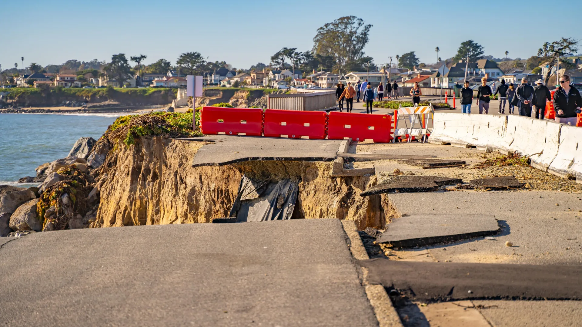
Main Facts: The Cascadia-San Andreas Connection
For decades, the seismic nightmare scenario for the West Coast of the United States was framed as a localized catastrophe. Seismologists warned of two distinct, monumental hazards: the long-overdue "Big One" along the Pacific Northwest’s Cascadia Subduction Zone, capable of unleashing a magnitude 9 or greater earthquake, and a catastrophic rupture along California’s infamous San Andreas Fault, similar to the devastating 1906 San Francisco event.
However, a groundbreaking study published in the journal Geosphere shatters the assumption that these two geologic behemoths operate in isolation. According to the research, a cataclysmic rupture of the Cascadia Subduction Zone might not just devastate Washington, Oregon, and Northern California—it could act as a geological trigger, immediately setting off a powerful, secondary earthquake along the San Andreas Fault to the south.
"It’s kind of hard to exaggerate what a M9 earthquake would be like in the Pacific Northwest," says Dr. Chris Goldfinger, a paleoseismologist at Oregon State University and the lead author of the study. "And so the possibility that a San Andreas earthquake would follow, it’s movie territory."
If confirmed by further study, this interconnected fault dynamic fundamentally rewrites the rules of West Coast hazard assessment. Instead of dealing with isolated regional disasters, emergency planners and government agencies must now confront the terrifying prospect of a cascading multi-state mega-disaster. Such an event would overwhelm emergency response networks, paralyze critical infrastructure from Vancouver to Los Angeles, and reshape our understanding of how tectonic plates communicate over vast distances.
Chronology: A Navigation Mistake That Altered Tectonic History
The revelation that the Cascadia and San Andreas faults might be mechanically linked did not come from a computer simulation or a theoretical physics model. It was born from a fortunate blunder on the high seas—a classic scientific accident that redirected the course of modern seismology.
The 1999 Research Cruise
In 1999, an expedition of marine geologists and paleoseismologists set sail on a research vessel with a singular objective: to reconstruct the historical timeline of ancient Cascadia earthquakes. By collecting sediment cores from the seafloor of the Pacific Northwest margin, the team hoped to read the history of prehistoric megathrust events preserved in the layers of mud and silt.
The Midnight Navigational Error
On the second night of the cruise, however, human error intervened. A graduate student on watch duty inadvertently entered the wrong latitude coordinates into the ship’s navigation system. Over the course of several hours, the autopilot dutifully steered the vessel roughly 90 kilometers south of its intended target zone. By daybreak, the ship had drifted entirely out of the Cascadia region and into unfamiliar waters off the coast of northern California, directly above the sphere of influence of the San Andreas Fault.
Dr. Goldfinger vividly recalls waking up to the discovery. "When I woke up, I was pretty hot," he admits, frustrated by the squandered ship time. But as he looked at the coordinates and assessed their location, a pragmatic instinct took over. "Once we were there, I thought, ‘well, let’s take a core here anyway.’"
Unlocking the Noyo Canyon Archive
The core sample extracted from Noyo Canyon, located near Fort Bragg, California, was intended to be a throwaway waypoint. Instead, it provided a geological Rosetta Stone.
When the researchers analyzed the core back in the laboratory, they found an unexpected archive of prehistoric seismic activity stretching back roughly 3,000 years. The sediment contained repeated, alternating layers known as turbidites—evidence of massive underwater landslides, or turbidity currents, triggered by severe ground shaking.
Ordinarily, a single turbidity deposit displays a predictable, graded structure: heavier, coarse sand settles to the bottom first, followed by progressively finer grains of silt and clay as the current loses momentum. But the Noyo Canyon cores defied this rule. Many of the deposits appeared in distinct pairs, featuring an unorthodox sequence that left the scientific team baffled.
"There were these big, thick, sandy doublet events where it had a fine-grained element, and on top of it was a very coarse-grained sandy unit," Goldfinger explains. "And we were just scratching our heads."
Supporting Data: Deciphering the Geological Doublets
Cracking the mystery of the Noyo Canyon doublets required rigorous dating techniques and comparative analysis with sediment cores collected thousands of kilometers to the north.
Radiocarbon Dating and Chronological Alignment
To determine when these anomalous double layers formed, the research team employed high-resolution radiocarbon dating on organic fragments trapped within the sediment. The results revealed a stunning chronological overlap. Many of the paired deposits found north of Cape Mendocino (in the Cascadia zone) and south of it (near the San Andreas Fault) had formed at virtually the same time, well within the margin of error for radiocarbon dating.
The statistical probability of these events occurring simultaneously by mere coincidence was astronomically low. The researchers systematically ruled out alternative hypotheses, such as severe storm surges, localized sea-level changes, or extreme weather events. The only phenomenon capable of generating massive, synchronous underwater landslides across such a vast geographic expanse was powerful, concurrent, or closely spaced seismic activity.
The Upside-Down Stratigraphy Explained
The team ultimately formulated a compelling mechanism to explain the inverted, double-layer sediment structure:
- The Primary Shock: A massive megathrust earthquake strikes the Cascadia Subduction Zone (magnitude 9+). The intense, prolonged shaking triggers a weak, fine-grained turbidity current near the San Andreas Fault system to the south. This material drifts down the canyon, forming the initial lower layer of sediment.
- The Secondary Trigger: The immense stress transfer from the Cascadia rupture propagates through the Earth’s crust, destabilizing the locked sections of the San Andreas Fault. Shortly thereafter, the San Andreas ruptures in its own major earthquake.
- The Secondary Deposit: The violent shaking from the San Andreas earthquake unleashes a massive, high-energy volume of heavy, coarse sand that rushes down Noyo Canyon, settling directly on top of the earlier fine-grained layer and creating the characteristic upside-down doublet stratigraphy.
Time Intervals: Minutes or Hours Apart
While exact timing between linked events remains difficult to constrain—as later sediment flows sometimes churn up and erase the physical record of the exact time gap—the physical evidence suggests a terrifying proximity. Several sample layers indicate that the second seismic event followed the first within a window of mere minutes to a few hours.
In geological terms, this constitutes an instantaneous chain reaction.
Official Responses and Scientific Implications
The publication of this study in Geosphere has sent ripples through the geological and emergency management communities. For years, federal, state, and local agencies have based their disaster planning models on the premise of isolated fault systems. The revelation that a Cascadia megathrust event could act as a geological domino, immediately igniting the San Andreas Fault, forces a total overhaul of these assumptions.
The ShakeOut Paradigm Challenged
Emergency exercises like the "Great ShakeOut" drills have traditionally focused on preparing populations for either a Cascadia event or a San Andreas event, but rarely both in rapid succession. State geological surveys in Washington, Oregon, and California are now re-evaluating their hazard maps and disaster response frameworks.
Dr. Lucy Jones, a renowned seismologist not directly involved in the study, notes that while the concept of triggered earthquakes is well-established in seismology—such as aftershocks following a major mainshock—the scale of interaction between these two distinct plate boundary systems is unprecedented. "We have long known that stress changes from one earthquake can trigger another on an adjacent fault," Jones explains. "What this study suggests is that a mega-event of magnitude 9 can alter stress fields across tectonic boundaries in a way that overcomes the normal barriers separating distinct fault systems."
Emergency Infrastructure Strains
The primary concern for public officials is the compounding nature of the disaster. A magnitude 9 earthquake in the Pacific Northwest will already cause unprecedented structural damage, liquefaction, and tsunami inundation across Oregon, Washington, and northern California. Lifeline infrastructure—including interstate highways, electrical grids, communication cables, and natural gas pipelines—would be severely compromised or entirely destroyed.
If a San Andreas rupture follows hours or even days later, it would strike California’s heavily populated San Francisco Bay Area and Central Coast while emergency services are still mobilizing for the initial northern disaster. Mutual aid agreements between states would instantly collapse, as every jurisdiction from the Canadian border to Southern California would be simultaneously grappling with regional devastation.
Implications: Preparing for the Unimaginable
The human element of this research is starkly personal, even for the scientists who spend their lives studying the cold, unyielding mechanics of tectonic plates. Dr. Chris Goldfinger, whose academic and professional roots run deep in Northern California, admits that the findings have changed his own personal risk calculus.
"I’m from the Bay Area originally," Goldfinger reflects. "If I were in my hometown of Palo Alto, and Cascadia went off, I think I would drive east. There looks to me like a very high risk the San Andreas would go off next."
Moving Beyond "Movie Territory"
While Goldfinger half-jokingly refers to the scenario as "movie territory," emergency planners emphasize that the threat is entirely real and demands concrete action. Policymakers are being urged to accelerate seismic retrofitting programs for older buildings, bridges, and hospitals, particularly in regions where overlapping seismic zones could amplify structural fatigue.
Furthermore, public education campaigns must evolve. Citizens living along the West Coast can no longer view earthquake preparedness through a localized lens. Survival strategies must account for extended lifelines failures, prolonged isolation, and the possibility of secondary seismic hazards that arrive before rescue operations can even begin.
A Unified West Coast
Ultimately, the accidental navigation error of 1999 has given the scientific community an invaluable, if sobering, warning. The tectonic boundary of the western United States is not a collection of independent faults, but a deeply interconnected web of immense physical power. By recognizing that the Cascadia Subduction Zone and the San Andreas Fault may dance to the same geological rhythm, society gains a vital window of opportunity—time to strengthen infrastructure, revise emergency plans, and prepare for the day when the earth finally moves.
