

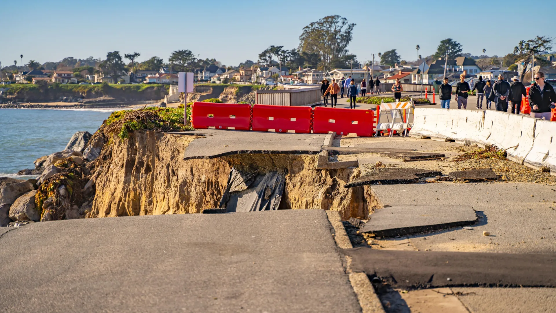
SAN FRANCISCO — For decades, emergency management agencies, structural engineers, and residents along the western seaboard of the United States have lived in the shadow of a terrifying geological inevitability. Referred to by scientists and disaster planners simply as "The Big One," a rupture of the Cascadia Subduction Zone off the Pacific Northwest coast is projected to unleash a magnitude 9 or greater earthquake. The subsequent cataclysm would combine violent, protracted ground shaking with towering tsunamis and massive coastal landslides, threatening immense devastation across Washington, Oregon, and Northern California.
Yet, newly published research indicates that the long-feared scenario in the Pacific Northwest may be only the opening act of a far more expansive regional disaster. According to a landmark study featured in the scientific journal Geosphere, a catastrophic megathrust event in Cascadia might not act in isolation. Instead, geological evidence suggests it could act as a tectonic trigger, waking its formidable southern neighbor: California’s iconic San Andreas Fault.
"It’s kind of hard to exaggerate what a M9 earthquake would be like in the Pacific Northwest," says Dr. Chris Goldfinger, a prominent paleoseismologist at Oregon State University and the lead author of the study. "And so the possibility that a San Andreas earthquake would follow—it’s movie territory."
If verified and integrated into modern hazard models, this potential for synchronized multi-fault ruptures fundamentally alters how seismologists assess earthquake risk, threatening to rewrite emergency response plans from Seattle to Los Angeles.
1. Main Facts: The Anatomy of a Dual-Fault Threat
To understand the magnitude of this discovery, one must look at the complex structural architecture underpinning the western edge of the North American continent. The region is a patchwork of shifting tectonic plates grinding against one another, creating distinct yet potentially interacting fault systems.
North of Cape Mendocino, California, the Juan de Fuca tectonic plate is slowly being forced underneath the North American plate at a convergent boundary known as the Cascadia megathrust. This locked subduction zone stores colossal amounts of elastic strain over centuries, which is periodically released in colossal, magnitude-9 or greater earthquakes—similar to the devastating 2011 Tōhoku earthquake in Japan.
South of Cape Mendocino, the tectonic regime shifts. Here, the Pacific plate and the North American plate meet at a transform boundary, sliding horizontally past one another along the San Andreas Fault system. This dynamic fault line is famous for generating historic disasters, including the catastrophic 1906 San Francisco earthquake and fire.
For decades, seismologists treated these two major systems as distinct, independent geological entities separated by the Mendocino Triple Junction. The prevailing assumption was that an earthquake on the Cascadia megathrust would expend its energy locally, while the San Andreas Fault would rupture entirely on its own schedule, governed by its own internal stress accumulation cycle.
The new research shatters this siloed perspective. By analyzing ancient marine sediment cores recovered off the coast of Northern California, Dr. Goldfinger’s team discovered that prehistoric earthquakes on the Cascadia subduction zone have frequently coincided with, or closely preceded, major ruptures on the northern segments of the San Andreas Fault. If these systemic links are real, a catastrophic rupture in the Pacific Northwest could ignite a devastating domino effect down the coast, subjecting multiple states to overlapping natural disasters before emergency responders can even begin to assess the initial damage.
2. Chronology: A Navigation Mistake That Unlocked 3,000 Years of History
The realization that Cascadia and the San Andreas Fault might be operating in a coordinated, terrifying partnership did not emerge from a high-tech computer simulation or a theoretical laboratory model. Instead, it was born from a fortunate human error that occurred more than two decades ago.
The 1999 Research Cruise
In the autumn of 1999, a team of marine geologists embarked on a research expedition aboard a scientific vessel. Their primary objective was to study ancient earthquakes along the Pacific Northwest margin by extracting sediment cores from the deep seafloor. By analyzing these layers, scientists hoped to reconstruct a precise historical timeline of past Cascadia megathrust ruptures.
However, a mundane navigation mistake completely altered the course of the investigation—and potentially the future of seismic research.
Overnight, a graduate student entered the incorrect latitude coordinates into the ship’s navigation system. Unbeknownst to the sleeping crew, the navigational error drove the research vessel approximately 90 kilometers (roughly 56 miles) south of its intended target area. By the time dawn broke and the scientists stepped onto the deck, their ship had drifted entirely out of the Cascadia study region and into the coastal waters governed by the San Andreas Fault system.
"We wound up off northern California," Dr. Goldfinger recalls. "When I woke up, I was pretty hot. But once we were there, I thought, ‘Well, let’s take a core here anyway.’"
Unearthing the Anomalous Sediment Layers
That impromptu decision in the waters off Noyo Canyon, near Fort Bragg, California, changed everything. As the crew extracted sediment cores from the canyon floor and brought them back to the laboratory for analysis, they began decoding a high-resolution archive of prehistoric seismic activity stretching back roughly 3,000 years.
The cores contained a repeating series of geological deposits known as turbidites. Turbidity currents are essentially underwater avalanches; when a massive earthquake shakes the continental shelf, loose sediment is dislodged from the slopes and rushes down submarine canyons, eventually settling onto the abyssal plain.
Ordinarily, a single turbidity current deposits a predictable, graded layer of sediment. As the underwater avalanche slows down, heavier sand grains settle to the bottom first, while finer, silty particles slowly drift down to form a smooth cap on top.
Yet, as the researchers examined the Noyo Canyon samples, they noticed something profoundly unusual. Many of the sediment deposits did not appear as single layers at all. Instead, they appeared in distinctive, recurring pairs—unusual geologic "doublets" that defied standard sedimentary models.
"There were these big, thick, sandy doublet events where it had a fine-grained element, and on top of it was a very coarse-grained sandy unit. And we were just scratching our heads," Dr. Goldfinger explains.
3. Supporting Data: Decoding the Geologic Doublets
To understand what forces could create such an upside-down, anomalous stratigraphy, the research team initiated a rigorous dating and cross-comparison campaign, pulling core samples from both north and south of Cape Mendocino.
Radiocarbon Dating and Chronological Overlap
Using advanced radiocarbon dating techniques on organic material trapped within the sediment layers, the scientists set out to determine the precise ages of the paired deposits.
The analytical results revealed an undeniable pattern: many of the paired sediment layers found in Northern California matched, within the statistical margins of radiocarbon dating precision, the exact dates of known Cascadia megathrust earthquakes recorded further north. This high degree of temporal overlap strongly implied a shared geological catalyst rather than a series of isolated, random coincidences.
Through a process of elimination, the research team ruled out alternate explanations such as severe local storms, oceanic currents, or independent local landslides. The sheer volume and spatial distribution of the deposits demanded a tectonic origin.
The Mechanics of an Upside-Down Stratigraphy
The puzzle of the "doublet" deposits finally clicked into place when the researchers conceptualized a chronological sequence of events triggered by a single, massive earthquake.
- The Primary Shock (Cascadia): A magnitude 9 earthquake strikes the Cascadia subduction zone. The intense ground motion travels hundreds of miles southward, triggering a weak, initial turbidity current near the San Andreas Fault that deposits a fine-grained layer of sediment into the Noyo Canyon.
- The Secondary Shock (San Andreas): Shortly thereafter—ranging from minutes to hours—the stress transferred by the massive Cascadia rupture or internal fault dynamics triggers a secondary, powerful rupture on the nearby San Andreas Fault. This second earthquake unleashes a massive, high-energy local slide, sending an enormous volume of coarse-grained sand rushing down the canyon to settle directly on top of the earlier fine-grained layer.
"A lightbulb went on and we realized that the Noyo channel was probably recording Cascadia earthquakes, and that at a similar distance, Cascadia sites were probably recording San Andreas earthquakes," Dr. Goldfinger says. "Well, what if? What if Cascadia went off and triggered a weak turbidity current near the San Andreas, and then the San Andreas went off some time later and triggered a very coarse, sandy deposit to come down? It would create this upside-down doublet stratigraphy."
4. Official Responses: The Seismic Community Reacts
The publication of the Geosphere study has sent ripples through the geological and emergency management communities. While the findings are based on robust paleoseismological data, mainstream seismologists and hazard mitigation experts are carefully evaluating the study’s implications for existing regional models, such as the Uniform California Earthquake Rupture Forecast (UCERF).
Re-Evaluating Fault Interaction Models
Historically, fault systems like Cascadia and the San Andreas were modeled as semi-autonomous systems because the distance between their primary rupture zones seemed too great for immediate mechanical triggering. However, recent global seismic events—such as the complex, multi-fault 2016 Kaikōura earthquake in New Zealand, which simultaneously ruptured more than 20 distinct faults—have forced seismologists to rethink traditional boundaries.
Dr. Sarah Sterling, a geophysicist unaffiliated with the study, notes that the geological record compiled by Goldfinger and his colleagues provides compelling empirical evidence for interconnected fault behavior.
"For years, our hazard models have largely focused on single-fault scenarios because they are easier to quantify," Dr. Sterling remarks. "Data like these sediment cores remind us that the Earth’s crust is an interconnected system. When a fault as massive as Cascadia unloads its immense tectonic energy, the stress redistribution across the western plate boundary is profound. It is entirely plausible that nearby fault systems near their breaking point are pushed over the edge."
Emergency Management and Infrastructure Planners
For state and federal disaster agencies, the prospect of a chained megathrust-to-transform earthquake sequence is a worst-case scenario.
Current emergency response frameworks in Washington, Oregon, and California are largely built around handling one major regional disaster at a time. State emergency management divisions rely on mutual aid agreements, wherein neighboring states send personnel, equipment, and medical supplies to assist the disaster zone.
If a Cascadia megathrust event simultaneously devastates Seattle, Portland, and surrounding rural communities while triggering a major earthquake along the San Andreas Fault that paralyzes the San Francisco Bay Area, the traditional mutual aid paradigm collapses entirely. There would be no unaffected neighboring states left to send reinforcements; every major population center along the Pacific Coast would be fighting for its own survival simultaneously.
5. Implications: Preparing for the Unimaginable
The psychological and practical implications of the Geosphere study weigh heavily on those who understand the mechanics of the West Coast fault systems. The thought of a cascading series of mega-earthquakes transforms abstract geological risks into an immediate, multi-state emergency preparedness crisis.
Infrastructure Vulnerability
Critical infrastructure along the Pacific Coast—including interstate highways, major bridges, electrical grids, water aqueducts, and communication networks—is already acknowledged to be vulnerable to a standalone Cascadia or San Andreas event.
A back-to-back rupture sequence would subject these lifelines to repeated, cumulative stress cycles. A bridge or highway overpass that manages to survive the initial minutes of shaking from a Cascadia event could easily suffer catastrophic structural failure when struck hours or even minutes later by a localized San Andreas rupture. Furthermore, ports and coastal shipping lanes would face compounded hazards from both tsunamis in the north and localized liquefaction and submarine landslides in California.
Personal Reflections and Mitigation Advice
The personal impact of these findings is perhaps best captured by Dr. Goldfinger himself, whose professional career has been dedicated to mapping the hidden dangers beneath the ocean floor, and whose personal roots lie directly in the crosshairs of the threat.
"I’m from the Bay Area originally," Dr. Goldfinger reflects. "If I were in my hometown of Palo Alto, and Cascadia went off, I think I would drive east. There looks to me like a very high risk the San Andreas would go off next."
While fleeing eastward may not be a practical or accessible strategy for the millions of residents inhabiting the coastal urban corridors, the study serves as an urgent wake-up call for individual and institutional preparedness.
Moving Forward
Emergency management officials emphasize that while scientists cannot predict the exact day or year of the next "Big One," studies like this underscore the absolute necessity of long-term resilience. Key recommendations from preparedness experts include:
- Extended Self-Sufficiency: Households along the Pacific Coast are increasingly advised to maintain emergency supplies—including water, non-perishable food, medical kits, and backup power—capable of sustaining families for a minimum of two weeks to a month, given that external emergency services would be overwhelmed across multiple states.
- Structural Retrofitting: Accelerating the seismic retrofitting of older unreinforced masonry buildings, soft-story apartment complexes, and critical bridge infrastructure remains a top municipal priority.
- Advanced Warning Systems: Continued investment in earthquake early warning systems, such as ShakeAlert on the West Coast, is vital to provide seconds to precious minutes of automated warning, allowing automated systems to slow trains, shut down pipelines, and halt surgery before the most destructive seismic waves arrive.
Ultimately, the revelation that the Cascadia Subduction Zone and the San Andreas Fault may dance to the same geological rhythm reminds humanity of the immense, dynamic power of the planet beneath our feet. As science continues to uncover the hidden connections knitting the Earth’s crust together, the mandate for communities along the Pacific Rim is clear: prepare not just for a single catastrophe, but for a world where the earth can move twice.
