

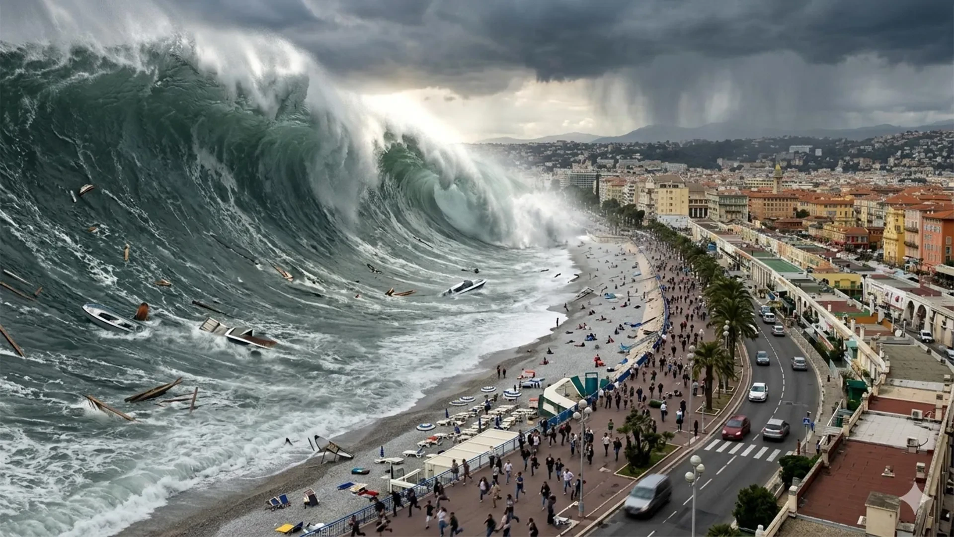
NICE, France — In the sun-drenched playgrounds of the French Riviera, where luxury yachts bob in glittering harbors and tourists crowd golden beaches, a terrifying geological reality is ticking down like a time bomb. If a tsunami strikes the Mediterranean coast near Nice, the initial waves could reach the shore in less than 10 minutes.
By contrast, France’s national tsunami warning center is designed to issue its primary alert to civil authorities within 15 minutes of a potentially hazardous earthquake. That math leaves a fatal gap. For thousands of beachgoers, fishermen, and coastal residents, an official warning text message or sirens could arrive long after the first wall of water has already smashed ashore.
Recognizing that technology alone cannot bridge this perilous timeline, researchers, municipal leaders, and emergency planners around Nice are pioneering a proactive paradigm shift. Instead of waiting for alarms to sound, they are mapping evacuation paths, establishing elevated refuge zones, and educating the public to recognize natural danger signs. The overarching philosophy is stark and uncompromising: the most critical survival decisions must be made before an emergency begins, not after the sea starts behaving strangely.
The Main Facts: A Misunderstood Threat in a Busy Basin
While the Pacific Ocean and regions like Japan or Indonesia are universally recognized as tsunami hotspots, the Mediterranean Sea is frequently dismissed as a tranquil, wave-free basin. UNESCO and international geological bodies have aggressively pushed back against this dangerous complacency.
On June 22, 2022, UNESCO issued a sobering warning: the probability of a tsunami wave exceeding one meter in height somewhere in the Mediterranean over the ensuing 30 years is close to 100 percent. While this statistical forecast is a basin-wide evaluation running through approximately 2052—rather than an immediate prediction of an imminent disaster—it underscores the underlying volatility of the region.
The Mediterranean possesses all the geological ingredients necessary to spawn dangerous tsunamis:
- Active Fault Lines: Tectonic activity along the Ligurian Sea directly threatens the French and Italian coasts.
- Plate Convergence: Farther south, the relentless collision of the African and Eurasian tectonic plates generates powerful earthquakes off the coast of North Africa.
- Underwater Landslides: Submarine slope failures can trigger localized, highly destructive tsunamis with virtually zero advance notice.
Crucially, experts emphasize that tsunamis do not always resemble the towering, cinematic walls of water depicted in Hollywood films. A tsunami can materialize as a sudden, aggressive rise or an unnerving retreat of the sea, followed by repeated, surging waves. Flooding can range from centimeters to several meters, but the real hazard often lies in the velocity of the water. Fast-moving currents can exert destructive forces equivalent to several tons per square meter against coastal structures, transforming ordinary surf into a raging, predatory torrent.
Historically, tsunamis have claimed more than 250,000 lives globally since 1970, dominated by mega-disasters in the Indian Ocean (2004) and Japan (2011). In the Mediterranean, however, the threat is historically documented, persistent, and dangerously close to shore.
Chronology of Risk: A History of Riviera Disasters
Montpellier researchers classify the Mediterranean as having the world’s most extensive historical tsunami record outside the Pacific. Along the French Riviera alone, approximately 20 notable events have been documented between the 16th century and the early 2000s, with several waves exceeding two meters in height. A look back at key historical events reveals how differently these marine hazards can unfold:
- February 23, 1887 (The Ligurian Earthquake): A powerful offshore earthquake, estimated between magnitude 6.5 and 6.8, ruptured the Ligurian Sea. Eyewitness accounts from Antibes and Cannes described the sea abruptly dropping by about one meter, stranding fishing boats on the exposed seabed. Moments later, waves approaching two meters surged violently over the beaches.
- October 16, 1979 (The Nice Port Collapse): Demonstrating that tsunamis do not always require tectonic shifts, a section of an active construction site for a new commercial port in Nice—situated right next to the international airport—catastrophically collapsed into the sea. The resulting underwater landslide and local tsunami claimed eight lives. Scientific reconstructions published in Natural Hazards revealed that local water heights reached 3.5 meters, pushing inland floods as far as 150 meters.
- May 21, 2003 (The Boumerdès Aftershocks): Proving that danger can originate thousands of kilometers away, a powerful earthquake in Boumerdès, Algeria, sent tsunami waves across the Mediterranean to the French Riviera in roughly 75 minutes. The event triggered abrupt sea-level drops of up to 1.5 meters, drained harbor basins, created violent whirlpools, and battered boats across eight different marinas. The varying damage exposed the phenomenon of "harbor resonance," where the unique geometry of a coastal basin amplifies water oscillations.
- December 4, 2022 (Stromboli Eruption): A flow of incandescent volcanic material cascaded into the sea at Italy’s Stromboli volcano, generating a localized tsunami that activated automated warning systems. Although Italy’s National Institute of Geophysics and Volcanology (INGV) reported no structural damage, the event served as a stark reminder that Mediterranean tsunami activity is an ongoing, present danger.
Supporting Data: Mapping the Exposure
To comprehend the scale of the challenge facing modern planners, one must look closely at the demographic and geographic data compiled by French government agencies and the University of Montpellier.
Researchers delineated a standardized coastal evacuation zone based on elevation, distance from the sea, and historical run-up data. As a planning baseline—not a forecast of exact wave heights—this zone generally encompasses all land lying below five meters in elevation and within 200 meters of the shoreline. Near river mouths and estuaries, this protective buffer zone expands to 500 meters inland.
Across the entire French Mediterranean coastline, including the island of Corsica:
- Footprint: The planning zone encompasses approximately 1,700 kilometers of coastline.
- Communities: 187 municipalities fall directly within the vulnerable zone.
- Permanent Population: At least 164,000 residents live year-round inside these boundaries.
- Seasonal Surge: During the peak of summer tourism, planners must account for an estimated 835,000 beach users crowding these exact coastal strips.
In the densely urbanized Nice Côte d’Azur metropolitan area, these numbers translate to an immense logistical hurdle. Computer modeling and photographic surveys by the University of Montpellier’s Laboratory of Geography and Land Planning estimate that beach attendance fluctuates wildly between 10,000 and 87,000 people depending on the season and hour of the day.
To solve this, researchers factored in human walking speeds, local slopes, urban obstacles, and potential bottlenecks. Using advanced algorithms, they mapped out the absolute fastest pedestrian evacuation routes leading to designated safety zones—referred to as areas beyond "waves’ reach." To date, nearly 100 secure refuge sites have been integrated into official operational evacuation blueprints.
Official Responses: Institutional Readiness and UNESCO Recognition
France’s national tsunami warning framework rests heavily upon the Centre d’alerte aux tsunamis (Cenalt), which has operated since July 2012. Integrated into the broader international monitoring system coordinated by UNESCO, Cenalt monitors seismic shifts across potential hazard zones and rapidly transmits initial notification messages to national civil protection authorities, such as the interdepartmental crisis management operational center (Cogic).
From there, alerts can be disseminated to the public via modern tools like FR-Alert, a mobile notification system capable of broadcasting geo-targeted emergency messages directly to cellular phones within threatened zones.
However, institutional authorities acknowledge the inherent limitations of technology. A tsunami spawned by an undersea landslide or a nearby Ligurian fault line leaves virtually no time for a human operator to verify seismic data, draft an alert, route it through civil defense channels, and broadcast it to a citizen’s phone before the water hits.
Nice Earns "Tsunami Ready" Status
Recognizing these tight timeframes, local officials have aggressively upgraded community-level preparedness. In June 2026, international validation arrived: UNESCO officially announced that the Nice Côte d’Azur metropolitan area had been granted prestigious Tsunami Ready recognition.
Administered under UNESCO’s Tsunami Ready Recognition Programme (TRRP), this credential evaluates municipalities against 12 strict indicators spanning risk assessment, coastal mapping, public education, emergency response planning, and 24/7 alert reception capabilities. Nice joins an elite group of pioneers, following Deshaies in Guadeloupe (recognized in 2023) and Cannes, which became mainland France’s first municipality to achieve the status in January 2024. Montpellier’s research teams provided crucial scientific and technical backing for these communities, establishing a gold standard for coastal safety across Europe and French overseas territories.
Implications: Changing Culture and Preparing for the Wave
Earning a plaque from UNESCO is only the beginning. Maps and algorithms are utterly useless if the public does not know how to interpret and act upon them.
To bridge this gap, the Nice project has deployed physical warning signs, conducted regular evacuation drills, and integrated safety education into local schools. Furthermore, a publicly accessible interactive digital platform allows residents and tourists to inspect evacuation zones, view designated routes, and study survival instructions before ever stepping foot on a beach.
International case studies validate these educational investments. A review conducted by GNS Science following the devastating March 11, 2011, tsunami in Japan revealed a remarkable 96% survival rate among people located within inundated areas, largely attributable to rigorous community education and ingrained evacuation drills. Conversely, the same review warned that individuals who hesitate, delay their escape, or wait passively for official confirmation suffer drastically higher casualty rates.
The Golden Rules of Tsunami Survival
For visitors and residents along the French Riviera, civil protection agencies emphasize a clear behavioral code:
- Trust Natural Warnings: A strong earthquake that makes it difficult to stand, a sudden, inexplicable recession of the sea, or a roaring ocean are immediate, unarguable evacuation orders. Do not wait for a siren.
- Move Inland on Foot: If an alert sounds or natural signs appear, immediately abandon vehicles. Drivers should pull over safely and proceed on foot toward higher ground or designated refuge sites.
- Stay Away: The first wave is rarely the largest. Destructive currents and secondary surges can ravage harbors and shorelines for hours. Evacuees must remain outside the hazard zone until local authorities officially declare it safe to return.
Ultimately, the transformation of the French Riviera holds a profound lesson for coastal communities worldwide. While advanced warning systems and international monitoring networks are vital components of modern disaster management, they cannot defy the laws of physics. When a tsunami can cross a basin in minutes, survival is no longer a matter of waiting for an alarm to ring—it is a matter of knowing your route, trusting your instincts, and escaping before the wave arrives.
