

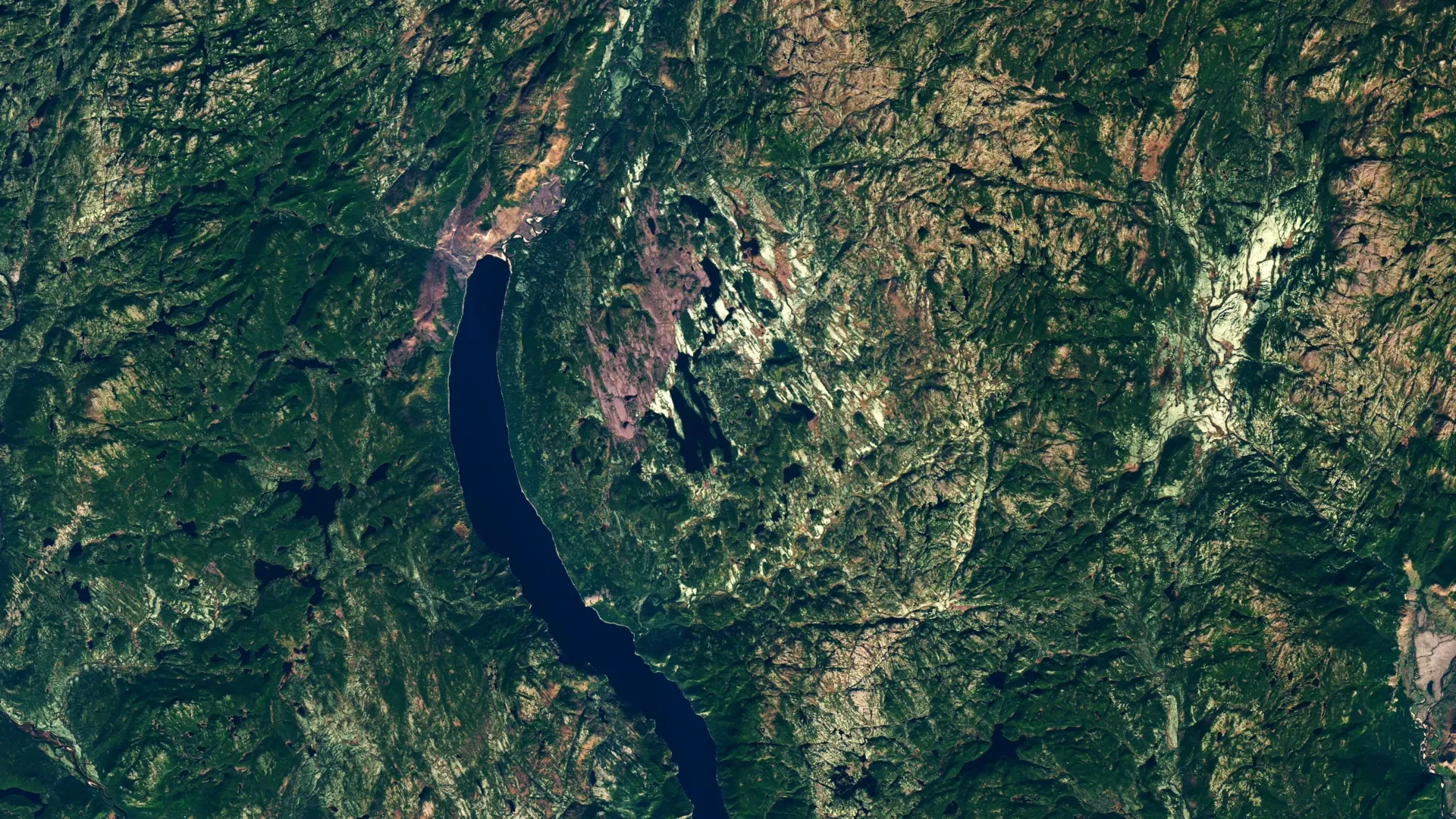
QUEBEC — What began as a routine weekend getaway search on digital mapping software has culminated in a monumental geological discovery deep in the Canadian wilderness. An amateur astronomer scouting for remote camping locations in Quebec’s rugged Côte-Nord region has inadvertently led scientists to confirm the existence of a massive, previously unrecognized meteorite impact crater.
Measuring approximately 25 kilometers (16 miles) in diameter, the newly identified structure—officially named Uhackatik following consultations with the Innu Council of Ekuanitshit—is the largest impact crater discovered anywhere on Earth since the 31-kilometer Hiawatha structure was identified beneath the Greenland ice sheet in 2018.
The find underscores the enduring value of citizen science in an era of global, open-source geospatial data. More importantly, it highlights how much of our own planet remains completely unexplored, even as scientists map distant worlds across the solar system.
Main Facts: The Uhackatik Impact Structure
While Earth boasts roughly 200 confirmed impact structures, geologists have long suspected that hundreds—if not thousands—more remain hidden beneath dense vegetation, glacial drift, or marine sediment. The confirmation of the Uhackatik structure brings a monumental new chapter to the geological history of North America.
- Location: The remote Côte-Nord region of Quebec, centered around a previously unassuming lake basin near Lake Marsal.
- Size: A massive, complex impact structure spanning roughly 25 kilometers (16 miles) across, featuring a central uplift and striking cliffs with columnar jointing.
- Age: Estimated at approximately 390 million years old, placing its formation during the Middle Devonian period.
- Origin: Initially misidentified by historical geological surveys as a volcanic diatreme (a funnel-shaped pipe of shattered rock formed by explosive magma), the site’s true identity was proven by the discovery of diagnostic shatter cones.
- Naming: Named Uhackatik after respectful consultations with the local Innu Council of Ekuanitshit.
- Significance: It is the 11th known impact structure in the province of Quebec and ranks as the most significant impact discovery globally in nearly a decade.
Chronology of a Discovery: From Satellite Maps to Swampy Wilderness
The path from a glowing computer screen in a home office to peer-reviewed geological confirmation reads like a modern scientific adventure novel.
Phase 1: The Accidental Observation (2024)
In 2024, amateur astronomer Joël Lapointe was using online satellite imagery to meticulously map out a potential camping and canoeing excursion into the isolated backcountry of Quebec’s Côte-Nord. While scanning the terrain, a distinct, perfectly circular depression near Lake Marsal caught his eye.
Familiar with astronomical formations and the quirks of terrestrial geography, Lapointe suspected the sweeping ring structure might be something far more extraordinary than a standard glacial valley or weathering basin. He wondered if it could be an impact crater. Rather than dismissing the thought, Lapointe reached out to specialists in both North America and Europe, presenting his coordinates and satellite observations.
Phase 2: Scientific Intrigue and Initial Skepticism
Lapointe’s inquiry sparked curiosity among a group of French researchers. At a 2024 meeting of the Meteoritical Society, the team formally presented the lake area as the center of a potential impact structure—which would be the 11th in Quebec.
The buzz eventually reached Dr. Gordon Osinski, a distinguished planetary geologist at Western University in Ontario and the director of the globally recognized Impact Earth database. Initially, Osinski was deeply skeptical. Circular geological anomalies can form through numerous terrestrial processes, including volcanism, glacial scouring, and salt dissolution. However, the symmetry and scale of the Quebec site were too compelling to ignore. Osinski resolved to see the anomaly with his own eyes, organizing a grueling field expedition for October 2025.
Phase 3: The Expedition Into the Canadian Shield (October 2025)
Reaching the site proved to be an exercise in extreme field logistics. Osinski and his research team traveled into the remote territory via floatplane. However, the pilot could not bring the aircraft all the way to the shoreline due to shallows and submerged hazards.
Carrying heavy geological sampling gear, cameras, and survival equipment, the scientists were forced to wade through 50 meters (165 feet) of freezing, hip-deep water just to reach the mainland.
Once ashore, the conditions deteriorated further. The landscape presented a labyrinth of rugged, swampy terrain choked with dense, interlocking vegetation. Osinski, who has spent decades conducting fieldwork across all seven continents, remarked that the location ranked among the most physically demanding environments he had ever encountered, noting its "deep, twisty, gnarly vegetation" and relentless swarms of insects.
Phase 4: Finding the Smoking Gun (October 2025)
Historical geological surveys of the area had previously classified the local breccia rocks as the remnants of a diatreme—a volcanic pipe created by an explosive underground eruption of gas and magma. For the first 24 hours of the expedition, the terrain seemed to support this volcanic hypothesis.
However, on the second day of fieldwork, the team struck definitive evidence. Scouring local rock outcrops, researchers uncovered numerous shatter cones. These rare, conical fractures propagate through rock under the unimaginable shock pressures of 2 to 10 gigapascals—pressures achievable almost exclusively by hypervelocity meteorite impacts or underground nuclear detonations.
"It’s the only unequivocal evidence of an impact event that you can see in the field with the naked eye," Osinski explained, confirming that the volcanic hypothesis had been soundly debunked.
Supporting Data and Geological Context
The physical dimensions and structural characteristics of the Uhackatik crater reveal an event of catastrophic proportions in Earth’s deep past.
A 25-kilometer-wide crater is classified as a complex impact structure. Unlike simple, bowl-shaped craters formed by smaller impacts (such as Meteor Crater in Arizona), complex craters exceed a few kilometers in diameter. As the shockwave dissipates, gravity causes the heavily fractured center of the crater to rebound upward, forming a central uplift—a geological dome of deep-seated rock pushed back toward the surface. This central uplift, paired with high perimeter cliffs displaying distinct columnar jointing, was mapped by Osinski’s team during their expedition.
Age Dating and Deep Time
Laboratory analysis of the collected rock samples indicates that the impact occurred roughly 390 million years ago, squarely within the Middle Devonian period.
This date holds specific interest for planetary scientists. It places the Uhackatik impact roughly 100 million years before a major, well-documented surge in terrestrial impact cratering. Researchers have long hypothesized that this later spike in asteroid impacts was triggered by massive cascading collisions within the main asteroid belt between Mars and Jupiter. Uhackatik predates that cluster, providing a vital baseline data point for understanding the flux of space rocks hitting Earth during the Paleozoic Era.
Official Responses and Perspectives
The discovery has generated excitement within both the professional geological community and the broader public, bridging the gap between academic research and citizen science.
- Dr. Gordon Osinski (Western University / Impact Earth Database): Reflecting on the difficulty of the expedition and the significance of the find, Osinski emphasized the raw violence of the ancient event. He noted that if an asteroid of this magnitude were to strike modern-day Quebec, the consequences would be catastrophic, resulting in "regional devastation on a scale that would wipe out major cities and have global climate impacts." Despite his prominent role training NASA astronauts on Earth’s analog impact sites—such as the younger, highly accessible Mistastin Lake (Kameshtashtan) crater in Labrador—Osinski confirmed that Uhackatik is far too remote to ever serve as an astronaut training ground.
- Joël Lapointe (Amateur Astronomer and Discoverer): For Lapointe, the journey from amateur map-scroller to scientific catalyst has been life-changing. Speaking to media outlets including CityNews and Radio-Canada, he admitted he was "over the Moon" when researchers verified his hunch. He has since become a vocal advocate for intuitive observation, urging people across all walks of life not to dismiss unusual findings simply because they fall outside their professional domain.
- Indigenous Consultation and Naming: Demonstrating a commitment to local heritage and stewardship, the research team collaborated closely with the Innu Council of Ekuanitshit. Through these discussions, the site was granted the traditional Innu name Uhackatik, cementing local cultural connection to the ancient geological monument.
Implications: The Power of Citizen Science
While the Meteoritical Society is expected to grant formal, official recognition to the Uhackatik structure at its next convening, the scientific community already considers the impact origin established beyond reasonable doubt.
Beyond its geological importance, the discovery serves as a powerful testament to the democratization of science. In the digital age, petabytes of high-resolution satellite imagery, topographic maps, and geological datasets are freely accessible to the public. Anyone with an internet connection and a curious mind can explore Earth’s hidden corners.
NASA and other space agencies actively cultivate this spirit through various citizen science initiatives:
- The Daily Minor Planet Project: Allows volunteers to scan astronomical data to help discover and track near-Earth asteroids and comets.
- Impact Flash: Invites participants to scour video footage and dark regions of the lunar surface for brief flashes of light produced by active meteoroid impacts.
- Exoasteroids: Empowers citizen scientists to hunt for circumstellar debris disks and evidence of asteroid belts orbiting distant stars beyond our solar system.
The story of Uhackatik proves that monumental discoveries are no longer restricted to institutional expeditions backed by massive budgets. Sometimes, all it takes is an amateur astronomer planning a summer camping trip, a sharp eye looking down at a glowing screen, and the willingness to ask a simple question: What made that circle?
