

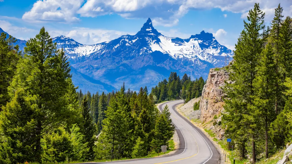
For generations, travelers heading toward the northeastern entrance of Yellowstone National Park have treated the stretch between Red Lodge and Cooke City as a transitional stage—a scenic warmup before entering the country’s most famous thermal wonderland. But to treat the 63-mile Beartooth Highway as merely a paved conduit is to miss one of the most remarkable alpine wilderness experiences in the American West.
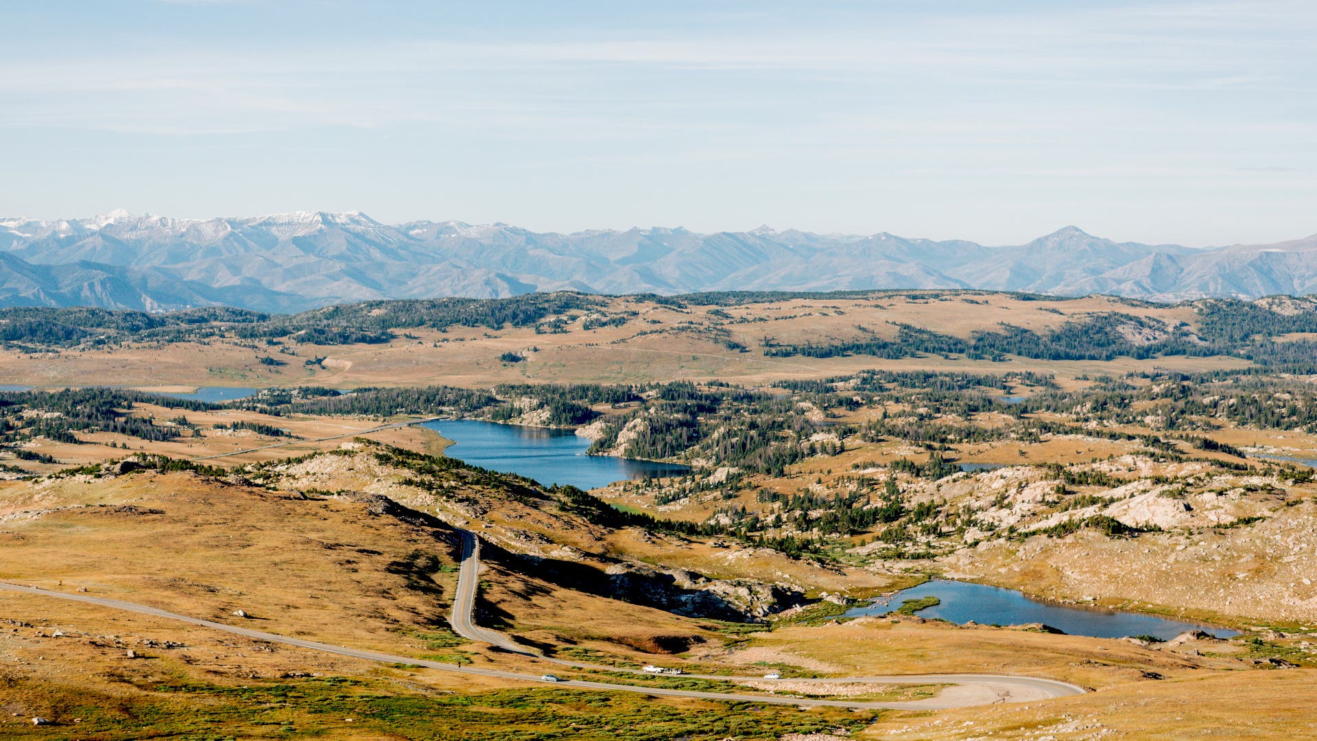
Dotted with 12 official backcountry trails and 18 distinct campgrounds, this federally designated All-American Road climbs from forested river valleys past the 10,000-foot threshold into an otherworldly high-altitude tundra. While driving the route from end to end takes roughly two hours of white-knuckle switchbacks and breathtaking pull-outs, stepping out of the vehicle and into the dirt transforms the roadway into a weeklong expedition.
As peak-season crowds at national parks continue to prompt travelers to seek out quieter alternatives, the Beartooth corridor offers a masterclass in accessible solitude. Here is a comprehensive look at the history, geography, and premier trail networks that make America’s highest-elevation highway a destination in its own right.
Main Facts: The Anatomy of an All-American Road
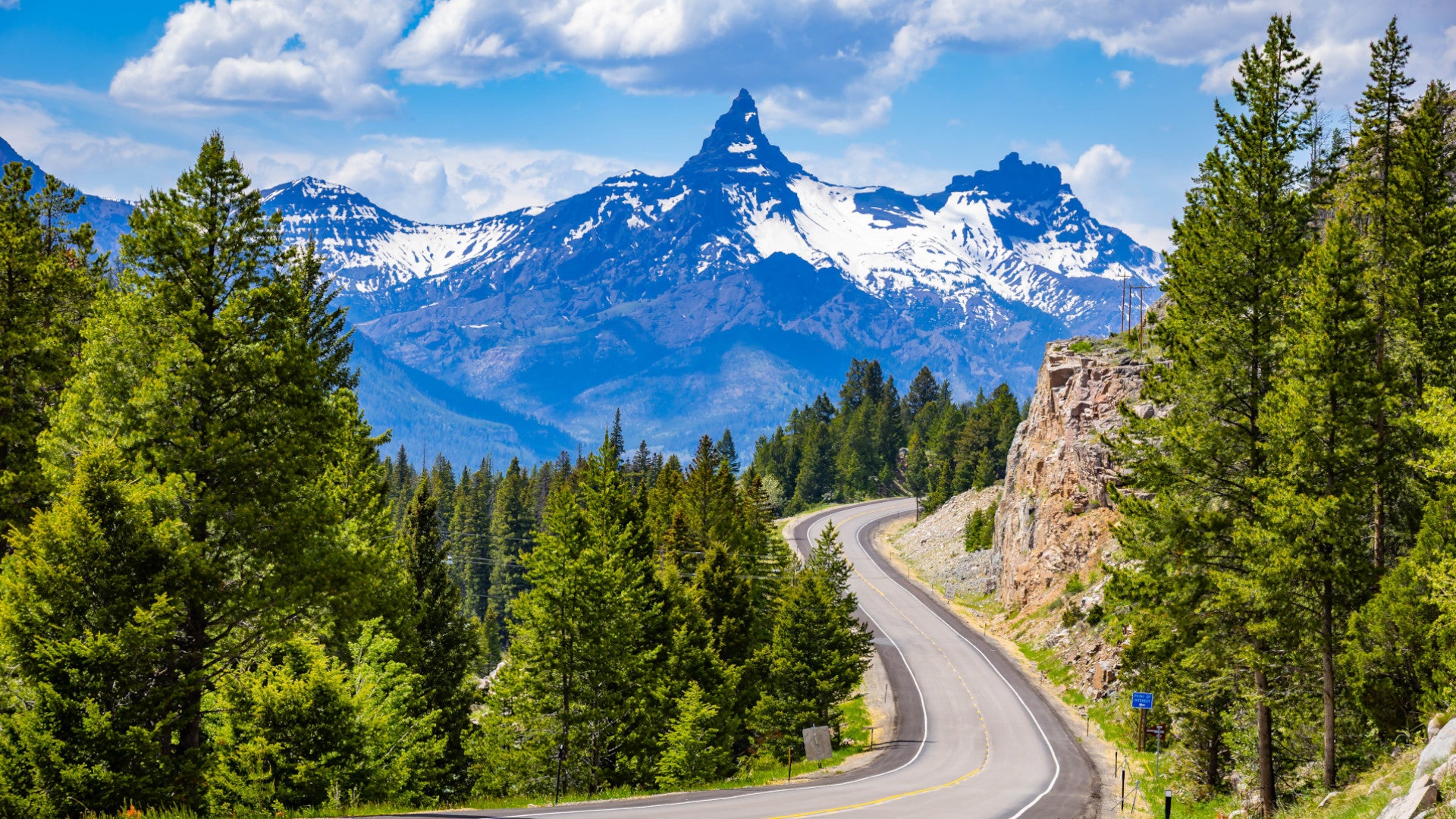
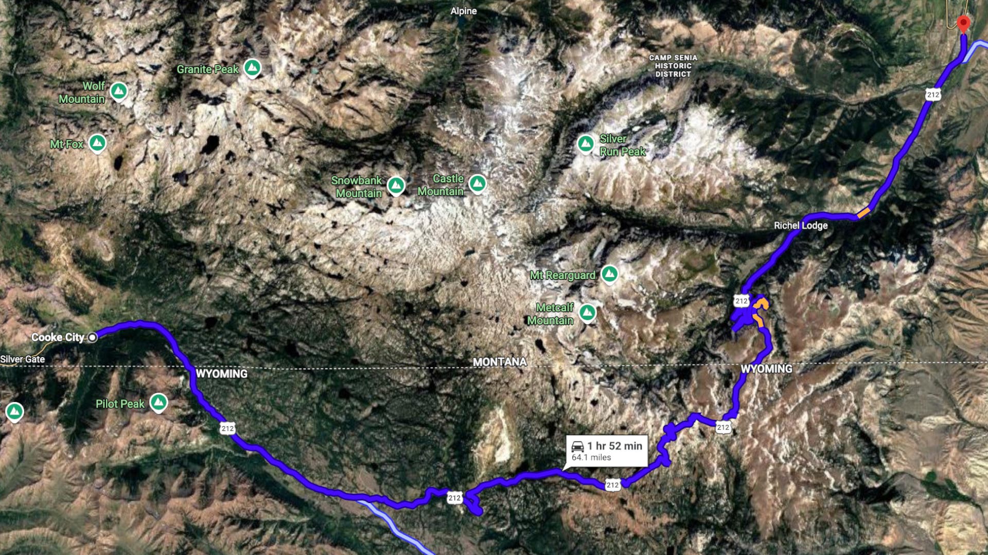
Straddling the rugged borderlands of Montana and Wyoming along US Highway 212, the Beartooth Highway is a triumph of early 20th-century civil engineering. Officially opened in 1932 after years of political maneuvering and rugged surveying, the road reaches its zenith at Beartooth Pass, sitting at an elevation of 10,947 feet.
- Geographic Scope: Spanning 63 miles, the highway passes through parts of the Custer Gallatin and Shoshone National Forests.
- Operational Window: Due to extreme winter weather, heavy snowfall, and avalanche risks, the highway is typically open to vehicular traffic only from late May or early June through mid-October.
- Recreation Infrastructure: The highway corridor features 18 campgrounds managed by the U.S. Forest Service, providing primitive to semi-primitive campsites with exceptional dark-sky viewing, alongside 12 primary trailheads.
- Wildlife: The region serves as a crucial habitat for grizzly and black bears, mountain goats, moose, bighorn sheep, and numerous alpine bird species.
Chronology: From Abandoned Trails to Scenic Icon
Understanding the Beartooth Highway requires looking back at the trials of early mountaineers, planners, and conservationists who sought to connect isolated mining and tourist outposts.
- 1919: Initial surveys begin for a roadway across the forbidding Line Creek Plateau, originally mapped as the "Black and White Trail." Due to severe budgetary constraints and the immense logistical challenges of blasting through granite walls, the project is temporarily shelved.
- 1930–1932: Construction resumes under modern engineering directives, carving a daring path through dizzying switchbacks that link Red Lodge, Montana, to the Cooke City gateway.
- 1952: The Civilian Conservation Corps establishes the Clay Butte Fire Lookout at 9,811 feet, providing vital early-warning wildfire surveillance through the height of the Cold War era.
- Late 20th Century: The lookout is phased out of active daily deployment as satellite monitoring and aerial reconnaissance replace ground-based spotters.
- Present Day: Designated as an All-American Road, the highway attracts hundreds of thousands of road-trippers annually, though only a small fraction trade their car keys for hiking boots to explore the surrounding wilderness.
Supporting Data: Trail Profiles and Ecosystem Statistics
The Beartooth ecosystem offers a spectrum of terrain suited for various skill levels, ranging from oxygen-rich valley floors to oxygen-thin granite plates.
1. Glacier Lake Trail
- Distance: 2.2 miles (out-and-back style terrain profile)
- Elevation Change: Climbs 1,700 feet in just 1.5 miles via intense switchbacks, followed by a 300-foot descent to the shoreline.
- Terrain Highlights: A turquoise alpine lake cradled by towering granite walls, vibrant seasonal wildflowers, and rushing glacial meltwater. This trail is widely regarded as offering one of the highest reward-to-effort ratios in the region.
2. Lost Lake Trail
- Distance: 5 miles (moderate difficulty)
- Ecosystem Focus: Dense subalpine forests running parallel to the Lake Fork River.
- Wildlife Notes: A prime habitat for local moose populations, particularly during the twilight hours of dawn and dusk. The trailhead also grants access to more rugged backcountry routes, including the Hellroaring Plateau Trail and Lower Lake Fork Trail.
3. Beartooth High Lakes Loop (Near Beartooth Pass)
- Distance: 5.8 miles (with an optional 1.8-mile extension to Beauty Lake)
- Elevation Change: A gradual 505-foot gain.
- Terrain Highlights: Weaves along the base of Beartooth Butte, passing a chain of high-altitude alpine bodies including Island Lake, Night Lake, and Becker Lake. It serves as an ideal introduction for hikers adjusting to high-altitude exertion.
4. Face-of-the-Mountain Trail
- Distance: 15 miles
- Historical Significance: The first three miles trace the historic "Black and White Trail," the exact path surveyed in 1919 before funding ran dry and planners shifted the route to the modern highway alignment.
- Terrain Highlights: Hugs the eastern flank of Mount Maurice and the Line Creek Plateau, offering deep historical immersion alongside expansive canyon vistas.
5. Clay Butte Fire Lookout
- Distance: 2.6-mile gravel access road (traversable by vehicle or on foot)
- Elevation: 9,811 feet
- Structural Background: Built by the Civilian Conservation Corps in 1952, the lookout commands 360-degree panoramic views stretching across both the Beartooth and Absaroka mountain ranges.
Official Responses and Conservation Perspectives
As visitor numbers to the Greater Yellowstone Ecosystem continue to rise, federal land management agencies have shifted messaging to promote responsible dispersion. Representatives from the Custer Gallatin National Forest emphasize that while drive-by tourism remains the economic lifeblood of gateway communities like Red Lodge and Cooke City, protecting fragile alpine tundra requires careful visitor management.
"The alpine tundra above 10,000 feet is a delicate ecosystem," notes a Custer Gallatin National Forest recreation planner. "Plants that look like soft mosses have taken decades, sometimes centuries, to grow in harsh conditions. When visitors step off the established trails, they leave scars that last for generations. We encourage everyone to utilize the designated campgrounds and trailheads rather than creating dispersed disturbances."
Furthermore, wildlife management teams consistently remind motorists and backcountry campers that the Beartooth corridor is prime grizzly and black bear habitat. Bear-resistant storage lockers are provided at many of the corridor’s 18 campgrounds, and carrying EPA-approved bear spray remains an absolute requirement for all trail users.
Implications: The Future of Slow Travel Along US-212
The growing trend toward "slow travel" has significant implications for how tourists experience the Northern Rockies. For decades, the prevailing travel model dictated rushing from one iconic Yellowstone geyser basin to the next, checking off landmarks under the pressure of congested park traffic.
By reframing the Beartooth Highway as a multi-day outdoor playground rather than a simple transit route, travelers can alleviate strain on overcrowded park infrastructure while deepening their connection to the landscape. Pitching a tent at nearly 9,000 feet, waking up to frost on the rainfly, and spending a day navigating granite switchbacks rather than idling in traffic jams fundamentally alters the nature of a mountain vacation.
Ultimately, the true magic of the Beartooth Highway lies not in the panoramic view from a car window, but in the silence found at the end of a dusty trail, where the roar of traffic fades and the wild expanse of the Beartooth Mountains takes center stage.
