

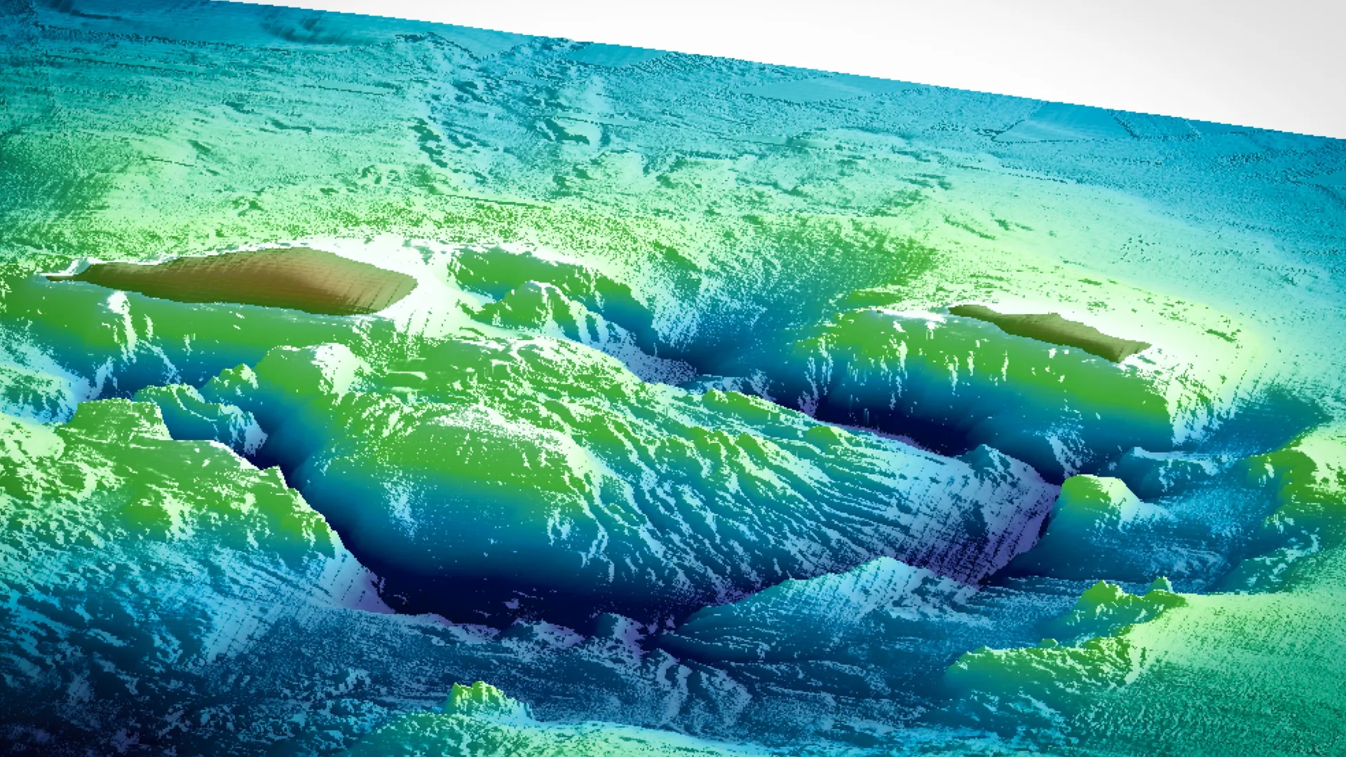
TOKYO — Deep beneath the rolling waves south of Japan lies a sleeping titan, and recent discoveries suggest it is slowly stirring back to life. A vast, hidden reservoir of molten rock beneath the submerged Kikai caldera is actively refilling, according to a groundbreaking study published in the journal Communications Earth & Environment.
Led by geophysicists at Kobe University in collaboration with the Japan Agency for Marine-Earth Science and Technology (JAMSTEC), the research offers volcanologists a rare, high-resolution window into the subterranean mechanics of supervolcanoes. Far from being dead remnants of ancient geological violence, giant caldera systems like Kikai—alongside global mega-volcanoes such as Yellowstone in the United States and Toba in Indonesia—maintain complex, dynamic plumbing networks. These networks allow them to slowly recover, heal, and accumulate the staggering volumes of magma required to fuel catastrophic, civilization-altering eruptions.
While experts emphasize that the findings do not indicate an imminent eruption, the discovery provides a critical baseline for understanding how supervolcanoes recharge over millennia.
Main Facts
The core of the discovery centers on the Kikai caldera, a largely submerged volcanic structure located in the Satsunan islands south of Kyushu, Japan. By deploying advanced marine seismic imaging techniques, researchers mapped a substantial, magma-rich chamber resting directly beneath the site of one of history’s most violent explosions.
Key takeaways from the study include:
- The Recharging Reservoir: Sub-surface mapping confirms that a massive magma chamber is actively refilling beneath Kikai, occupying the same underground system that fed a catastrophic eruption 7,300 years ago.
- Fresh Magma Injection: Chemical and geological analyses show that the current molten material is not leftover residue from the ancient disaster, but rather "fresh" magma injected into the system over time from a deeper source.
- Global Implications: The findings support a unified model for supervolcano recovery that likely applies to other massive calderas worldwide, including Yellowstone and Toba.
- Methodological Breakthrough: Conducting the research underwater gave scientists a distinct advantage, allowing for systematic, large-scale seismic surveys across the entire volcanic architecture without the topographical obstructions common to land-based volcanoes.
Chronology: From Ancient Catastrophe to Modern Discovery
To understand the significance of Kikai’s subterranean refill, scientists must look far back into Earth’s geological timeline, tracing the lifecycle of the volcano from its prehistoric devastation to modern technological breakthroughs.
The Holocene Super-Eruption (Approx. 7,300 Years Ago)
During the Holocene epoch—the current geological period that began roughly 11,700 years ago—Kikai produced the largest known volcanic eruption on Earth. The scale of the event was unimaginably vast. The eruption expelled such an immense volume of magma that the ground above the collapsing chamber caved in, forming a massive underwater depression known as a caldera rather than a traditional cone-shaped mountain. Geologists illustrate the staggering volume of ejected material with a sobering mental image: the magma involved would be enough to bury all of New York City’s Central Park under a scorching layer of molten rock 12 kilometers (7.4 miles) deep.
The Post-Collapse Era and Lava Dome Formation (Approx. 3,900 Years Ago to Present)
Following the cataclysm, the volcano did not remain entirely dormant. Approximately 3,900 years ago, a lava dome began forming near the center of the Kikai caldera. Lava domes are created when highly viscous, thick magma slowly oozes to the surface, piling up directly over a volcanic vent rather than running off into fluid rivers of lava. For millennia, this dome served as a quiet reminder of the volcano’s presence, though the deep plumbing system supplying it remained poorly understood.
The JAMSTEC Collaborative Survey (Recent Years)
Seeking to uncover the hidden mechanisms driving post-caldera activity, a team of researchers from Kobe University partnered with JAMSTEC to map the crust beneath the ocean floor. Using specialized research vessels equipped with airgun arrays, the team sent controlled seismic pulses deep into the Earth’s crust. Simultaneously, sensitive seismometers placed directly on the ocean floor recorded how these sound waves traveled, refracted, and reflected off subterranean rock layers.
The 2024–2025 Findings
By analyzing the shifts in seismic wave speeds—which slow down significantly when passing through partially molten rock—the research team successfully mapped the boundaries of the hidden reservoir. Their peer-reviewed publication unveiled the definitive proof that Kikai’s ancient magma system has not only survived the millennia, but is actively being replenished with fresh geological fuel from Earth’s mantle.
Supporting Data and Geophysical Methodology
Studying active supervolcanoes presents a unique logistical nightmare. Most continental supervolcanoes are covered by dense forests, rugged terrain, or layers of older debris, making comprehensive geophysical surveys exceptionally difficult. However, Kikai’s marine environment turned out to be an unexpected scientific asset.
"The underwater location allows us to implement systematic, large-scale surveys," notes Kobe University geophysicist Nobukazu Seama, a lead researcher on the project.
How Seismic Tomography Works
The research team relied on controlled-source seismology, a technique akin to a medical ultrasound for the Earth’s crust.
- Generation: Airgun arrays towed behind research vessels released high-energy acoustic pulses down through the water column and into the oceanic crust.
- Propagation: As these seismic waves traveled through different geological formations, their velocity and trajectory altered depending on the density, temperature, and physical state of the rock. Solid, cool granite transmits waves rapidly; hot, partially molten magma chambers act as speed bumps, drastically slowing the waves down.
- Detection: Ocean-bottom seismometers (OBS) captured these subtle variations, transmitting the data back to researchers.
- Imaging: Advanced computational modeling translated the wave data into high-resolution, three-dimensional cross-sections of the subterranean magma architecture.
Chemical Verification
Seismic imaging alone cannot prove that a reservoir is refilling with new magma—it could simply be detecting residual, cooling melt from the ancient eruption. To solve this puzzle, the researchers integrated geochemical data gathered from the central lava dome and surrounding recent volcanic deposits.
The chemical signatures of the modern lavas contrasted sharply with the debris left behind by the 7,300-year-old super-eruption. This chemical divergence confirmed that the current reservoir is a living, evolving system fed by newly injected magma rising from deeper mantle sources.
Official Responses and Expert Perspectives
The academic and scientific communities have greeted the study with immense enthusiasm, viewing it as a major step forward in understanding the lifecycle of large igneous provinces.
Dr. Nobukazu Seama emphasized the broader significance of the team’s findings during discussions surrounding the publication in Communications Earth & Environment.
"We must understand how such large quantities of magma can accumulate to understand how giant caldera eruptions occur," Seama stated, outlining the primary motivation behind the multi-year study. Addressing the physical continuity of the chamber, he added: "Due to its extent and location, it is clear that this is in fact the same magma reservoir as in the previous eruption."
Furthermore, Seama highlighted that the mechanics observed at Kikai validate longstanding theories about other global supervolcanoes. "This magma re-injection model is consistent with the existence of large shallow magma reservoirs beneath other giant calderas like Yellowstone and Toba," he explained.
While the findings mark a triumph for academic volcanology, researchers are careful to contextualize the discovery for the general public. Kikai is not showing signs of an impending eruption. Instead, the data reveals the baseline "resting" state of a healthy, active supervolcano—proving that long periods of quiet do not mean a system is dead; rather, they mean it is quietly recharging behind the scenes.
Implications for Global Monitoring and Future Research
The implications of the Kikai study extend far beyond Japanese waters, offering a potential roadmap for monitoring the world’s most dangerous volcanic systems.
Refining Supervolcano Warning Systems
Historically, predicting eruptions at caldera systems has been notoriously difficult because scientists have lacked clear models of how magma accumulates in the upper crust during quiescent periods. By proving that fresh magma continuously cycles into shallow reservoirs, the Kobe-JAMSTEC study provides a vital framework for hazard assessment.
If researchers can track the rate of magma re-injection, they may eventually be able to identify the critical thresholds that separate safe, stable systems from those entering a dangerous pre-eruptive phase.
"We want to refine the methods that have proved to be so useful in this study to more deeply understand the re-injection processes," Seama concluded. "Our ultimate goal is to become better able to monitor the crucial indicators of future giant eruptions."
A Global Framework: Yellowstone and Toba
Supervolcanoes like Yellowstone (USA) and Lake Toba (Indonesia)—the latter of which was responsible for a global climate bottleneck roughly 74,000 years ago—pose existential threats to modern civilization. Both systems possess massive, partially molten reservoirs beneath their calderas.
The validation of the Kikai re-injection model gives international volcanologists a shared point of comparison. Techniques pioneered in the shallow seas of Japan can now be adapted to continental monitoring networks, enhancing our global capacity to keep watch over Earth’s subterranean giants.
Research funding for this project was provided by the Ministry of Education, Culture, Sports, Science and Technology (MEXT) under the Third Earthquake and Volcano Hazards Observation and Research Program, alongside the Japan Society for the Promotion of Science (Grant 20H00199). Fieldwork and technological support were supplied in direct collaboration with the Japan Agency for Marine-Earth Science and Technology (JAMSTEC).
