

By Global Environmental Desk
Published: October 2023
Main Facts
More than half a billion people worldwide reside in low-lying coastal zones, placing them on the front lines of one of the 21st century’s most urgent environmental challenges. For decades, the global conversation surrounding coastal threats has focused almost exclusively on rising oceans driven by melting ice sheets and thermal expansion. However, groundbreaking new research reveals a hidden, compounding crisis: in many of the world’s most densely populated regions, the ground itself is sinking.
A collaborative study conducted by researchers from the German Geodetic Research Institute at the Technical University of Munich (DGFI-TUM) and Tulane University in New Orleans has unveiled alarming statistics regarding relative sea-level rise. Published in the prestigious journal Nature Communications, the study demonstrates that people living in heavily populated coastal regions experience an average relative sea-level rise of roughly 6 millimeters per year.
To contextualize this figure, it is nearly three times the coastline-weighted global average of 2.1 millimeters per year—a metric representing the mean relative increase recorded along coastlines worldwide. Furthermore, it is almost twice the climate-driven, absolute sea-level rise of approximately 3.15 millimeters per year.
The primary culprit behind this dangerous discrepancy is land subsidence—the gradual sinking or settling of the Earth’s surface. While climate change causes oceans to swell from above, human activities and geological phenomena are pulling the land down from beneath, creating a disastrous double jeopardy for coastal communities across the globe.
Chronology
Understanding the modern coastal subsidence crisis requires looking at both deep geological epochs and recent decades of intense urbanization.
- The Post-Glacial Era (Thousands of Years Ago to Present): Following the end of the last Ice Age, massive ancient ice sheets melted, relieving the Earth’s crust of immense weight. In regions like Scandinavia, this triggered a slow, ongoing geological phenomenon known as post-glacial rebound or crustal uplift, causing the land to rise even today. Conversely, river deltas began accumulating thick layers of young, compressible sediments.
- The Mid-20th Century (1950s–1970s): Rapid industrialization and urban expansion triggered unprecedented groundwater and resource extraction in coastal megacities. Cities like Tokyo experienced catastrophic subsidence, with certain areas sinking by more than 10 centimeters—and in worst-case scenarios, up to 24 centimeters—annually.
- 1975: Recognizing the existential threat of sinking land driven by excessive water extraction, local authorities in Texas took direct policy action, establishing the Harris-Galveston Subsidence District to regulate groundwater usage and promote conservation.
- Late 20th Century to Early 21st Century: Megacities in Asia and the Global South experienced explosive, unregulated population growth. Groundwater pumping skyrocketed to meet municipal and industrial demands, pushing subsidence rates in cities like Jakarta, Tianjin, and Bangkok to dangerous extremes.
- Recent Years (Present Study): Researchers at DGFI-TUM and Tulane University synthesized advanced geodetic observation data to map population-weighted relative sea-level rise, publishing findings that explicitly link human-induced land subsidence to a near-tripling of the sea-level threat for over 500 million people.
Supporting Data
The empirical data compiled by the DGFI-TUM and Tulane University research team highlights stark regional disparities in how coastal populations experience sea-level changes.
Global Hotspots and Regional Averages
Nationwide population-weighted coastal averages reveal that developing nations in Asia and Africa bear the brunt of relative sea-level rise.
- High-Impact Nations (7 to 10 mm/year): Thailand, Bangladesh, Nigeria, Egypt, China, and Indonesia lead the world in relative sea-level rise rates.
- Elevated-Impact Nations (4 to 5 mm/year): The United States, the Netherlands, and Italy face significant, albeit slightly lower, composite rates.
City-Level Sinking Rates
At the municipal level, average sinking rates expose extraordinary vulnerabilities in specific urban centers:
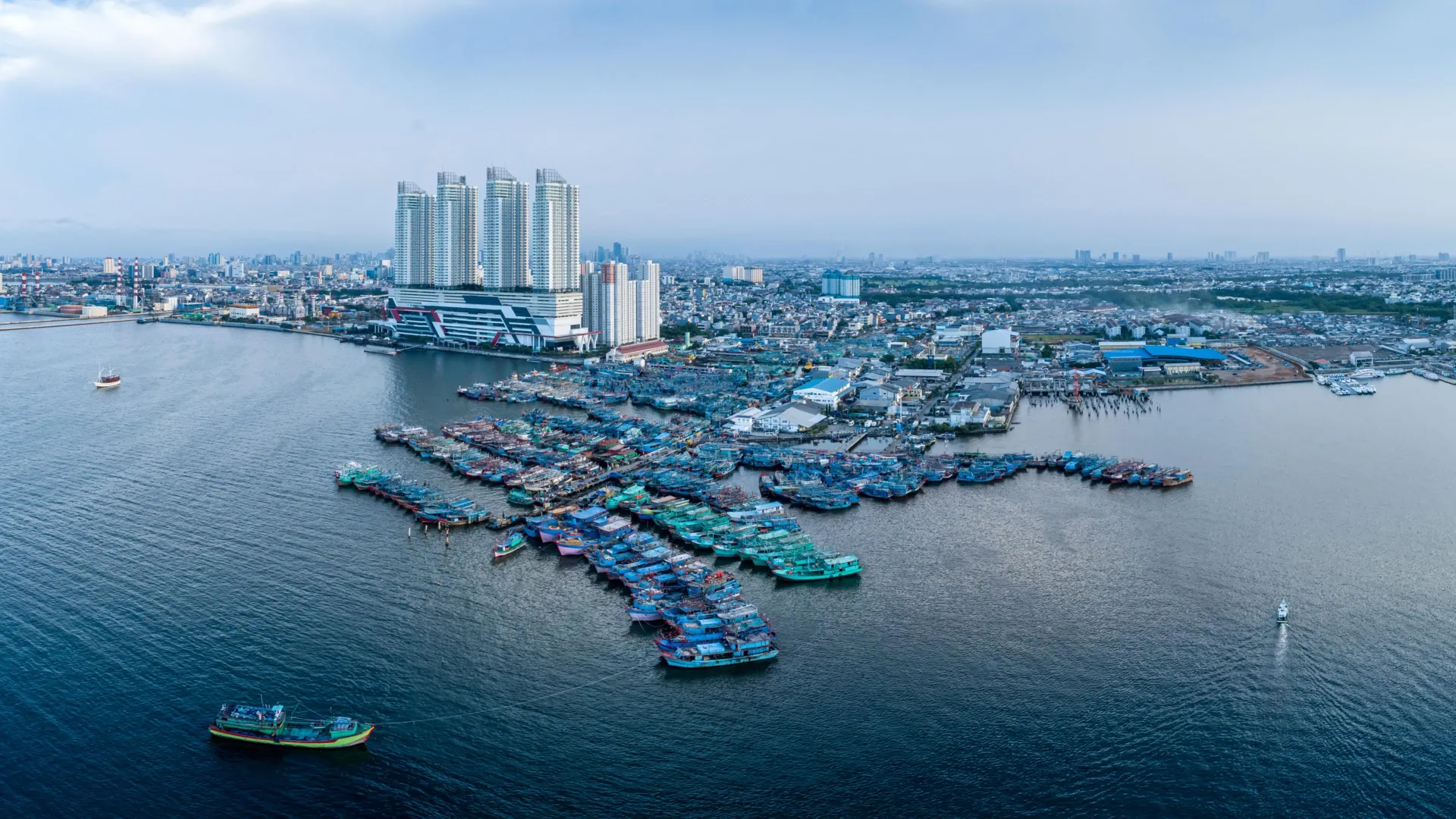
- Jakarta, Indonesia: 13.7 mm/year (average), with hyper-localized extremes plunging by up to 42 millimeters per year in some districts, while adjacent sections paradoxically rise.
- Tianjin, China: 13.5 mm/year
- Bangkok, Thailand: 8.5 mm/year
- Lagos, Nigeria: 6.7 mm/year
- Alexandria, Egypt: 4 mm/year
The Mechanics of Sinking Land
The causes of coastal subsidence are multifaceted, often compounding one another within the same geographic footprint. Dr. Julius Oelsmann, lead author of the study and a researcher at DGFI-TUM, emphasizes that human activities are frequently the primary accelerator.
The most prominent contributors to land subsidence include:
- Groundwater Pumping: Excessive extraction of subterranean water depletes aquifers, causing the underground matrix to compact permanently.
- Resource Extraction: Oil and gas drilling removes underlying support structures from the Earth’s crust.
- Sediment Compression: Naturally occurring, relatively young sediments found in river deltas compress naturally under their own weight, a process accelerated by human development.
- Urban Load: The sheer weight of expanding concrete jungles, skyscrapers, and infrastructure places immense pressure on soft coastal soils.
- Tectonic and Geological Forces: Natural fault movements and long-term adjustments in the Earth’s crust following historic glacial retreats also play a role.
The Exception: Uplifted Coasts
Not all coastlines are succumbing to gravity. In Northern Europe, particularly in Sweden and Finland, geological forces are actually producing a relative decline in sea level along sections of the coast. This is driven by post-glacial rebound, where the land continues to bounce upward from the melting of ice sheets that vanished millennia ago—proceeding at a pace faster than the global oceans are rising.
Official Responses
While certain geological drivers of subsidence are entirely beyond human control, policymakers, scientists, and water-management authorities have demonstrated that targeted intervention can drastically alter outcomes.
Dr. Florian Seitz, Professor of Geodetic Geodynamics and Director of DGFI-TUM, underscores the importance of local governance in mitigating the crisis.
"In many large coastal cities, groundwater extraction is a major driver of land subsidence. This means that local political and water-management decisions can make a significant difference," says Professor Seitz. "Improved groundwater management, stricter regulation of withdrawals, or targeted recharge of aquifers can at least slow subsidence rates and, in some cases, largely halt them."
Precedents for Success: Tokyo and Texas
History offers tangible proof that regulatory frameworks can successfully arrest land subsidence.
- Tokyo, Japan: Once plagued by subsidence rates exceeding 10 centimeters annually—with localized zones sinking by a staggering 24 centimeters per year—the Japanese capital intervened decisively. Through rigorous government regulation of groundwater extraction and the development of alternative municipal water supplies, Tokyo successfully curbed excessive pumping, ultimately bringing sinking rates down to manageable levels.
- Harris-Galveston, Texas: Facing severe land subsidence caused by decades of unchecked industrial and municipal groundwater withdrawal, local officials in Texas took legislative action in 1975. The creation of the Harris-Galveston Subsidence District empowered regulators to restrict groundwater use, mandate alternative surface-water sources, and enforce regional water conservation programs. The initiative successfully stabilized vulnerable tracts of land along the Gulf Coast.
Implications
The findings from the DGFI-TUM and Tulane University collaboration carry profound implications for urban planning, climate adaptation strategies, and global humanitarian security.
1. A Paradigm Shift in Coastal Monitoring
For decades, adaptation strategies have relied on satellite altimetry measuring absolute sea-level rise from space. The new research proves that observing the ocean alone is dangerously insufficient. Scientists and policymakers must adopt a holistic monitoring approach that tracks vertical land motion with millimeter-level precision using advanced geodetic techniques, such as Interferometric Synthetic Aperture Radar (InSAR) and Global Navigation Satellite Systems (GNSS).
2. Amplified Flood Risks and Infrastructure Stress
Because relative sea-level rise along densely populated coasts is outpacing climate projections by a factor of nearly three, coastal defense infrastructure—including sea walls, levees, drainage systems, and storm surge barriers—is aging and failing much faster than anticipated. Cities built on deltaic plains face increased risks of catastrophic flooding during routine high tides, tropical storms, and storm surges.
3. Socioeconomic and Geopolitical Pressures
The concentration of rapid relative sea-level rise in developing nations across Asia and Africa raises critical equity and climate justice concerns. Megacities housing tens of millions of citizens face severe threats to freshwater supplies, agricultural viability, and habitable land. Without immediate, aggressive intervention in groundwater management and urban planning, these regions risk unprecedented economic disruption and climate-induced displacement.
Ultimately, while halting global climate change requires international cooperation on carbon emissions, the battle against land subsidence offers a ray of hope. It is a localized crisis subject to local solutions. By reforming water policies, regulating subterranean extraction, and factoring land movement into urban design, coastal cities around the world can buy themselves vital time against the rising tides.
