

By Global Environmental Desk
Published: Special Investigative Report
Main Facts
Across the globe, the world’s coastal communities find themselves trapped in a planetary vise. For decades, the public narrative surrounding rising seas has focused almost exclusively on melting glaciers, thermal expansion, and the melting of polar ice caps. However, groundbreaking scientific research published in Nature Communications reveals a stark, compounding reality: the ground beneath the feet of hundreds of millions of people is actively collapsing.
Conducted by an international team of researchers from the Technical University of Munich (TUM) and Tulane University in New Orleans, the study highlights a perilous dual mechanism. While ocean levels are steadily climbing, densely populated regional landmasses are simultaneously sinking. This geological downward movement dramatically accelerates the relative sea level rise (RSLR) experienced by coastal populations.
Key takeaways from the comprehensive analysis include:
- The Scale of Vulnerability: More than half a billion people reside in low-lying coastal zones worldwide, placing them on the absolute front lines of one of the 21st century’s most defining climate and geological emergencies.
- The Acceleration Factor: Heavily populated coastal regions experience an average relative sea level rise of approximately 6 millimeters per year.
- Stark Multipliers: This local rate is nearly three times the coastline-weighted global average of 2.1 millimeters per year and nearly twice the climate-driven absolute sea level rise of roughly 3.15 millimeters per year.
- The Root Cause: While climate change swells the ocean, human intervention—specifically heavy groundwater pumping, natural compaction of delta sediments, resource extraction, and the staggering weight of urban infrastructure—is forcing the land downward at unsustainable rates.
Chronology: Understanding the Evolution of Coastal Crisis Science
To understand how researchers arrived at these alarming metrics, it is vital to trace the historical progression of coastal observation and earth sciences.
Pre-1970s: The Era of Isolated Observations
For much of the 20th century, sea-level monitoring relied heavily on traditional tide gauges. These instruments measured the height of the water relative to the land structure to which they were attached. However, because tide gauges could not differentiate between a rising ocean and a sinking coastline, data remained localized, fragmented, and often misunderstood. Coastal sinking was frequently viewed as a localized engineering annoyance rather than a systemic planetary threat.
The 1970s–1990s: Early Policy Responses to Subsidence
As industrialization and rapid urbanization accelerated post-World War II, excessive groundwater extraction began causing catastrophic ground collapse in several major urban centers.
- 1975: Recognizing the existential threat of sinking land caused by subterranean water depletion, authorities in the United States established the Harris-Galveston Subsidence District in Texas. This pioneering regulatory body was tasked with strictly limiting groundwater withdrawal and transitioning the region toward alternative surface-water supplies—proving for the first time that human-induced subsidence could be mitigated through aggressive policy intervention.
- Late 20th Century: Tokyo, which historically suffered from staggering subsidence rates exceeding 10 centimeters annually (with peak zones sinking by 24 centimeters per year), successfully curbed its land collapse through sweeping municipal water regulations and alternative water infrastructure sourcing.
The 2000s–2010s: The Advent of Satellite Geodesy
The arrival of advanced satellite technologies—specifically InSAR (Interferometric Synthetic Aperture Radar) and high-precision GPS/GNSS positioning—transformed geodetic science. For the first time, scientists could measure millimeter-scale deformations of the Earth’s crust from space. Researchers began to realize that the oceans were not merely creeping up uniformly; rather, localized land subsidence was drastically skewing risk assessments in major delta and coastal cities across Asia, Africa, and the Americas.
Present Day: The TUM and Tulane Breakthrough
The recent publication in Nature Communications represents a generational leap forward. By combining satellite altimetry, tide-gauge records, and advanced vertical land motion (VLM) datasets, the joint research team from DGFI-TUM and Tulane University quantified the population-weighted realities of relative sea-level rise on a global scale. The study exposed the critical blind spot in climate modeling: failing to account for local land motion grossly underestimates the immediate flood risks facing coastal megacities.
Supporting Data: The Numbers Behind the Sinking Coastlines
The empirical data compiled by the TUM and Tulane researchers paints a vivid, quantitative picture of a planet out of balance. By analyzing population distributions alongside absolute sea-level changes and vertical land movements, the researchers categorized vulnerability across nations and individual urban centers.
Global and Regional Comparisons
- Coastline-Weighted Global Average: 2.1 mm/year (baseline global relative increase).
- Climate-Driven Absolute Sea Level Rise: 3.15 mm/year (pure oceanic expansion and meltwater).
- Population-Weighted Average in Populated Coastal Zones: 6.0 mm/year (nearly triple the global baseline due to the compounding effect of sinking land).
National and Regional Hotspots (Population-Weighted Coastal Averages)
- Tier 1 (Highest Risk – 7 to 10 mm/year): Thailand, Bangladesh, Nigeria, Egypt, China, and Indonesia. In these developing coastal nations, explosive urban growth, unmonitored groundwater extraction, and massive river delta geomorphology combine to create extreme relative sea-level rise.
- Tier 2 (Elevated Risk – 4 to 5 mm/year): The United States, the Netherlands, and Italy. Despite advanced infrastructure and robust economic resources, these nations still battle significant historical subsidence and localized deltaic compaction.
Extreme Urban Subsidence Rates
Individual cities far exceed national averages, transforming into profound urban "sinkholes":
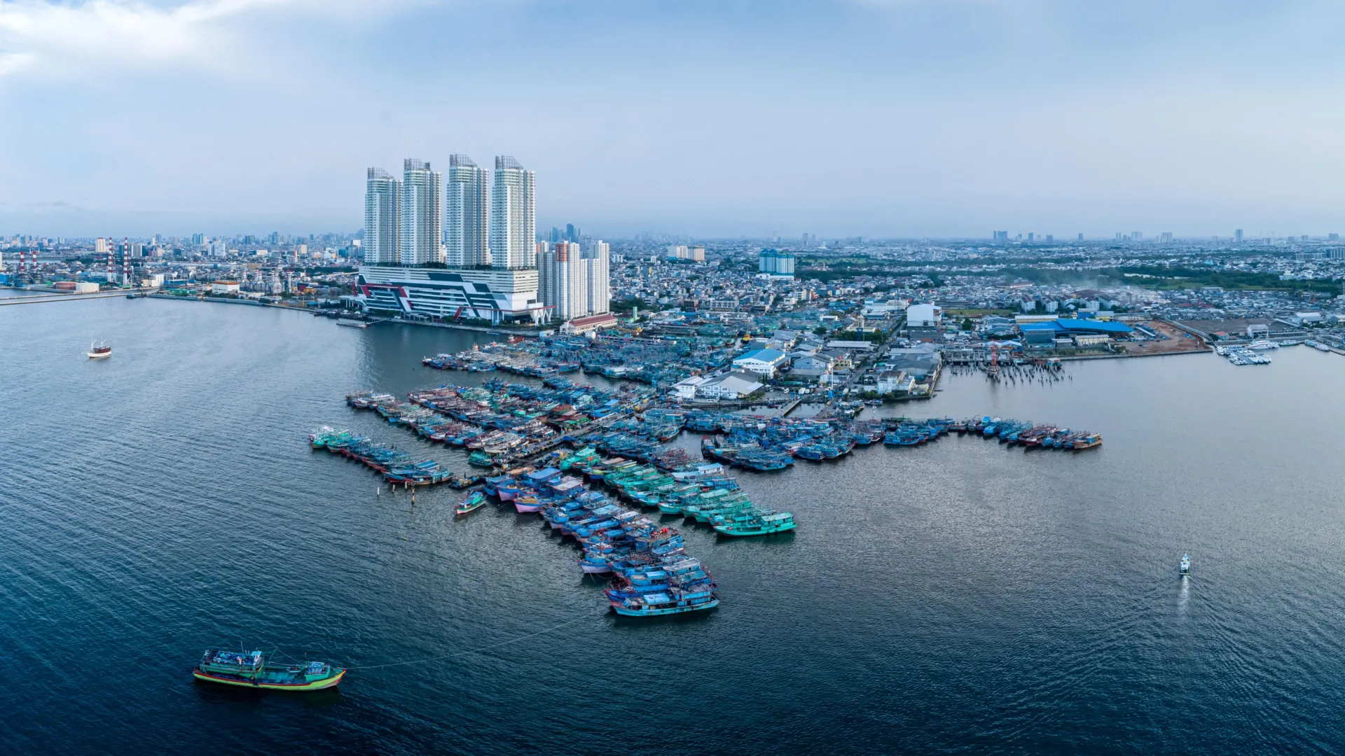
- Jakarta, Indonesia: Average sinking rate of 13.7 mm/year (with hyper-localized zones collapsing by an astonishing 42 mm/year, even as isolated pockets experience minor structural rebound).
- Tianjin, China: 13.5 mm/year.
- Bangkok, Thailand: 8.5 mm/year.
- Lagos, Nigeria: 6.7 mm/year.
- Alexandria, Egypt: 4.0 mm/year.
The Exception: Postglacial Rebound
Not every coastline in the world is sinking. In northern Europe, particularly across parts of Sweden and Finland, geological forces are working in reverse. Due to postglacial rebound—the slow, ongoing upward elastic recovery of the Earth’s crust following the melting of massive ice sheets from the last Ice Age—the land is rising faster than the ocean is advancing. This creates a relative decline in sea level along specific northern European coasts, serving as a unique geological counter-weight to the global trend.
Official Responses and Expert Insights
The scientific community, urban planners, and municipal policy-makers are increasingly vocal about the immediate need to pivot from passive adaptation to active geological management.
Dr. Julius Oelsmann (Lead Author, DGFI-TUM)
Emphasizing the necessity of a holistic observational framework, lead researcher Dr. Julius Oelsmann explains:
"If we want to understand sea-level rise along coastlines and respond effectively, we must not only observe the ocean but also the land itself. Especially in densely populated coastal regions, human activities cause the land to subside more strongly—often due to excessive extraction of water and resources that previously stabilized the subsurface. The sheer weight of cities, along with long-term geological processes, can further intensify this subsidence. In doing so, we significantly amplify the effects of climate-driven sea-level rise."
Professor Florian Seitz (Director, DGFI-TUM)
Highlighting the power of regulatory intervention, Professor Florian Seitz points out that local political and infrastructural decisions can dramatically alter outcomes:
"In many large coastal cities, groundwater extraction is a major driver of land subsidence. This means that local political and water-management decisions can make a significant difference. Improved groundwater management, stricter regulation of withdrawals, or targeted recharge of aquifers can at least slow subsidence rates and, in some cases, largely halt them."
As demonstrated by the historical turnarounds in Tokyo and the Harris-Galveston Subsidence District in Texas, political will, alternative surface water pipelines, and strict aquifer protection laws can successfully transition a sinking urban landscape into a stabilized one. Governments worldwide are now under pressure to replicate these regulatory frameworks before natural thresholds are irrevocably crossed.
Implications: The Future of Coastal Civilization
The implications of the TUM and Tulane study stretch far beyond academic circles, carrying profound consequences for global economics, humanitarian security, and urban engineering.
1. Inadequate Global Defenses
Because conventional climate models have traditionally prioritized oceanographic tracking over geodetic land motion, coastal defense strategies worldwide are dangerously miscalculated. Sea walls, dikes, and surge barriers engineered to withstand standard climate-driven sea-level projections are failing or reaching obsolescence decades ahead of schedule because the ground beneath them is continually dropping.
2. Economic and Humanitarian Crises
More than 500 million people living in low-lying coastal zones face a cascade of existential threats:
- Infrastructure Failure: Accelerated relative sea-level rise compromises foundations, fractures road networks, ruptures underground sewage and freshwater pipelines, and undermines structural integrity in major financial hubs.
- Salinization of Freshwater Resources: As land sinks and relative sea levels rise, saltwater intrusion poisons coastal aquifers, destroying fertile agricultural deltas (such as the Nile, Mekong, and Ganges-Brahmaputra) and threatening drinking water security for tens of millions.
- Mass Climate Migration: Without urgent intervention, hyper-subsidence zones in cities like Jakarta, Bangkok, and Lagos will face catastrophic, unmitigable recurrent flooding, triggering forced internal displacement and international refugee crises.
3. A Paradigm Shift in Urban Planning
Moving forward, coastal management can no longer be treated as a purely maritime engineering challenge. Urban planners must integrate multidisciplinary geodetic data into zoning laws, building codes, and municipal water policies. Restricting deep-aquifer pumping, enforcing artificial aquifer recharge programs, regulating high-density heavyweight high-rise construction in soft-sediment deltas, and protecting natural wetlands must become cornerstones of modern urban survival.
The message from the scientific community is unequivocal: humanity can no longer watch the rising tide alone. To save the world’s coastal civilizations, we must learn to steady the ground beneath our feet.
