

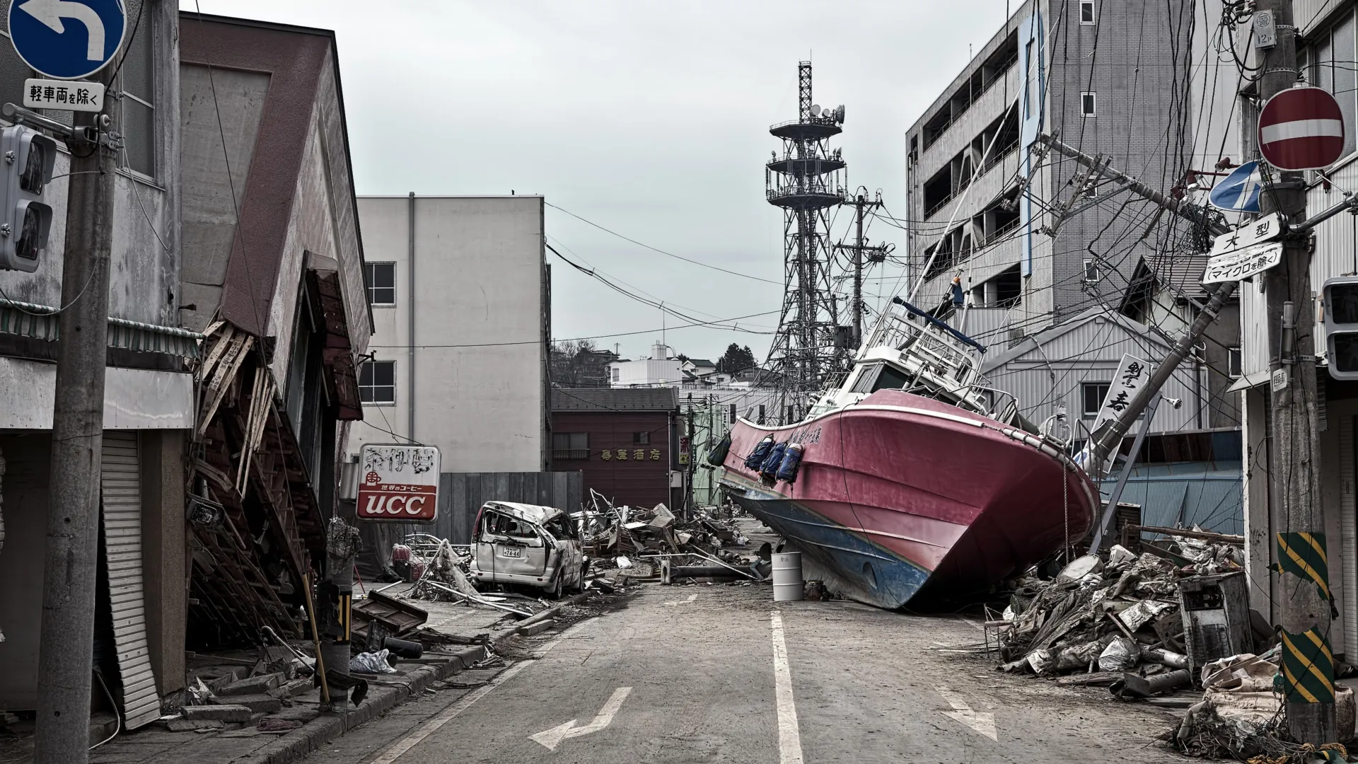
TOKYO / FLAGSTAFF, Ariz. — More than a decade after a wall of water devastated the northeastern coast of Japan, triggering the worst nuclear crisis since Chernobyl and claiming nearly 20,000 lives, an international team of geoscientists has uncovered a critical piece of the puzzle that explains the unimaginable scale of the catastrophe.
In a groundbreaking study published in the prestigious journal Science, researchers revealed the discovery of a hyper-localized, ultra-weak geological feature resting deep beneath the Pacific Ocean floor. This hidden layer of ancient sediment acted as a microscopic lubricant, allowing the Earth’s crust to fracture in a way scientists previously thought physically impossible.
The findings not only rewrite the textbook mechanics of subduction zone earthquakes—where one tectonic plate slides beneath another—but also provide a vital roadmap that could fundamentally transform early-warning systems, building codes, and coastal disaster preparedness worldwide.
Main Facts: Anatomy of a Record-Breaking Rupture
On March 11, 2011, a magnitude 9.1 megathrust earthquake struck off the coast of Japan’s Tōhoku region. While subduction zones are routinely responsible for Earth’s most violent seismic events, the Tōhoku earthquake defied conventional geophysical models.
Typically, earthquakes originate deep within the Earth’s crust. For comparison, the destructive 2001 Nisqually earthquake in the Pacific Northwest ruptured roughly 32 miles beneath the seafloor. In contrast, the 2011 Japanese earthquake behaved with shocking shallow efficiency. Its rupture propagated all the way up to the surface of the Japan Trench, breaking just 15 miles beneath the ocean bottom.
This shallow slip unleashed a catastrophic cascade of events:
- Seismic Energy: The fault line unlocked over an unprecedented breadth, causing the Pacific seafloor to violently shift horizontally and vertically by an extraordinary 130 to 200 feet.
- The Tsunami Mechanism: To put that movement into perspective, study co-author Christine Regalla, an associate professor at Northern Arizona University, noted that the displacement was "equivalent to the entire area between Los Angeles and San Francisco moving 130 to 200 feet in just six minutes."
- Global Resonance: This massive, piston-like displacement of the water column generated towering tsunami waves exceeding 130 feet in certain coastal areas, washing miles inland, decimating towns, and crippling the Fukushima Daiichi Nuclear Power Station.
The culprit behind this unprecedented seismic behavior? A 100-foot-thick layer of pelagic clay sandwiched between rigid rock formations directly beneath the Japan Trench. Formed over millions of years through the slow accumulation of microscopic marine organisms and wind-blown dust settling on the ocean floor, this sediment acted as a geologic "tear line," concentrating immense tectonic stress along a remarkably narrow, frictionless path.
Chronology: From the Seafloor Disaster to Record-Breaking Discovery
To understand how a silent layer of clay beneath miles of ocean water could dictate the fate of millions, a multi-national team of scientists embarked on an expedition that pushed the boundaries of modern oceanography.
The 2011 Catastrophe
- March 11, 2011 (2:46 PM JST): A rupture begins deep off the coast of Sendai. Instead of stalling out deep underground as expected, the seismic slip breaches the upper crust, surging unabated all the way to the oceanic trench.
- Post-2011: Seismologists and geologists worldwide are left baffled. Observational data shows that the slip near the trench was vastly larger than computer simulations predicted, leading to years of intense debate over the mechanical properties of the shallow plate boundary.
The Quest Beneath the Waves
- The Expedition: Seeking answers, an international team of more than a dozen researchers boarded the state-of-the-art Japanese scientific drilling vessel Chikyu.
- Drilling into the Abyss: Operating in the western Pacific, the expedition achieved a monumental engineering feat. They drilled approximately 26,000 feet (nearly 5 miles) into the ocean floor, extracting pristine core samples of the fault zone. This endeavor was officially recognized by Guinness World Records as the deepest scientific ocean drilling project ever completed.
- Laboratory Analysis: Back on land, analysis of the extracted core samples revealed the anomalous, slippery pelagic clay layer. Laboratory shearing tests confirmed that the clay lost nearly all of its frictional resistance under rapid stress, explaining how the fault could slip so far, so fast, right up to the seabed.
- Publication: The findings culminated in the landmark paper published in Science, shifting the paradigm of how scientists view shallow subduction zone mechanics.
Supporting Data: The Mechanics of a Megathrust
The significance of the discovery lies in its mechanical properties. According to Patrick Fulton, an associate professor at Cornell University and co-author of the study, the geologic layering of the Japan Trench predetermines fault behavior.
+-------------------------------------------------------------+
|                OVERRIDING PLATE (Japan)                     |
+-------------------------------------------------------------+
                                                         ^
       [ 100-foot Pelagic Clay Layer: The "Tear Line" ]  |  <--- 130-200 ft
                                                         |       Seafloor Shift
      v                                                   |
+-------------------------------------------------------------+
|                SUBDUCTING PLATE (Pacific)                   |
+-------------------------------------------------------------+
When tectonic plates converge, immense pressure builds up over centuries. In most subduction zones, the materials near the trench are unconsolidated, heterogeneous sediments that tend to absorb energy, causing faults to lock or distribute slip broadly rather than cleanly breaking the surface.
However, at the Japan Trench, the uniform, slippery nature of the pelagic clay created an extreme mechanical contrast against the surrounding hard rock layers. When the 2011 earthquake hit, the stress did not dissipate; instead, it funneled entirely into this weak plane.
Data compiled from ocean-bottom pressure gauges, GPS networks, and seismic stations deployed after 2011 validated the core samples. The data proved that shallow megathrust slips are not isolated anomalies confined strictly to theoretical models, but physical realities driven by specific stratigraphic compositions.
Official Responses and Expert Insights
The geological community has received the findings with a mix of validation and urgency. Because subduction zones encircle the Pacific Basin—comprising the infamous "Ring of Fire"—the implications stretch far beyond the shores of Honshu.
"That’s equivalent to the entire area between Los Angeles and San Francisco moving 130 to 200 feet in just six minutes," said Dr. Christine Regalla. "We’ve never seen anything like that in the time we’ve been observing earthquakes. Based on what we understood, we didn’t think that could happen."
Governments and disaster mitigation agencies are taking notice. While Japan remains a global leader in earthquake-resistant engineering, early-warning systems, and tsunami sea-walls, the 2011 event exposed the limits of human readiness against a natural force that was poorly understood.
Dr. Patrick Fulton emphasized that identifying these weak layers changes how hazard maps are drawn. "It becomes an extremely focused, extremely weak surface, which makes it easier for ruptures to propagate all the way to the seafloor," Fulton noted. By mapping where similar clay deposits or lubricating sediments exist globally, geologists can pinpoint which subduction zones harbor the hidden potential for catastrophic shallow-slip events.
International bodies, including UNESCO’s Intergovernmental Oceanographic Commission, are evaluating how these findings can be integrated into Pacific-wide tsunami warning networks.
Implications: Preparing for the Next Global Megaquake
The discovery of the clay layer beneath the Japan Trench transforms the conversation surrounding global seismic risk. Earthquakes and tsunamis of this magnitude are not localized inconveniences; they are planetary-scale events with immediate trans-oceanic repercussions.
Trans-Oceanic Vulnerability
As Regalla pointed out, the hazards do not stop at the country of origin. "An earthquake and tsunami in Japan doesn’t just impact people who live locally—it also impacts people at the ports and people who live across the ocean," she said. "Think about Hawaii: Their most devastating tsunamis come from Japan and Alaska. These are truly global events."
When a seafloor shifts by hundreds of feet over a vast area, the resulting wave energy radiates outward across the entire Pacific basin, threatening coastlines thousands of miles away within hours.
Policy and Infrastructure Overhauls
Armed with the knowledge that shallow, clay-lubricated faults can amplify tsunami heights far beyond traditional models, urban planners and policymakers face a clear directive:
- Revised Building Codes: Coastal infrastructure must be engineered to withstand not only violent ground shaking but also the hydrodynamic forces of larger-than-expected tsunami run-ups.
- Advanced Seafloor Mapping: Governments are expected to invest more heavily in deep-sea drilling and seismic imaging to catalog sediment compositions in other major subduction zones, such as the Cascadia Subduction Zone off the Pacific Northwest of the United States and the Hikurangi Trench off New Zealand.
- Enhanced Evacuation Protocols: Emergency management agencies can use improved rupture models to run more accurate simulations, updating evacuation routes and vertical evacuation structures in low-lying coastal communities.
A Path Forward
Japan’s painful experience in 2011 catalyzed a generation of scientific inquiry that has now borne fruit two miles beneath the ocean floor. While scientists cannot stop tectonic plates from moving, understanding the microscopic secrets of the pelagic clay layer gives humanity a fighting chance to anticipate where the Earth will fracture next.
"Japan is one of the world leaders in earthquake and tsunami preparation, but even they weren’t prepared for what happened in 2011," Regalla concluded. "We all need to gain a better understanding of where these events might happen in the future. Only then can we make emergency plans that will keep everyone safe."
