

By Global Science Correspondent
Published in partnership with international research institutions
Main Facts: Solving a Decades-Old Climate Conundrum
For generations, paleoclimatologists and geologists have wrestled with a profound chronological paradox: how did Antarctica manage to develop a massive, continent-spanning ice sheet roughly 34 million years ago, at a time when global temperatures were approximately 5°C warmer than they are today?
Traditional climate models have long pointed to declining atmospheric carbon dioxide ($textCO_2$) levels as a primary catalyst for global cooling and glaciation. However, $textCO_2$ drops alone struggle to explain why Antarctica froze tens of millions of years before the Arctic. If atmospheric chemistry were the sole driver of polar ice formation, both polar regions should have responded in a far more symmetrical fashion.
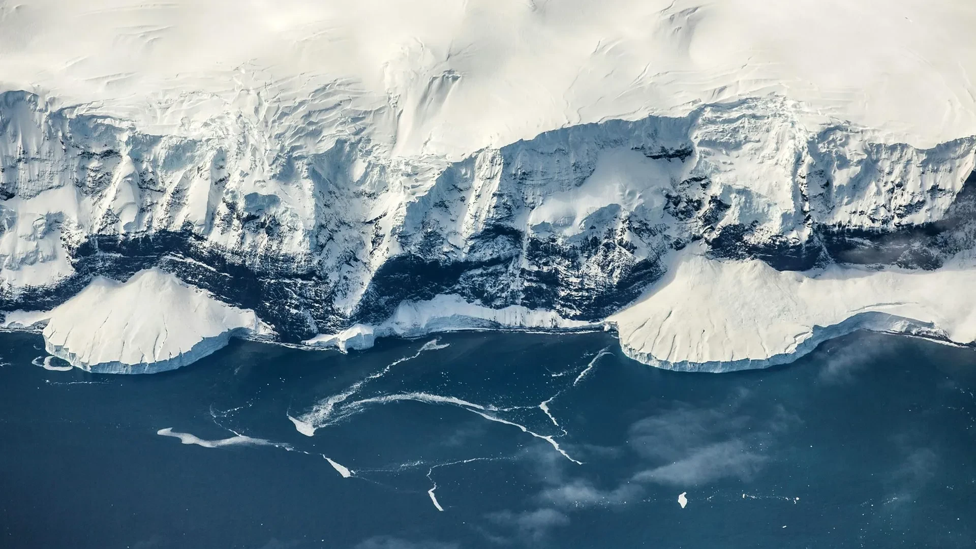
Now, an international team of scientists has published groundbreaking research in the journal Science that points to a radically different culprit: the Earth’s deep interior. According to the study, the gradual uplift of high terrain across East Antarctica—including an extensive coastal escarpment, an elevated plateau, and massive inland mountain ranges—created high-altitude environments cold enough for snow and ice to persist and accumulate.
This monumental tectonic uplift gave Antarctica a massive head start in the global glaciation race. While the Southern Hemisphere continent was raised into the freezing skies by internal geological forces, Northern Hemisphere landmasses remained at lower elevations, keeping the Arctic largely ice-free for another 30 million years. Today, the resulting East Antarctic Ice Sheet stands as the largest single mass of ice on Earth, containing enough frozen water to elevate global sea levels by roughly 52 meters (170 feet) should it ever completely melt.
Chronology: 100 Million Years of Tectonic and Climatic Evolution
To understand how Antarctica transformed from a temperate landscape into an ice-bound fortress, researchers had to reconstruct a geological timeline spanning more than 100 million years.
1. The Breakup of Gondwana (201–143 Million Years Ago)
The story begins during the Jurassic Period, when tectonic forces initiated the breakup of the supercontinent Gondwana. As Antarctica and Africa began their slow, inexorable separation, massive stress fields were imparted upon the underlying mantle and continental crust.
2. The Rise of ‘Mantle Waves’ (Over 100 Million Years)
As tectonic plates separate, they trigger lesser-known subterranean phenomena. The study was enabled by a newly identified geological mechanism known as "mantle waves." Recently discovered by the research team led by the University of Southampton, these slow-moving waves travel horizontally and vertically beneath continents following tectonic rifting. Previously, mantle waves had been linked to the eruption of deep-seated diamond volcanoes and mysterious, episodic continental uplifts.
As these subterranean waves passed steadily beneath East Antarctica over a span of more than 100 million years, they acted like a slow-moving conveyor belt of heat and pressure. They gradually bowed and lifted the Earth’s crust, forming a vast, high-altitude plateau topped by the Gamburtsev Mountain Range.
3. Crossing the Critical Threshold (45 Million Years Ago)
By approximately 45 million years ago, computer simulations indicate that vast portions of East Antarctica had been shoved upward, climbing above the critical elevation threshold—roughly 2 kilometers (1.2 miles) above sea level—required for mountain glaciers to successfully develop, survive summer thaws, and expand.
4. The Birth of the Ice Sheet (34 Million Years Ago)
As localized mountain glaciers grew, merged, and thickened, they eventually coalesced into the nascent East Antarctic Ice Sheet. This major glaciation event locked in permanent ice around 34 million years ago, fundamentally altering the planet’s albedo and ocean circulation systems. By comparison, major ice sheets in the Northern Hemisphere did not materialize until roughly the past five million years.
Supporting Data: Modeling the Ancient Landscape
To map out these sweeping subterranean and surface changes, the research team employed advanced computational modeling. These simulations reconstructed the dynamic evolution of East Antarctica’s surface topography across 100 million years, tracking how elevation changes intersected with ancient climate states.
The numerical models successfully captured the physical evolution of the two-kilometer-high coastal escarpment, the sweeping interior plateau, and the rugged inland mountains. The data underscores a fundamental rule of meteorology and geomorphology: topography dictates local climate. Air temperatures drop precipitously—by roughly 1°C for every 100 meters of altitude gained.
Before 50 million years ago, the majority of the Gamburtsev Mountains sat at modest elevations below 1.5 kilometers. By 34 million years ago, however, nearly half of the mountain range had been pushed above the critical 2-kilometer mark. At these soaring elevations, summer temperatures dropped low enough to prevent seasonal snowpack from melting.
Once permanent snow and ice established a foothold, a series of powerful climate feedbacks accelerated the cooling process across the entire continent:
- The Ice-Albedo Effect: As the ice sheet expanded, its pristine, bright white surface reflected a vastly higher percentage of incoming solar radiation back into space. The researchers estimate this single feedback loop reduced global temperatures by an additional 1°C.
- Atmospheric Dehumidification: Colder regional air holds significantly less water vapor. Because water vapor acts as a natural greenhouse gas—insulating the planet like a blanket—a drier atmosphere weakened this insulating effect, driving temperatures down even further.
- Continental Spreading: Propelled by these compounding feedbacks, the Antarctic ice sheet broke free of the high mountain strongholds, creeping steadily outward across the plateau until it reached the coastlines.
Official Responses and Perspectives from the Research Team
The international study was led by the University of Southampton in close collaboration with Durham University (UK), the GFZ Helmholtz Centre for Geosciences (Germany), the University of Potsdam (Germany), Utrecht University (the Netherlands), and the University of Florence (Italy). Generous support for the project was provided by the WoodNext Foundation.
Prof. Thomas Gernon, Professor of Earth Science at the University of Southampton and lead author of the study, emphasized how geological preparation trumps simple atmospheric chemistry in dictating climate milestones:
"Antarctica’s land surface was gradually lifted to the point where ice could gain a permanent foothold, even while the surrounding polar oceans as well as global temperatures remained surprisingly warm… If falling levels of $textCO_2$ acted alone, you would expect the poles to respond more symmetrically. Instead, Antarctica gained a major head start because geological processes had raised land to higher elevations, making it colder."
Dr. Thea Hincks, Senior Research Fellow at the University of Southampton and co-lead of the study, highlighted the precision of their predictive models:
"We found that our models can realistically capture the evolution of the two-kilometer-high coastal escarpment, elevated plateau and inland mountains, eventually seeding the East Antarctic Ice Sheet."
Dr. Guy Paxman, Royal Society University Research Fellow at Durham University and co-author, pointed to the absolute necessity of topographic data in climate modeling:
"Topography is fundamentally important for glaciation. Air temperatures can drop by up to 1°C for every 100 meters of altitude gained."
Dr. Philip Goodwin, a climate physicist at the University of Southampton and study co-author, detailed the compounding nature of post-uplift environmental shifts:
"As the ice sheet expanded, its bright surface reflected more sunlight back into space, cooling the region further… Together, these feedbacks allowed the Antarctic ice sheet to spread from the mountains across the continent, eventually reaching the coast."
Implications: Rethinking Earth’s Ancient History and Future Tipping Points
The implications of this study stretch far beyond the paleoclimatic history of the southern polar cap. Traditionally, climatologists and geologists have viewed major global climate transitions—such as the onset of ice ages—through a strictly atmospheric or oceanographic lens, focusing heavily on greenhouse gas fluctuations, ocean currents, and orbital cycles (Milankovitch cycles).
This research fundamentally broadens that perspective, suggesting that the Earth’s interior acts as an active architect of climate change. By physically altering surface elevations over geological timescales, the planet’s deep mantle dynamics "precondition" landscapes for glaciation, dictating precisely when and where major climatic shifts become physically possible.
As humanity looks toward a rapidly warming future, understanding the complex interplay between solid Earth geology and fluid climate systems is more critical than ever. Recognizing how internal tectonic forces set the stage for ancient tipping points provides researchers with vital context for evaluating future tipping points in our modern climate system, proving that the ground beneath our feet is just as important to the atmosphere above us as the gases we pump into it.
