

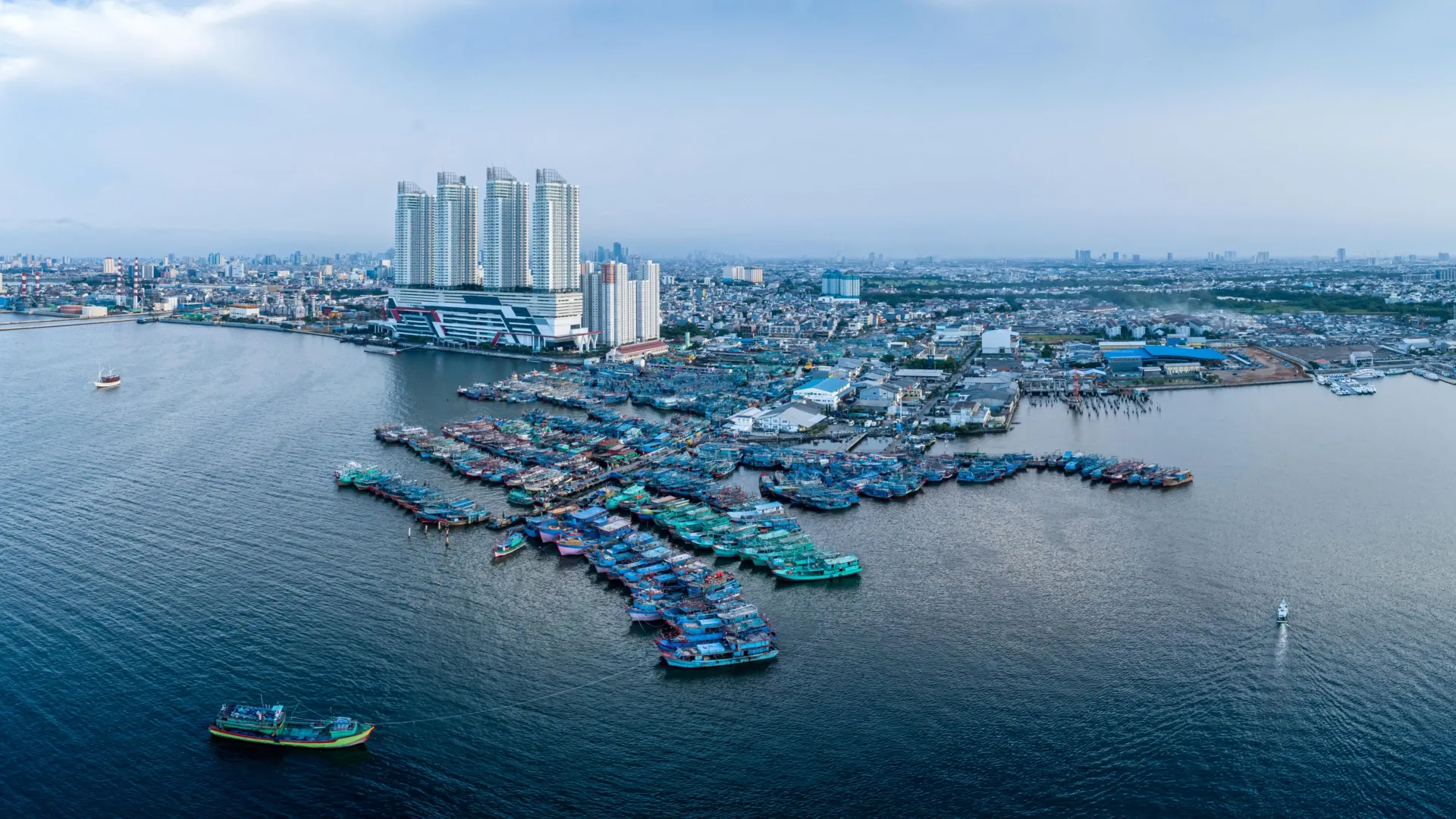
GLOBAL — Along the world’s fragile waterfronts, an insidious double-whammy is quietly redrawing maps and threatening the lives of more than half a billion people. For decades, the global conversation surrounding coastal hazards has been dominated by a singular focus: melting ice sheets and warming oceans driving up absolute sea levels. However, groundbreaking new research reveals that this narrative has missed a massive, compounding variable.
While the oceans are rising from above, the ground beneath many of the world’s most densely populated coastal regions is sinking from below.
According to a landmark study published in the journal Nature Communications by researchers from the Technical University of Munich (TUM) and Tulane University, this downward movement of land is drastically accelerating the rate of sea level rise experienced by coastal communities. Rather than facing the globally averaged rate of sea level rise, hundreds of millions of urban residents are battling a relative sea level rise that is nearly three times higher.
The findings present an urgent call to action for urban planners, policy-makers, and climate scientists alike. Successfully adapting to the future of our coasts requires looking not just at the water, but deep into the earth beneath our feet.
1. Main Facts: The Double Threat to Coastal Megacities
The core revelation of the TUM and Tulane University study is the vast discrepancy between global sea level metrics and the reality on the ground in populated coastal zones.
On a global scale, climate-driven absolute sea level rise clocks in at approximately 3.15 millimeters per year. When factoring in the geographical distribution of coastlines worldwide, the coastline-weighted global average sits at roughly 2.1 millimeters per year.
However, when researchers weighted these calculations against actual human population density, the picture changed dramatically. People living in heavily populated coastal regions experience an average relative sea level rise of about 6 millimeters per year—nearly triple the coastline-weighted average and almost double the absolute climate-driven rate.
This dangerous multiplier effect is driven by land subsidence: the gradual sinking of the geological strata beneath coastal cities and agricultural basins. While climate change adds water to the world’s oceans, human activity and natural geological shifts are simultaneously lowering the container holding it.
The Human Toll on the Front Lines
More than 500 million people currently reside in low-lying coastal zones (LEZs). These areas are economic powerhouses, hosting major global ports, financial centers, agricultural breadbaskets, and cultural hubs. Because urban expansion has historically favored flat, sedimentary coastal plains and river deltas, humanity has inadvertently concentrated its highest-density populations in the very geographies most susceptible to dual-axis sinking.
When relative sea level rise outpaces predictions based purely on climate models, critical infrastructure—including sanitation systems, subways, foundations, roads, and electrical grids—faces premature failure, frequent catastrophic flooding, and eventual abandonment.
2. Chronology: How the Crisis Unfolded and Was Uncovered
Understanding the intersection of subsidence and sea level rise requires examining how scientists arrived at this modern consensus, as well as the historical timeline of human intervention in coastal geology.
- Pre-20th Century: Natural Foundations
For millennia, coastal deltas and floodplains maintained a delicate equilibrium. River systems deposited fresh layers of silt and sediment, naturally offsetting compaction and gradual geological settling. - Mid-20th Century: The Industrial Boom and Groundwater Extraction
As global populations surged, coastal cities industrialized rapidly. To feed growing populations and fuel industrial manufacturing, municipalities and industries began tapping underground aquifers on an unprecedented scale. Cities like Tokyo and Houston experienced massive drops in water tables, triggering unprecedented land subsidence rates that sometimes exceeded 10 to 24 centimeters per year. - Late 20th Century: Early Regional Interventions
Recognizing the immediate threat of collapsing foundations and worsening storm surges, jurisdictions like Tokyo and Texas’s Harris-Galveston region enacted strict groundwater management policies, proving that subsidence could be slowed or halted through aggressive regulatory frameworks. - The 2010s: The Rise of Satellite Geodesy
Advances in remote sensing—specifically Interferometric Synthetic Aperture Radar (InSAR) and satellite altimetry—allowed scientists to measure millimeters of vertical land movement from space. For the first time, researchers could map localized subsidence on a global scale rather than relying solely on isolated tide gauges. - Recent Years: The Nature Communications Breakthrough
Collaborating across continents, researchers from the German Geodetic Research Institute at TUM (DGFI-TUM) and Tulane University synthesized global satellite data with demographic maps. Their published findings exposed the population-weighted reality: coastal residents are experiencing relative sea level rise nearly three times faster than standard global projections suggest.
3. Supporting Data: Sinking Hotspots and Global Metrics
The data compiled by the TUM and Tulane research team highlights striking disparities across nations and individual urban centers.
National Averages
Countries with massive river deltas, intense agricultural groundwater usage, and rapid urbanization bear the brunt of relative sea level rise.
- High-Impact Nations: Thailand, Bangladesh, Nigeria, Egypt, China, and Indonesia record population-weighted coastal averages ranging from 7 to 10 millimeters per year.
- Moderate-High Impact Nations: The United States, the Netherlands, and Italy experience average relative sea level rises of approximately 4 to 5 millimeters per year.
Urban Subsidence Hotspots
Certain major coastal cities are sinking at extraordinary speeds, far outstripping the baseline rate of climate-driven sea level rise. Average annual sinking rates in these urban centers include:
- Jakarta, Indonesia: 13.7 mm/year (with hyper-local zones sinking up to 42 mm/year)
- Tianjin, China: 13.5 mm/year
- Bangkok, Thailand: 8.5 mm/year
- Lagos, Nigeria: 6.7 mm/year
- Alexandria, Egypt: 4.0 mm/year
Even within individual cities, conditions vary wildly. In Jakarta, for instance, localized geotechnical variations mean that while some neighborhoods are sinking by more than four centimeters annually, other sections of the city are simultaneously experiencing minor relative uplift due to localized fault movements or reduced extraction pressures.
The Exception: Postglacial Rebound
Not every coastline on Earth is headed downward. In regions like Sweden and Finland, geological uplift is producing a relative decline in sea level. These areas are still rebounding from the immense weight of heavy ice sheets that pressed down on the Earth’s crust during the last Ice Age—a process known as postglacial rebound. In these northern European locations, the land is rising faster than the ocean waters around them, offering a rare geological reprieve from rising seas.
4. Official Responses: Insights from the Scientific Community
The complex drivers of subsidence require a fundamental shift in how governments approach climate resilience. Experts emphasize that mitigating coastal hazards cannot rely on sea walls alone; it requires active management of the ground beneath our feet.
Dr. Julius Oelsmann, lead author of the study and a researcher at DGFI-TUM, emphasizes the need for a holistic observational approach:
"If we want to understand sea-level rise along coastlines and respond effectively, we must not only observe the ocean but also the land itself. Especially in densely populated coastal regions, human activities cause the land to subside more strongly—often due to excessive extraction of water and resources that previously stabilized the subsurface. The sheer weight of cities, along with long-term geological processes, can further intensify this subsidence. In doing so, we significantly amplify the effects of climate-driven sea-level rise."
Addressing the root causes of subsidence requires political will and robust regulatory mechanisms, notes Florian Seitz, Professor of Geodetic Geodynamics and Director of DGFI-TUM:
"In many large coastal cities, groundwater extraction is a major driver of land subsidence. This means that local political and water-management decisions can make a significant difference. Improved groundwater management, stricter regulation of withdrawals, or targeted recharge of aquifers can at least slow subsidence rates and, in some cases, largely halt them."
Proof of Concept: Regulatory Success Stories
History proves that targeted intervention can successfully mitigate human-induced sinking.
- Tokyo, Japan: Decades ago, the Japanese capital faced catastrophic subsidence exceeding 10 centimeters annually, with the worst-hit areas sinking by roughly 24 centimeters per year. Through sweeping government action, restrictions on deep groundwater pumping, and the development of alternative municipal water supplies, Tokyo successfully brought these extreme subsidence rates to a near halt.
- Harris-Galveston, Texas: In the United States, extensive groundwater withdrawal caused severe land sinking along the upper Texas coast. In response, officials established the Harris-Galveston Subsidence District in 1975. By regulating groundwater usage, encouraging alternative surface water sources, and promoting aggressive conservation, the district successfully mitigated further rapid sinking in the region.
5. Implications: The Future of Coastal Planning
The insights provided by the TUM and Tulane study carry profound implications for the future of global infrastructure, economic stability, and human migration.
1. Inadequate Climate Models
Traditional climate adaptation plans often rely on absolute sea level rise projections. If local urban planners fail to factor in land subsidence—which can double or triple the speed at which water encroaches—infrastructure investments like sea walls, drainage systems, and flood gates will be severely undersigned and prematurely overwhelmed.
2. A Call for Integrated Water and Land Management
Cities can no longer view water security and geological stability as separate disciplines. Sustainable urban planning in coastal deltas must integrate:
- Strict limits on deep-aquifer groundwater extraction.
- Mandatory artificial aquifer recharge programs to replenish underground water tables.
- Zoning laws that account for the added structural weight of high-density real estate developments on compressible delta sediments.
- Comprehensive micro-geodetic monitoring (using satellite InSAR data) to track millimeter-scale shifts in real time.
3. Managed Retreat and Hard Adaptation
For certain severely sinking delta cities—such as Jakarta, which has prompted Indonesia to construct an entirely new capital city (Nusantara)—engineered defenses may eventually prove economically or physically unsustainable. Policymakers will increasingly face difficult choices regarding managed retreat, wetland restoration, and the high cost of defending sinking terrain.
Conclusion
The ticking clock of coastal flooding is moving faster than climate models alone indicate. By revealing that half a billion people face relative sea level rises three times the global average due to sinking land, researchers have reframed the climate crisis. The message is clear: saving our coastal cities requires us to protect not only the integrity of our oceans, but the stability of the very earth we stand upon.
