

Main Facts: The Race Against a 10-Minute Timeline
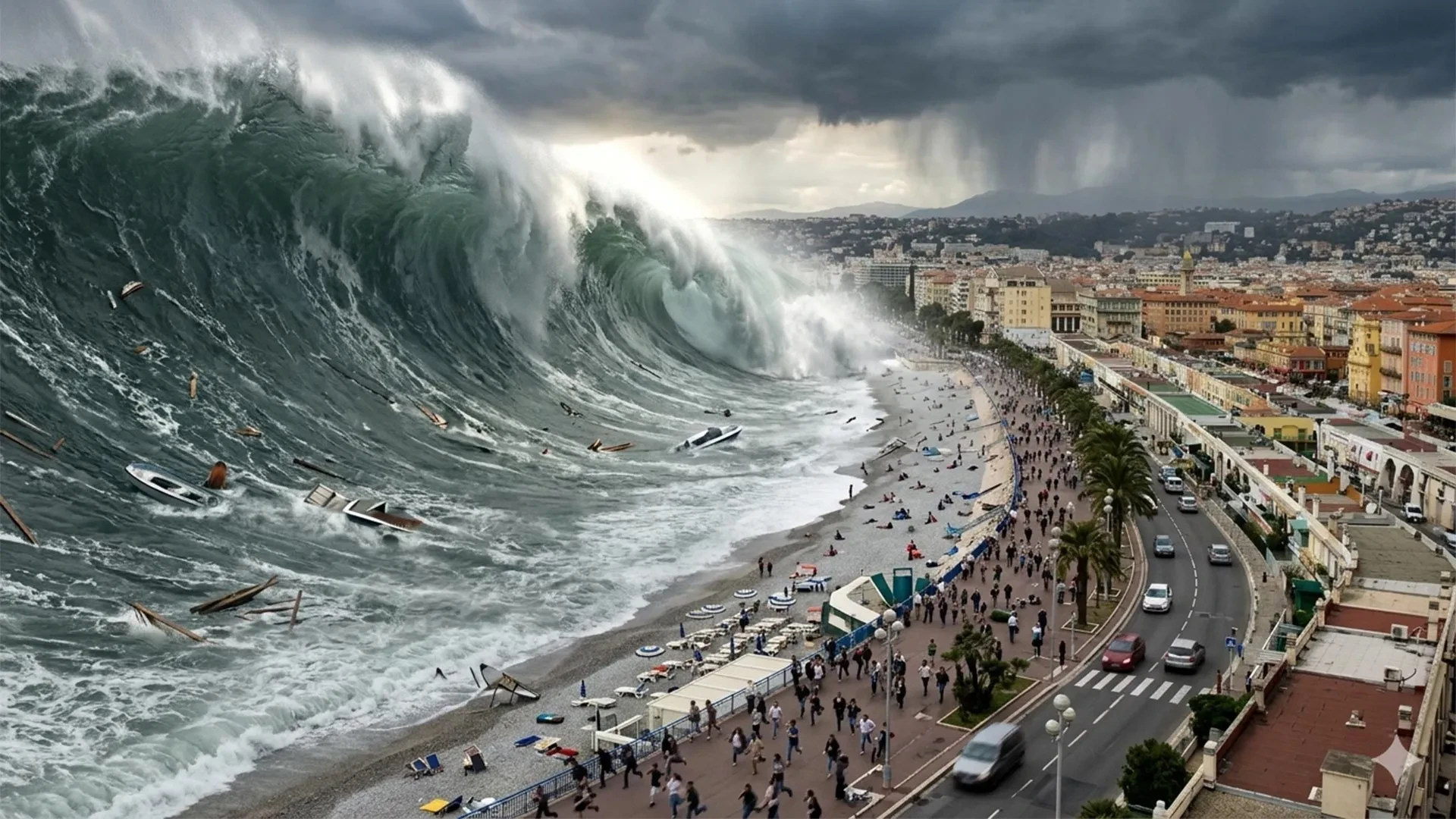
On the sun-drenched beaches of the French Riviera, tourists lounge on the sand and children play by the shoreline, blissfully unaware that a silent, fast-moving threat could emerge from the blue expanse of the Mediterranean Sea. In worst-case local scenarios, a tsunami could crash onto the coast in under 10 minutes—arriving long before a formal warning could ever reach a beachgoer’s mobile phone.
France’s national tsunami warning center, the Centre d’alerte aux tsunamis (Cenalt), is designed to dispatch its initial alert to civil protection authorities within 15 minutes of a potentially dangerous undersea earthquake. That critical five-minute gap leaves virtually zero margin for error.
Recognizing that a text message or siren may arrive too late, researchers and local officials around Nice are shifting their strategy. Instead of relying solely on post-event notifications, they are proactively mapping evacuation routes, designating secure inland refuge sites, and training residents and visitors to recognize natural warning signs. The overarching objective is radical yet essential: make life-saving evacuation decisions before an emergency begins, rather than waiting until the sea behaves abnormally.
The Mediterranean basin is frequently perceived as a tranquil, wave-locked sea immune to seismic cataclysms. However, UNESCO has shattered that complacency. On June 22, 2022, the international body issued a stark warning: the probability of a tsunami wave exceeding one meter anywhere in the Mediterranean over the next 30 years—roughly spanning through 2052—is close to 100%.
While this estimate is a basin-wide statistical probability rather than a localized countdown to a specific disaster, the geological ingredients for disaster are undeniable. Active fault lines snake through the Ligurian Sea near the French and Italian coasts. Further south, the collision of the African and Eurasian tectonic plates generates powerful earthquakes off the coast of North Africa. In addition, localized underwater landslides can trigger abrupt, hyper-local waves that bypass regional monitoring networks altogether.
Contrary to Hollywood depictions of towering walls of water, Mediterranean tsunamis often manifest differently. They can arrive as a rapid, violent rise or a sudden, eerie retreat of the sea, followed by repeated, chaotic surges. While floodwaters can range from mere centimeters to several meters, the hidden danger lies in the hyper-kinetic currents. Fast-moving water can exert immense pressures—equivalent to several tons per square meter—against coastal architecture. Italy’s National Institute of Geophysics and Volcanology notes that even a modest 50-centimeter tsunami can behave like a rushing mountain torrent, sweeping people off their feet and tossing vehicles like toys.
Globally, tsunamis have claimed more than 250,000 lives since 1970, driven largely by mega-disasters in the Indian Ocean (2004) and Japan (2011). While Mediterranean events rarely reach those catastrophic scales, the region possesses a deeply documented history of coastal devastation.
Chronology: A History of Mediterranean and Riviera Tsunamis
Researchers at the University of Montpellier describe the Mediterranean as holding the world’s second-largest historical tsunami record, surpassed only by the Pacific. Along the French Riviera alone, archives document roughly 20 significant events between the 16th century and the early 2000s, with several waves exceeding two meters. A review of key historical milestones reveals how diverse and unpredictable these marine hazards can be:
- February 23, 1887 (The Ligurian Sea Earthquake): A powerful offshore earthquake, estimated between magnitude 6.5 and 6.8, struck the Ligurian basin. Historical records document the sea suddenly receding by roughly one meter in Antibes and Cannes, stranding local fishing boats on exposed seabed. Moments later, waves approaching two meters surged over the beaches, catching coastal populations entirely off guard.
- October 16, 1979 (The Nice Port Collapse): A catastrophic man-made and natural disaster struck when a portion of a commercial port construction site near the Nice airport collapsed into the sea. The resulting underwater landslide triggered a localized tsunami that claimed eight lives. Scientific reconstructions published in Natural Hazards revealed that the wave reached local elevations of 3.5 meters and penetrated up to 150 meters inland, with strong disturbances felt in Antibes for over half an hour.
- May 21, 2003 (The Boumerdès Earthquake, Algeria): Demonstrating the far-reaching threat of southern Mediterranean faults, an earthquake in Algeria generated waves that reached the French Riviera approximately 75 minutes later. The event produced abrupt sea-level drops ranging from 50 centimeters to 1.5 meters, swirling whirlpools, and severe damage to boats across eight marinas. Harbor resonance—where the specific geometry of a basin traps and amplifies water oscillations—caused wildly different impacts in neighboring ports.
- December 4, 2022 (The Stromboli Eruption): A flow of incandescent volcanic material cascaded into the sea at Stromboli, Italy, instantly generating a small local tsunami and activating the island’s automated warning systems. Although Italy’s geological institute reported no structural damage, the event served as a stark reminder that the region’s submarine and volcanic dynamics remain continuously active.
Supporting Data: Demographics and Evacuation Scale
Translating historical warnings into modern civil protection requires meticulous demographic and geographic data. Government agencies and the University of Montpellier have modeled a standardized coastal evacuation zone based on elevation, shoreline proximity, and historical flood heights.
This planning zone generally encompasses all land below five meters in elevation and within 200 meters of the coastline. Near river mouths and estuaries, that boundary expands up to 500 meters inland. Planners emphasize that these are operational planning perimeters, not a prediction that every future wave will reach a height of five meters.
Across the entire French Mediterranean coastline—including the island of Corsica—this vulnerability zone comprises:
- 1,700 kilometers of shoreline.
- 187 municipalities.
- At least 164,000 permanent residents.
During the peak of the summer tourism season, however, the stakes multiply exponentially. Planners must factor in an estimated 835,000 beach users dispersed across these coastal strips.
The Nice Côte d’Azur metropolitan area faces the most severe logistical hurdle due to its dense urban development and immense tourist foot traffic. Advanced computer modeling and photographic surveys conducted by Montpellier researchers indicate that daily beach attendance fluctuates dramatically between 10,000 and 87,000 people depending on the season and hour.
To solve this evacuation puzzle, geography researchers utilized algorithms that factor in local topography, street slopes, physical barriers, average walking speeds, and potential urban bottlenecks. Rather than drawing simplistic lines inland, they mapped the absolute fastest walking routes to verified "safe zones" situated safely beyond a wave’s reach. Today, nearly 100 designated refuge sites have been integrated into official municipal emergency frameworks.
Official Responses: UNESCO Recognition and Institutional Preparedness
France’s national tsunami warning architecture is anchored by Cenalt, which has operated since July 2012 under the international umbrella of UNESCO’s Intergovernmental Oceanographic Commission. Cenalt monitors seismic shifts across the Mediterranean and Northeast Atlantic, transmitting automated alerts to France’s interdepartmental crisis management operational center (Cogic), which then coordinates local authorities.
To bridge the gap between institutional detection and public awareness, France utilizes FR-Alert, a mobile notification system capable of instantly broadcasting emergency instructions to cell phones within a targeted geographical zone. However, recognizing the limitations of digital alerts during rapid-onset local tsunamis, municipalities have taken grassroots action.
The gold standard of this preparedness push came in June 2026, when UNESCO formally awarded Tsunami Ready recognition to the Nice Côte d’Azur metropolitan area.
The UNESCO Tsunami Ready Recognition Program (TRRP) is a rigorous international standard that evaluates communities against 12 strict indicators spanning risk assessment, mitigation planning, public education, and 24/7 emergency response readiness. Certified communities must demonstrate functional evacuation mapping, continuous alert-distribution capabilities, and regular community drills. This certification must be officially renewed every four years.
Nice follows in the footsteps of Deshaies in Guadeloupe (recognized in 2023) and Cannes, which became mainland France’s first Tsunami Ready municipality in January 2024. In all these milestones, the Laboratory of Geography and Land Planning at the University of Montpellier provided critical scientific and technical scaffolding.
Beyond bureaucratic planning, the initiative focuses heavily on public engagement. The region has installed permanent coastal signage, launched educational outreach programs in local schools, and deployed a publicly accessible interactive web platform. This digital tool allows residents and tourists to inspect local hazard zones, trace evacuation routes, and review survival protocols long before an emergency occurs.
International case studies validate these measures. A post-disaster review of the 2011 Great East Japan Earthquake conducted by GNS Science revealed a remarkable 96% survival rate among people living within inundated zones who had prior education and practiced evacuation drills. Conversely, the review cautioned that hesitating for official confirmation or waiting to visually verify an approaching wave drastically reduces survival odds.
Implications: A New Culture of Coastal Resilience
The sobering reality facing the French Riviera holds profound implications for coastal communities worldwide: possessing an advanced technological warning system is only half the battle. When a tsunami can arrive in less than 10 minutes, human behavior becomes the ultimate determinant of life and death.
Survival protocols established for Nice and the wider Mediterranean coast emphasize clear, uncompromising rules of thumb:
- Trust Natural Warnings First: A felt earthquake, a sudden, unnatural withdrawal of the ocean, or a roaring ocean sound are immediate, undeniable emergency alarms. Do not wait for an official siren or text message.
- Move Inland on Foot: If an alert is triggered or natural signs appear, immediately abandon the beach and head on foot toward elevated terrain or designated refuge sites. Drivers must abandon vehicles if traffic stalls, as gridlocked cars transform coastal roads into death traps.
- Protect During Shaking: If a local earthquake occurs, drop, cover, and hold on until the shaking stops, then immediately sprint toward higher ground without pausing to gather belongings.
- Stay Away Long-Term: The first wave is rarely the largest. Destructive surges and lethal currents can persist for hours. Evacuees must remain outside the hazard zone until civil protection authorities issue an explicit all-clear.
Ultimately, the transformation of the French Riviera illustrates a vital paradigm shift in disaster risk reduction. By blending advanced seismological monitoring with meticulous urban geography, community education, and international certification standards, Nice and its neighboring municipalities are proving that vulnerability to natural hazards is not an absolute destiny. On shores where the sea can turn hostile in minutes, the ultimate defense is a community prepared before the first wave ever forms.
