

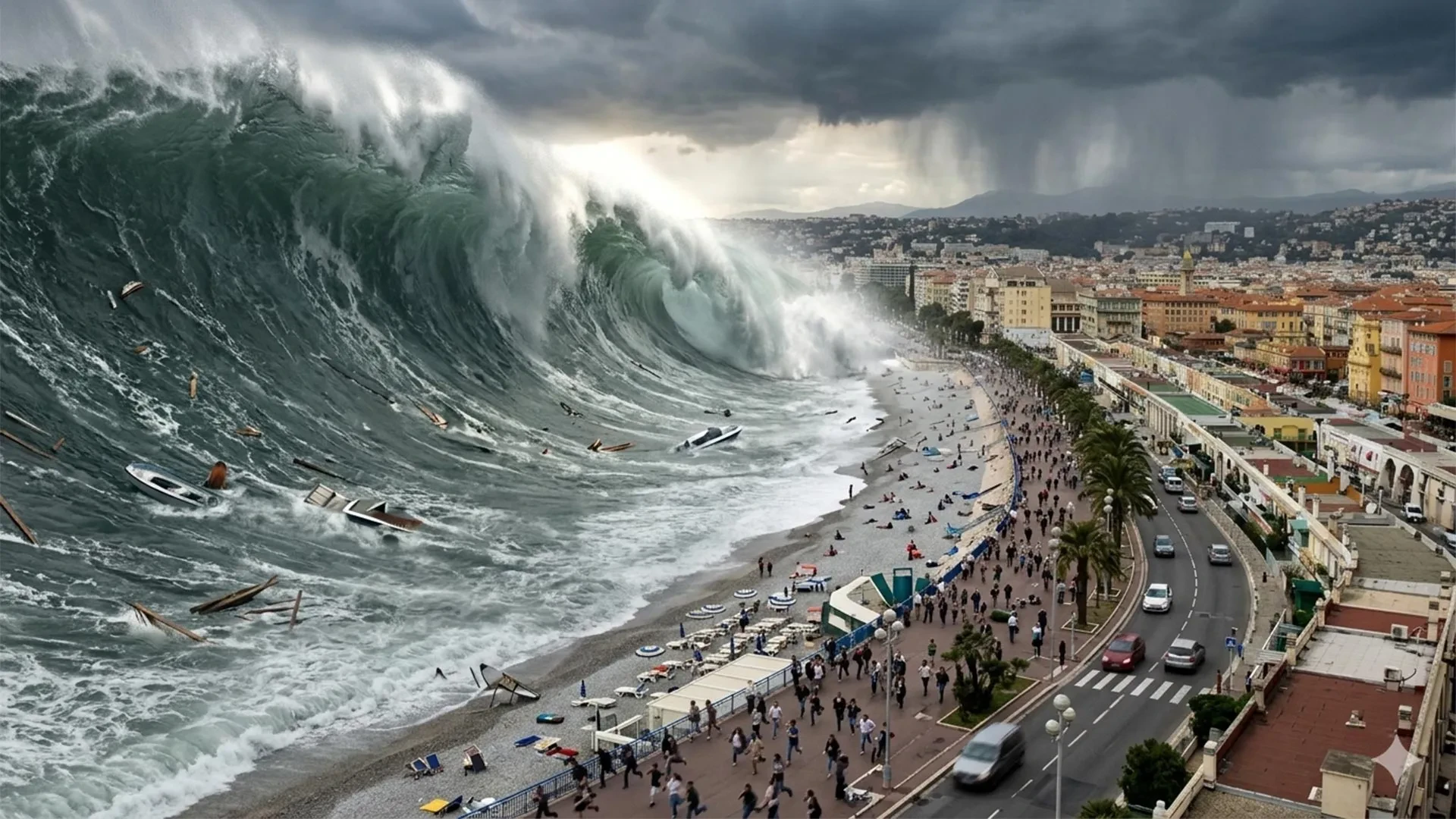
NICE, France — In the sun-drenched paradise of the French Riviera, tourists lounge on pebble beaches while luxury yachts glide smoothly across the azure waters of the Mediterranean. It is a landscape defined by leisure and tranquility. Yet beneath this idyllic veneer lies a ticking geological clock.
According to marine geologists and emergency planners, a tsunami could strike the French coastline faster than official warning systems can process and broadcast an alert. In worst-case local scenarios, the initial wall of water could thunder onto the shore in less than 10 minutes. Meanwhile, France’s national warning center—designed to detect seismic activity and notify civil protection authorities—operates on a 15-minute timeline.
Those two contrasting windows leave zero room for error, prompting a radical shift in how coastal communities approach disaster preparedness. Rather than relying solely on high-tech sirens and digital alerts that may arrive too late, researchers, local officials, and civil defense units around Nice are preemptively mapping walking routes, designating high-ground refuge sites, and educating the public. The underlying philosophy is stark: when seconds count, the most vital evacuation decisions must be made before the sea even begins to behave strangely.
Main Facts: The Hidden Vulnerability of an Inland Sea
The popular perception of the Mediterranean is that of a calm, enclosed sea largely immune to the catastrophic tsunamis associated with the Pacific Ring of Fire. UNESCO and international geological bodies have aggressively pushed back against this dangerous assumption.
On June 22, 2022, UNESCO released a sobering warning: the probability of a tsunami wave exceeding one meter in height somewhere in the Mediterranean over the ensuing 30 years (roughly through 2052) is close to 100%. While this estimate did not predict an imminent catastrophe or guarantee that every stretch of coastline would be impacted, it highlighted the region’s underlying geological volatility.
The Mediterranean possesses all the active ingredients necessary to generate powerful tsunamis:
- Active Fault Lines: Seismic rifts in the Ligurian Sea sit dangerously close to the French and Italian coasts.
- Tectonic Convergence: Further south, the collision of the African and Eurasian plates spawns massive underwater earthquakes off the coast of North Africa.
- Submarine Landslides: Underwater collapses of continental slopes can trigger hyper-localized, highly destructive waves with almost zero warning time.
The Myth of the Towering Wall of Water
Popular culture has conditioned people to view tsunamis as towering, curling waves crashing down onto cities. In reality, a Mediterranean tsunami is often far more insidious.
Triggered by sudden displacements of water, these events can manifest as a rapid, terrifying surge or a sudden, unnatural retreat of the sea, followed by repeated, aggressive waves. While flooding may range from mere centimeters to several meters, the true danger lies in the sheer kinetic energy of the water. Fast-moving currents can exert forces equivalent to several tons per square meter against coastal infrastructure, turning streets into rushing torrents.
According to Italy’s National Institute of Geophysics and Volcanology, even a modest tsunami with an amplitude of just 50 centimeters can be lethal due to the sustained, heavy momentum of the water. Globally, tsunamis have claimed more than 250,000 lives since 1970, overwhelmingly driven by mega-disasters in the Indian Ocean (2004) and Japan (2011). However, historical data proves the Mediterranean is far from exempt.
Chronology: A History of Seismic Shocks and Sudden Floods
Researchers at the University of Montpellier describe the Mediterranean as holding the world’s most extensive historical tsunami record outside the Pacific. Along the French Riviera alone, scientists have documented roughly 20 significant events between the 16th century and the early 2000s, with waves frequently exceeding two meters. Four major historical milestones illustrate how diversely this threat can materialize:
1. The Ligurian Earthquake of February 23, 1887
An earthquake registering between 6.5 and 6.8 on the Richter scale struck the Ligurian Sea, sending shockwaves along the French and ItalianRiviera. Historical documentation records the sea suddenly withdrawing by roughly one meter in Antibes and Cannes, leaving fishing vessels stranded on exposed seabed. Moments later, waves approaching two meters slammed violently onto the beaches.
2. The Port Collapse of October 16, 1979
A man-made disaster with natural consequences occurred when a portion of a commercial port construction site in Nice—situated right next to the international airport—catastrophically collapsed into the sea. The resulting underwater landslide and localized tsunami caused eight deaths. Scientific reconstructions later revealed that water reached local elevations of 3.5 meters and penetrated as far as 150 meters inland, with violent disturbances recorded in Antibes for half an hour.
3. The Boumerdès Earthquake of May 21, 2003
Demonstrating that a threat could originate from across the basin, a powerful earthquake in Algeria sent tsunami waves across the Mediterranean to the French Riviera in roughly 75 minutes. The event triggered abrupt sea-level drops of 50 centimeters to 1.5 meters, completely draining harbor basins, creating swirling whirlpools, and smashing boats against one another in eight separate marinas. The phenomenon of harbor resonance—where the specific geometric shape of a port basin amplifies water oscillations—explained why neighboring ports suffered vastly different levels of damage.
4. The Stromboli Eruption of December 4, 2022
A recent reminder of ongoing risks occurred when a flow of red-hot volcanic material cascaded into the sea at Stromboli, generating a minor tsunami that immediately triggered local warning systems. While Italy’s geological institute reported no structural damage, the event underscored that Mediterranean tectonic and volcanic activity remains an active, continuous hazard.
Supporting Data: The Demographics of Coastal Danger
Preparing for a disaster of this scale requires precise demographic and geographic modeling. Government agencies and researchers at the University of Montpellier utilized elevation data, distance metrics, and historical archives to define a rigorous coastal evacuation zone across the French Mediterranean and Corsica.
- The Planning Boundary: The designated evacuation zone generally encompasses any land situated below five meters in elevation and within 200 meters of the shoreline. Around river mouths and estuaries, this buffer zone extends up to 500 meters inland. (Experts emphasize these are operational planning boundaries, not a guarantee that future waves will reach five meters in height).
- The Scale of Exposure: Across 1,700 kilometers of coastline, this zone blankets 187 towns and municipalities, housing at least 164,000 permanent residents.
- The Tourist Factor: During the height of the summer tourism season, that number explodes dramatically. Planners must account for an estimated 835,000 beach users and tourists packed into these high-risk coastal strips.
In the densely populated Nice Côte d’Azur metropolitan area, these challenges are compounded. Depending on the season and time of day, computer modeling estimates that anywhere from 10,000 to 87,000 people can be found directly on the beaches at any given moment.
To solve this, urban geographers at Montpellier’s Laboratory of Geography and Land Planning deployed advanced algorithms. Factoring in local slopes, physical street obstacles, pedestrian walking speeds, and potential crowd bottlenecks, they mapped the fastest possible walking routes to safe ground. Local authorities have since validated nearly 100 dedicated refuge sites located safely beyond the reach of potential waves.
Official Responses: From National Alerts to International Recognition
France’s official line of defense begins with Cenalt (Centre d’alerte aux tsunamis), the national tsunami warning center established in July 2012. Operating within UNESCO’s international monitoring framework, Cenalt continuously tracks seismic events capable of triggering tsunamis, relaying rapid assessments to France’s interdepartmental crisis management operational center (Cogic) and local civil authorities.
Once authorities receive the data, the message must reach the public. France utilizes the FR-Alert system, capable of broadcasting emergency notifications directly to mobile phones within threatened sectors. However, experts acknowledge the inherent time lag. For a tsunami originating near North Africa, the Riviera has roughly 90 minutes; for a local Ligurian Sea event or an underwater landslide, that window shrinks to mere minutes, rendering traditional text-alert chains dangerously slow.
Nice Earns UNESCO "Tsunami Ready" Status
Recognizing that technology alone cannot save lives, municipal and national leaders have leaned heavily into grassroots preparedness. In June 2026, those efforts bore fruit when UNESCO officially designated the Nice Côte d’Azur metropolitan area as a Tsunami Ready community.
The UNESCO Tsunami Ready Recognition Program (TRRP) is a rigorous international benchmark evaluating communities against 12 strict indicators. These include comprehensive risk mapping, public education programs, approved evacuation protocols, and reliable 24/7 reception and dissemination of emergency warnings. Communities must recertify their status every four years.
Nice follows in the footsteps of Deshaies in Guadeloupe (recognized in 2023) and Cannes, which became mainland France’s first Tsunami Ready municipality in January 2024. Montpellier researchers provided vital scientific backing for all these initiatives, establishing a blueprint that can be replicated across Europe and France’s overseas territories.
Implications: Changing the Mindset of Coastal Populations
Having maps and evacuation routes is meaningless if the public does not know how to act. Nice’s preparedness campaign extends deep into schools, community centers, and digital spaces. An interactive public platform allows residents and tourists to check evacuation zones and designated routes on their smartphones before an emergency ever occurs.
Global data underscores the lifesaving value of this proactive education. A review by GNS Science analyzing Japan’s devastating 2011 tsunami revealed an astonishing 96% survival rate among people inside inundated zones who had prior education and practiced evacuation drills. Conversely, the review issued a stark warning: waiting for official, top-down confirmation before fleeing drastically increases fatality rates.
The Golden Rules of Survival
Emergency planners stress that natural warning signs are often the only clues a person will get:
- Trust Nature: A sudden, violent withdrawal of the sea, or conversely, a rapid, unnatural rise of water, is a dead giveaway. However, not all tsunamis are preceded by a sea retreat.
- Move on Foot: If an earthquake is felt near the coast—or if an official alert sounds—people must immediately move inland and toward higher ground on foot. Drivers are instructed to abandon vehicles safely if caught in traffic gridlock, as cars quickly become death traps in rising water.
- Protect First, Then Flee: During heavy shaking from an earthquake, individuals should drop, cover, and hold on, then sprint toward safety the exact moment the shaking stops.
- Stay Away: The first wave is rarely the largest. Dangerous currents and secondary surges can ravage the coast for hours. Evacuees must remain outside the designated hazard zone until civil defense authorities issue an official all-clear.
For the French Riviera, the modern reality is clear: technology provides a safety net, but human preparedness provides survival. When the ocean turns hostile and the first wave is only minutes away, the time to figure out an escape route is long before the emergency begins.
