


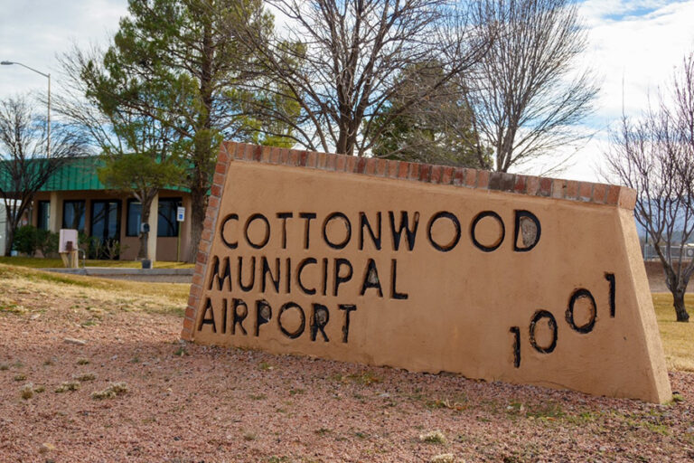
COTTONWOOD, ARIZONA — In an effort to address the complex challenges of modern general aviation, Cottonwood Municipal Airport (KP09) has officially released updated pilot operating guides. Designed for both fixed-wing aircraft and helicopter operators, these revised guidelines establish comprehensive noise abatement practices and standardize flight procedures.
The initiative comes as the Verde Valley experiences steady population growth and an increase in regional air traffic. By formalizing these guidelines, airport authorities aim to foster a safer, more predictable flying environment while remaining a conscientious neighbor to the surrounding residential communities.
Main Facts: The New Standard for Cottonwood Airspace
The newly updated guidelines represent a collaborative effort to modernize pilot protocols at Cottonwood Municipal Airport. Located in Yavapai County, the airport serves as a vital transportation, emergency medical, and recreational hub for northern Arizona. The updated guides are divided into distinct operating procedures for fixed-wing aircraft and helicopters, alongside universal safety protocols.
At the core of the updates is a push for voluntary compliance with noise abatement procedures. While the Federal Aviation Administration (FAA) maintains ultimate authority over aircraft in flight, local municipal airports frequently implement voluntary guidelines to mitigate the acoustic impact of aviation on nearby homes, schools, and business districts.
+-----------------------------------------------------------------------------------------+
|                               COTTONWOOD MUNICIPAL AIRPORT                              |
|                                QUICK REFERENCE PROTOCOLS                                |
+------------------------------+----------------------------+-----------------------------+
| Aircraft Category            | Pattern Altitude (MSL)     | Pattern Altitude (AGL)      |
+------------------------------+----------------------------+-----------------------------+
| Helicopters                  | 4,060 feet                 | 500 feet                    |
| Single-Engine Aircraft       | 4,360 feet                 | 800 feet                    |
| Multi-Engine Aircraft        | 4,560 feet                 | 1,000 feet                  |
| Turbine/Jet Aircraft         | 5,060 feet                 | 1,500 feet                  |
+------------------------------+----------------------------+-----------------------------+
| Runway 14 Pattern Direction  | Left-Hand Rectangular                                    |
| Runway 32 Pattern Direction  | Right-Hand Rectangular (Calm-Wind Runway)                |
+------------------------------+----------------------------+-----------------------------+
Airport officials have strongly urged all transient and home-based pilots to review these documents before planning their flights. The complete guides are accessible via the official City of Cottonwood municipal portal.
Chronology: The Evolution of KP09 and the Push for Mitigation
The history of Cottonwood Municipal Airport reflects the broader transformation of the Verde Valley. Established in the mid-20th century as a modest rural airstrip, the facility originally served local ranchers, light utility aircraft, and early recreational aviators. For decades, the surrounding landscape remained largely agricultural and sparsely populated, meaning aircraft noise was rarely a point of contention.
However, over the past thirty years, the region’s demographic landscape has shifted dramatically:
- 1990s–2000s: Rapid residential development expanded outward from Cottonwood’s historic core. Subdivisions began encroaching closer to the airport’s boundaries, narrowing the buffer zone between residential neighborhoods and active flight paths.
- 2010s: The Phoenix metropolitan area experienced an aviation training boom. Due to congested airspace in the Valley of the Sun, flight schools increasingly utilized regional airports like Cottonwood for cross-country training, touch-and-go practice, and simulated emergency maneuvers. This led to a significant spike in daily takeoffs and landings.
- 2020–Present: The post-pandemic influx of new residents to the Verde Valley, combined with a surge in regional aerial tourism (including helicopter tours of nearby Sedona and the red rock country), brought noise concerns to a head.
In response to rising community feedback and the changing mix of airspace users, airport administration initiated a comprehensive review of its operating guides. This process culminated in the newly released directives, which aim to systematically codify safety and noise-reduction practices that had previously been communicated only informally.
Supporting Data: Technical Specifications and Airspace Parameters
The updated guidelines outline highly specific parameters designed to organize traffic flow and minimize the acoustic footprint of departing and arriving aircraft. Because Cottonwood Municipal Airport sits at an elevation of approximately 3,560 feet above mean sea level (MSL), precise altitude management is critical for safety and noise mitigation.
1. Stratified Traffic Pattern Altitudes
To ensure vertical separation between different aircraft performance categories, the airport has established stratified traffic pattern altitudes:
- Helicopters: 4,060 feet MSL (500 feet above ground level [AGL]). This lower altitude keeps rotorcraft clear of higher, faster fixed-wing traffic while allowing them to maneuver safely to designated landing zones.
- Single-Engine Aircraft: 4,360 feet MSL (800 feet AGL). This is the standard pattern altitude for light training and personal aircraft, providing a safe glide distance to the runway in the event of an engine failure.
- Multi-Engine Aircraft: 4,560 feet MSL (1,000 feet AGL). The additional altitude accommodates the higher speeds and wider turning radii of multi-engine aircraft.
- Turbine/Jet Aircraft: 5,060 feet MSL (1,500 feet AGL). High-performance turboprops and business jets are kept at the highest tier to maximize safety margins and keep high-decibel engines as far from the ground as practical during the approach phase.
2. Runway Configuration and Traffic Flow
The airport features a single paved runway oriented northwest/southeast, designated as Runway 14/32:
- Runway 14 utilizes a standard left-hand rectangular pattern.
- Runway 32 utilizes a right-hand rectangular pattern.
- Runway 32 is officially designated as the calm-wind runway. When wind speeds are negligible (typically under 5 knots), pilots are encouraged to utilize Runway 32 for departures and arrivals to streamline traffic flow and direct noise away from noise-sensitive areas southeast of the field.
       [Runway 32]  <--- Right-Hand Pattern
           ▲
           │   (Runway Direction: 320° / 140°)
           │
           ▼
       [Runway 14]  ---> Left-Hand Pattern
3. Noise Abatement Flight Paths
For fixed-wing aircraft, the guidelines recommend specific climb-out profiles. Pilots are advised to climb at the maximum safe rate of climb ($V_y$) to gain altitude as quickly as possible, thereby reducing the duration of high-power engine noise over nearby homes. Left turns on departure from Runway 14 and right turns from Runway 32 should be delayed until the aircraft has cleared congested residential areas and reached a safe maneuvering altitude.
For helicopters, operators are urged to avoid low-altitude overflights of residential structures, schools, and parks. Instead, pilots should follow established natural corridors—such as the Verde River basin or major highway alignments—whenever safety and wind conditions permit.
Official Responses: Municipal and Aviation Perspectives
Local leadership and airport management have emphasized that the success of these guidelines relies on cooperation and mutual respect between the aviation community and Cottonwood residents.
"Cottonwood Municipal Airport is a vital economic driver and a lifesaving asset for our community," stated a representative from the City of Cottonwood’s aviation division. "However, we recognize that being a good neighbor means actively working to minimize our environmental and acoustic footprint. These updated guides provide pilots with clear, actionable steps to fly safely and quietly."
Local flight instructors have also expressed support for the revised Standard Operating Procedures (SOPs).
"Consistency is the foundation of safety in aviation," said an instructor based out of the Verde Valley. "By clearly defining pattern altitudes, turn directions, and the calm-wind runway, these guidelines eliminate ambiguity. It makes it much easier to train student pilots to operate professionally and courteously in a relatively busy, non-towered airspace."
Implications: Balancing Safety, Economics, and Quality of Life
The implementation of these updated guidelines carries significant implications for several key areas of the community:
Airspace Safety in a Mixed-Use Environment
Cottonwood’s airspace is uniquely complex. In addition to traditional general aviation traffic, the area is highly popular for recreational aviation, including:
- Skydiving operations
- Hang gliders and paragliders
- Ultralight aircraft
- Medical transport helicopters serving the nearby Yavapai Regional Medical Center and local clinics
- Scenic aerial tours
The mandate for pilots to maintain "Lights On" operation at all times within the airport environment is a direct response to this high-density, mixed-use traffic. Enhanced visual conspicuity is crucial in a non-towered environment where pilots rely on "see-and-avoid" principles to prevent mid-air conflicts.
Community Relations and Noise Mitigation
By establishing clear, written expectations for noise abatement, the city hopes to reduce the volume of noise complaints from local property owners. While the guidelines are technically voluntary under federal aviation law, the aviation community historically demonstrates high rates of compliance with local noise-mitigation requests when they are clearly communicated and do not compromise flight safety.
Regional Economic Integration
As a key regional airport, KP09 facilitates business travel, tourism, and emergency services. Keeping the airport operational and integrated with the community’s needs prevents the type of political friction that has led to severe operating restrictions or closures at other regional airports across the United States. Through proactive self-regulation, Cottonwood aims to preserve its aviation infrastructure for future generations while respecting the peaceful lifestyle valued by Verde Valley residents.
