

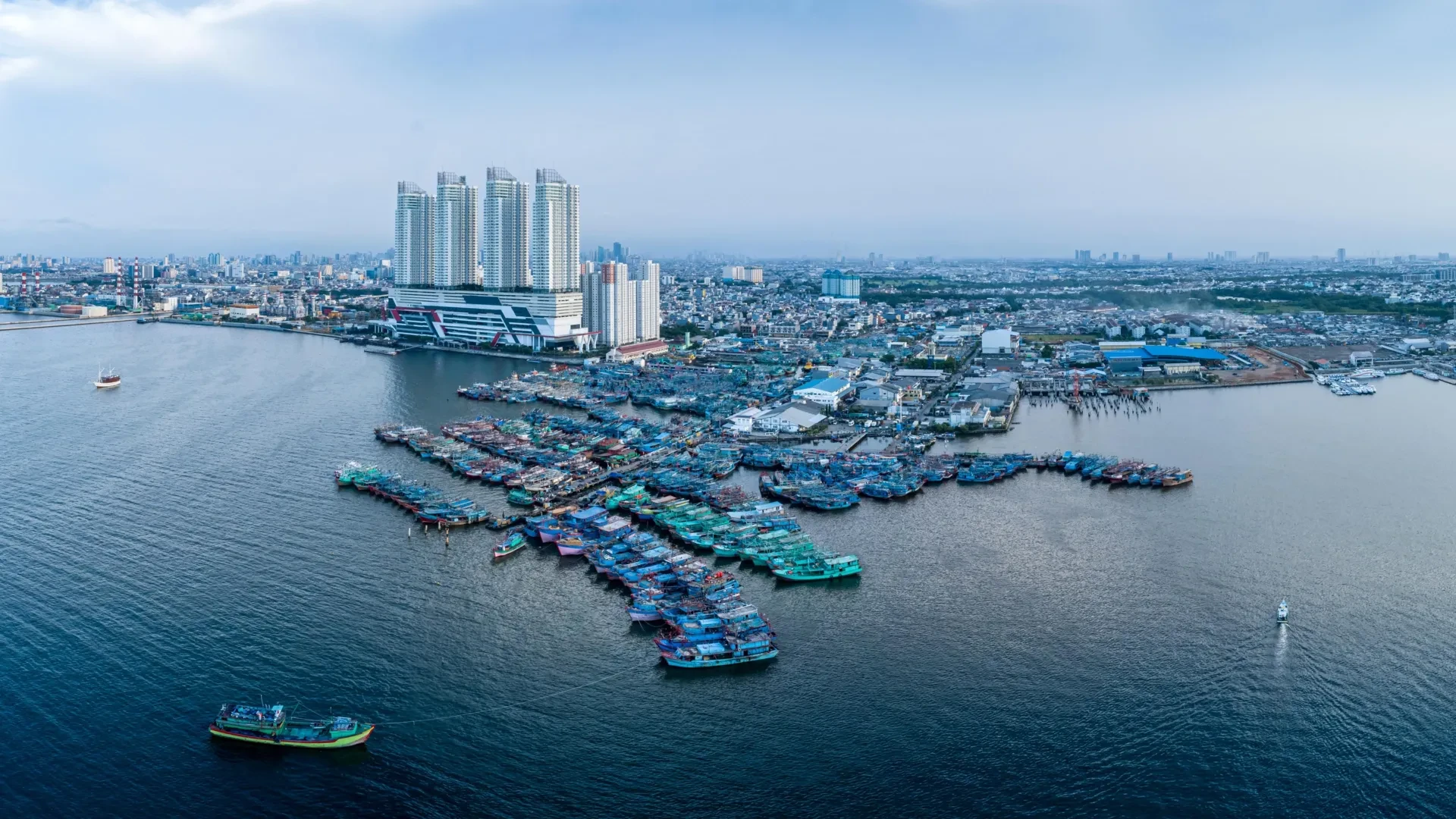
GLOBAL — Across the world’s most densely populated coastal margins, a silent and relentless crisis is unfolding. While international climate negotiations frequently center on melting ice sheets and expanding ocean waters, a parallel, equally destructive force is accelerating the threat: the ground beneath our feet is sinking.
A landmark study published in Nature Communications by researchers from the Technical University of Munich (TUM) and Tulane University reveals that human-driven land subsidence is dramatically worsening the impact of sea-level rise. For more than half a billion people living in low-lying coastal zones, this dual threat means that the reality of rising waters is arriving nearly three times faster than global climate averages suggest.
1. Main Facts: The Double Threat to Coastal Communities
The fundamental thesis of the TUM and Tulane University research is straightforward yet alarming: coastal populations are caught in a pincer movement. On one side, climate change is driving absolute sea-level rise as glaciers melt and ocean waters warm. On the other, intensive human activity and geological shifts are causing the land itself to collapse downward.
According to the study, individuals living in heavily populated coastal regions experience an average relative sea-level rise of approximately 6 millimeters per year. To put this in perspective:
- This rate is nearly three times the coastline-weighted global average of 2.1 millimeters per year.
- It is almost twice the climate-driven absolute sea-level rise of approximately 3.15 millimeters per year.
This discrepancy is driven primarily by land subsidence. While rising seas capture global headlines, the localized collapse of river deltas, the extraction of subsurface resources, and the crushing weight of urban infrastructure are dragging coastlines downward at rates that dwarf standard climate projections.
Consequently, vulnerable populations in megacities across Asia, Africa, and the Americas are facing flooding, infrastructure degradation, and catastrophic storm surges decades earlier than previously anticipated.
2. Chronology: The Evolution of Modern Coastal Sinking
To understand how global coastlines arrived at this precarious juncture, it is necessary to examine the timeline of human interaction with coastal geomorphology and the milestones of scientific discovery regarding subsidence.
Pre-Industrial Era: Natural Geological Adjustments
For millennia, coastal evolution was dictated by slow, natural geological cycles. River deltas naturally subsided as thick layers of young, soft sediments compacted under their own weight. Simultaneously, tectonic plate movements and postglacial rebound—the slow upward crustal adjustment following the retreat of massive ice sheets from the last Ice Age—dictated regional variations in relative sea levels. In places like Scandinavia, the land rose faster than the seas, while other regions experienced steady, natural sinking.
Mid-20th Century: The Acceleration of Resource Extraction
The post-World War II economic boom triggered unprecedented urbanization and industrialization in coastal zones. To support exploding populations and manufacturing centers, municipalities and industries began tapping heavily into deep aquifers, oil reservoirs, and natural gas fields.
By the mid-20th century, cities like Tokyo began recording staggering environmental consequences. Tokyo experienced land subsidence exceeding 10 centimeters per year, with the worst-affected sectors sinking by an astonishing 24 centimeters annually. Similar crises emerged in the Houston-Galveston region of Texas, where unchecked groundwater pumping caused massive swaths of land to drop below sea level, leaving communities dangerously exposed to hurricanes and tidal flooding.
Late 20th Century: Regulatory Interventions and Early Successes
Recognizing the man-made nature of extreme subsidence, regional governments began implementing pioneering mitigation strategies:
- 1975: In response to severe flooding and sinking land, the State of Texas authorized the creation of the Harris-Galveston Subsidence District. Its mandate was to regulate groundwater withdrawals, mandate alternative surface water supplies, and promote conservation.
- Late 20th Century: Tokyo authorities enacted stringent regulations on groundwater abstraction, transitioning the metropolis to imported surface water and treated wastewater. These interventions successfully slowed and, in some districts, nearly halted the sinking trend, proving that human-induced subsidence could be managed.
21st Century: Satellite Geodesy and Global Integration
As remote sensing technology advanced, scientists gained the ability to monitor Earth’s surface movements with millimeter-level precision using Interferometric Synthetic Aperture Radar (InSAR) and satellite altimetry.
The publication of the Nature Communications study by the German Geodetic Research Institute at TUM (DGFI-TUM) and Tulane University marks a pivotal modern milestone. By synthesizing global satellite data with local hydrological metrics, researchers have quantified the exact divergence between absolute sea-level rise and the relative sea-level rise experienced by urban populations worldwide.
3. Supporting Data: Global Hotspots and Sinking Rates
The data compiled by Dr. Julius Oelsmann and his colleagues highlights stark geographic disparities in relative sea-level rise. While some regions experience manageable changes, others are locked in an accelerated race against the sea.
National Averages (Population-Weighted Coastal Rates)
- High-Risk Nations (7 to 10 mm/year): Thailand, Bangladesh, Nigeria, Egypt, China, and Indonesia.
- Moderate-to-High Risk Nations (4 to 5 mm/year): The United States, the Netherlands, and Italy.
Urban Subsidence Hot Spots
At the city level, the rates of sinking are often staggering, frequently far outpacing global sea-level rise benchmarks:
- Jakarta, Indonesia: Average sinking of 13.7 mm/year (with extreme hyper-local pockets dropping by up to 42 mm/year).
- Tianjin, China: Average sinking of 13.5 mm/year.
- Bangkok, Thailand: Average sinking of 8.5 mm/year.
- Lagos, Nigeria: Average sinking of 6.7 mm/year.
- Alexandria, Egypt: Average sinking of 4 mm/year.
The Exception: Postglacial Uplift
Not all coastlines are moving downward. In nations like Sweden and Finland, geological uplift continues as a lingering legacy of the last Ice Age. In these postglacial rebound zones, the land is rising faster than global oceans are expanding, resulting in a relative decline in local sea levels. However, these exceptions are geographically isolated and offer no relief to the hundreds of millions of people clustered around sinking tropical and temperate deltas.
4. Official Responses and Scientific Insights
The scientific community is increasingly vocal about the need to shift policy frameworks. Policymakers can no longer focus solely on oceanographic monitoring; they must also account for terrestrial dynamics.
Dr. Julius Oelsmann, lead author of the study and a researcher at DGFI-TUM, emphasizes the necessity of a holistic observational approach:
"If we want to understand sea-level rise along coastlines and respond effectively, we must not only observe the ocean but also the land itself. Especially in densely populated coastal regions, human activities cause the land to subside more strongly—often due to excessive extraction of water and resources that previously stabilized the subsurface. The sheer weight of cities, along with long-term geological processes, can further intensify this subsidence. In doing so, we significantly amplify the effects of climate-driven sea-level rise."
Florian Seitz, Professor of Geodetic Geodynamics and Director of DGFI-TUM, underscores that unlike melting polar ice sheets—which require global, multi-national climate mitigation treaties to address—land subsidence is frequently governed by local and regional management decisions:
"In many large coastal cities, groundwater extraction is a major driver of land subsidence. This means that local political and water-management decisions can make a significant difference. Improved groundwater management, stricter regulation of withdrawals, or targeted recharge of aquifers can at least slow subsidence rates and, in some cases, largely halt them."
Historical precedents support Professor Seitz’s optimism. When Tokyo faced catastrophic sinking in the mid-20th century, strict legislative controls on industrial groundwater use reversed the trend. Similarly, the Harris-Galveston Subsidence District in Texas demonstrated that institutionalizing water conservation and shifting toward surface water supplies can successfully stabilize vulnerable subsurface strata.
5. Implications: What This Means for the Future of Coastal Civilization
The findings from the TUM and Tulane University collaboration carry profound implications for urban planners, civil engineers, national security strategists, and international policymakers.
Accelerated Infrastructure Vulnerability
Traditional flood defenses—such as sea walls, dikes, and levees—are engineered based on standard climate models that often overlook local land subsidence. When a city like Jakarta or Tianjin sinks by more than a centimeter every year, engineering safety margins evaporate rapidly. Infrastructure designed to withstand a 100-year flood event may find itself tested on an annual or even monthly basis.
Economic and Humanitarian Crises
With more than 500 million people residing in low-lying coastal zones, unchecked subsidence threatens trillions of dollars in real estate, industrial facilities, agricultural land, and transportation networks. The displacement of coastal populations could trigger unprecedented migration crises, putting immense strain on municipal resources and national economies.
A Call for Integrated Water and Land Management
The clear takeaway from current geodetic research is that adaptation strategies must be two-pronged. Global carbon emissions must be reduced to curb absolute sea-level rise, but local authorities must simultaneously implement aggressive terrestrial management practices:
- Regulate Subsurface Extraction: Enforce strict legal caps on groundwater and hydrocarbon pumping in vulnerable deltas.
- Artificial Aquifer Recharge: Implement engineering projects that safely pump treated wastewater or stormwater back into depleted underground aquifers to restore subsurface pressure.
- Urban Zoning Reform: Restrict heavy industrial construction in areas characterized by unstable, young sedimentary soils.
- Advanced Monitoring: Deploy continuous InSAR satellite tracking and ground-based geodetic networks to map micro-subsidence zones in real time, allowing cities to target interventions where they are needed most.
Ultimately, the survival of the world’s great coastal cities depends on acknowledging a sobering reality: we cannot save our shores by watching the ocean alone. The battle to protect coastal civilization must be fought as fiercely beneath the ground as it is along the water’s edge.
