

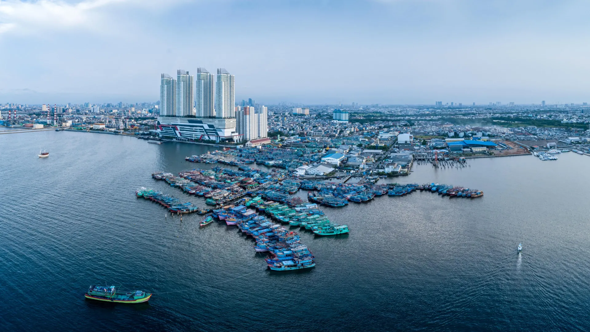
GLOBAL — Along the dynamic edges where continents meet the world’s oceans, a silent crisis is accelerating. For decades, the global conversation surrounding sea level rise has focused almost exclusively on melting glaciers, thermal expansion, and the relentless, creeping advance of ocean waters. However, a groundbreaking study published in Nature Communications by researchers from the Technical University of Munich (TUM) and Tulane University reveals that humanity is facing a dual-pronged emergency. Coastal communities are being squeezed from two directions simultaneously: global sea levels are rising, and in many of the world’s most densely populated regions, the land itself is sinking.
This dangerous convergence is dramatically amplifying the real-world flood risks for more than half a billion people living in low-lying coastal zones. Rather than merely waiting for the tides to rise, these populations are standing on foundations that are actively giving way, turning what was once considered a gradual, multi-century climate threat into an urgent, contemporary emergency.
Main Facts: The Double-Whammy of Relative Sea Level Rise
The core finding of the TUM and Tulane University research team centers on a critical metric: relative sea level rise. While absolute sea level rise—driven strictly by climate change—averages approximately 3.15 millimeters per year globally, the reality for urban dwellers on the coast is far more severe.
According to the study, individuals living in heavily populated coastal regions experience an average relative sea level rise of about 6 millimeters per year. This rate is nearly three times the coastline-weighted global average of 2.1 millimeters per year and nearly double the absolute climate-driven rate.
The primary driver behind this dangerous discrepancy is land subsidence—the downward movement of the Earth’s crust beneath coastal settlements. While climate change adds water to the world’s oceans, local geological and anthropogenic forces are pulling the land down to meet it.
The Scale of the Crisis
- Population Impact: More than 500 million people currently reside in low-lying coastal zones, placing them on the absolute front lines of global environmental change.
- Global Hotspots: Developing nations, particularly in Asia and Africa, bear the brunt of this crisis. Population-weighted coastal averages in countries like Thailand, Bangladesh, Nigeria, Egypt, China, and Indonesia range from 7 to 10 millimeters per year.
- Developed Nations: Wealthier nations are not immune. The United States, the Netherlands, and Italy record average relative sea level rises of approximately 4 to 5 millimeters per year.
Chronology: How the Science and the Crisis Evolved
To understand how researchers arrived at these alarming conclusions, it is necessary to look at the timeline of how coastal geodetic science and human intervention have shaped the modern shoreline.
Pre-Industrial Era to the Mid-20th Century
For millennia, coastal evolution was defined primarily by slow geological processes: tectonic plate movements, natural sediment compaction in massive river deltas (such as the Mississippi, Nile, and Ganges-Brahmaputra), and postglacial adjustments following the retreat of ancient ice sheets. Human settlements were generally small enough to exist in equilibrium with these dynamic environments.
The Post-WWII Industrial and Urban Boom
As the global population surged in the mid-20th century, coastal regions became magnets for megacities. To support burgeoning populations and burgeoning industrial sectors, cities began pulling massive volumes of water from subterranean aquifers. Concurrently, oil and gas extraction skyrocketed in coastal basins.
By the mid-1900s, extreme localized subsidence began to manifest. For instance, Tokyo experienced staggering subsidence exceeding 10 centimeters per year, with its most vulnerable neighborhoods sinking by up to 24 centimeters annually.
The Regulatory Awakening (Late 20th Century)
Faced with catastrophic infrastructure damage and escalating flood risks, governments began to realize that sinking land was not merely an act of nature, but a man-made crisis.
- 1975: In Texas, escalating groundwater withdrawal caused catastrophic sinking in the Houston-Galveston area. In response, officials established the Harris-Galveston Subsidence District, pioneering legislative and regulatory frameworks to control groundwater extraction and promote alternative water sources.
- Late 20th Century: Tokyo implemented strict regulations on groundwater pumping, paired with the development of alternative municipal water supplies, successfully halting its catastrophic subsidence rates.
The Modern Era: Satellite Geodesy and Nature Communications (Present Day)
With the advent of advanced satellite radar interferometry (InSAR), GPS, and global tide-gauge networks, scientists can now measure land elevation changes and sea level shifts with millimeter-level precision.
The recent publication in Nature Communications represents a watershed moment in climate science. Led by Dr. Julius Oelsmann of the German Geodetic Research Institute at TUM (DGFI-TUM), the research synthesized vast geospatial datasets to calculate population-weighted relative sea level changes on a global scale. The study proved conclusively that human-induced land subsidence is not just a localized quirk of a few cities, but a systemic amplifier of global sea level rise affecting hundreds of millions of people worldwide.
Supporting Data: Subsidence Hotspots Around the Globe
The data compiled by DGFI-TUM and Tulane University highlights profound disparities across the globe. While some regions are experiencing stable or even rising land masses, others are plunging at rates that make traditional flood defenses obsolete.
Extreme Sinking Cities
Average sinking rates in several major coastal urban centers illustrate the severity of the crisis:
- Jakarta, Indonesia: 13.7 mm/year (with micro-locations sinking by up to 42 mm/year)
- Tianjin, China: 13.5 mm/year
- Bangkok, Thailand: 8.5 mm/year
- Lagos, Nigeria: 6.7 mm/year
- Alexandria, Egypt: 4.0 mm/year
Even within individual cities, the landscape is fractured. In Jakarta, for example, certain districts are plunging downward at an astonishing 42 millimeters per year, while adjacent neighborhoods may actually be experiencing minor tectonic uplift. This uneven settling creates extreme stress on foundations, roads, pipelines, and drainage systems, triggering structural failures long before floodwaters ever arrive.
The Exception: Postglacial Rebound
It is worth noting that not all coastlines are moving downward. In countries like Sweden and Finland, geological uplift is producing a relative decline in sea level along parts of the coast. These regions are still experiencing postglacial rebound—the gradual springing back of the Earth’s crust after the immense weight of the last Ice Age’s massive ice sheets melted away. In these fortunate locations, the land is rising faster than the ocean is advancing, providing a natural buffer against global sea level trends.
Official Responses and Expert Insights
The scientific community is increasingly vocal about the need to shift policy frameworks. Addressing the ocean alone is no longer enough; governments must look down at the ground beneath their feet.
"If we want to understand sea-level rise along coastlines and respond effectively, we must not only observe the ocean but also the land itself," explains Dr. Julius Oelsmann, lead author of the study and researcher at DGFI-TUM. "Especially in densely populated coastal regions, human activities cause the land to subside more strongly—often due to excessive extraction of water and resources that previously stabilized the subsurface. The sheer weight of cities, along with long-term geological processes, can further intensify this subsidence. In doing so, we significantly amplify the effects of climate-driven sea-level rise."
The good news, according to geodetic experts, is that unlike melting polar ice caps—which are governed by global atmospheric dynamics beyond the control of any single municipality—land subsidence driven by resource extraction can be directly managed and mitigated by local authorities.
"In many large coastal cities, groundwater extraction is a major driver of land subsidence. This means that local political and water-management decisions can make a significant difference," notes Professor Florian Seitz, Chair of Geodetic Geodynamics and Director of DGFI-TUM. "Improved groundwater management, stricter regulation of withdrawals, or targeted recharge of aquifers can at least slow subsidence rates and, in some cases, largely halt them."
Historical precedents prove this approach works. Tokyo’s decisive policy shifts in the mid-to-late 20th century transformed it from a sinking disaster zone into a model of urban stability. Similarly, the Harris-Galveston Subsidence District in Texas demonstrated that when policy, science, and public conservation efforts align, the downward plunge of the land can be arrested.
Implications: A Race Against Time for Coastal Civilization
The implications of the TUM and Tulane findings ripple across urban planning, economic stability, national security, and global humanitarian efforts.
1. The Obsolescence of Current Flood Defenses
Most seawalls, dikes, and storm surge barriers are engineered based on projected climate-driven sea level rise. If local land is sinking at rates of 10 to 40 millimeters per year, these engineering safeguards will reach their design limits decades ahead of schedule. A barrier built to withstand sea level rise for the next 80 years may fail in 30 years if the ground beneath it drops out of alignment.
2. Infrastructure Stress and Structural Integrity
Subsurface settling is inherently uneven. As different parts of a city sink at varying speeds, underground utilities—sewers, water mains, electrical grids, and transit tunnels—are subjected to shearing forces. Building foundations crack, roads buckle, and bridges risk structural compromise, transforming coastal urban maintenance into an astronomical financial burden.
3. Accelerated Displacement and Climate Migration
As relative sea level rise outpaces adaptation efforts, low-lying deltas and coastal megacities will face an escalating habitability crisis. Millions of people living in agricultural river deltas—such as those in Bangladesh and Vietnam—will face salinization of agricultural soils, poisoned groundwater wells, and recurrent catastrophic flooding, forcing mass internal and international migration.
4. A Paradigm Shift in Climate Adaptation
Ultimately, the study serves as a wake-up call to policymakers worldwide. Adaptation strategies must be holistic, combining global carbon mitigation with rigorous local resource management. Urban planners must integrate geodesy, hydrogeology, and civil engineering to monitor subsurface dynamics in real time.
The ground beneath our feet is no longer a given. For the half-billion people living on the edge of the world’s oceans, saving coastal communities will require looking past the horizon, watching the tides, and keeping a very close eye on the earth below.
