

Published September 2, 2026
Pushing the SOS button on a satellite messenger feels like a momentous responsibility. With a single press, a signal shoots through the atmosphere from wherever a hiker is sprawled out on the ground in the middle of nowhere. That invisible transmission triggers a massive technological and human machine, causing dispatchers, emergency departments, and rescue operators to assume their own physical risks as they work to extract adventurers from the consequences of their choices.
Ultimately, pressing that button means handing over one of the core responsibilities that modern outdoor enthusiasts sign up for in the backcountry: the absolute responsibility for their own safety. There is an immense psychological and logistical weight that comes with the decision to summon boots on the ground. But behind that flashing red light lies a complex, multi-layered process. What actually happens when a desperate traveler sends out that call for help?
In short: the details vary wildly depending on the provider, the technology, and the network routing the distress call.
Major market players approach crises through distinctly different lenses. Texas-based Garmin takes a communication-forward approach that leverages the robust messaging capabilities of its hardware and proprietary response centers. Meanwhile, British Personal Locator Beacon (PLB) maker Ocean Signal occupies a tighter, more traditional niche, linking directly into government-backed, SAR-specific satellite networks without the need for a private middleman or a paid subscription.
Regardless of the operational pathways, one truth remains undeniable: emergency beacons are being set in motion more frequently than ever before.
The Main Facts: A Surprising Surge in Backcountry Rescues
The democratization of satellite communication technology has fundamentally altered backcountry safety. What was once considered an expensive luxury reserved for elite mountaineers and deep-sea sailors has rapidly transformed into standard field gear for casual day hikers, weekend campers, and trail runners.
Data from industry giants reveals an exponential climb in emergency activations. Garmin estimates that it has received well over 250,000 SOS alerts since launching its tracking and messaging ecosystem in 2007, originating from virtually every country and territory on Earth. Out of that massive total, more than 20,000 incidents have required active coordination and emergency response from Garmin’s internal teams, translating to an average of more than 1,000 responses per year historically—a number that is climbing steeply.
The call volume continues to accelerate. In 2025 alone, Garmin reported upwards of 3,000 yearly emergency incidents. Trail and mountain calls, the company noted, had "notably" increased compared to previous years. To handle this unrelenting wave of distress, Garmin maintains a 24/7/365 dedicated emergency response center staffed by trained coordinators.
The macro-level industry data follows a strikingly similar trend. Cospas-Sarsat, the international satellite system dedicated to search and rescue (SAR) that services Ocean Signal’s PLBs, operates across a network of 45 of the planet’s largest economies. Back in the 1990s, the system recorded a few hundred structured "SAR events" per year. By 2024, that annual tally climbed to well over 1,000 major coordinated rescues.
Concurrently, the proliferation of hardware in the field has exploded. Cospas-Sarsat estimated that over 3,354,000 devices capable of communicating with its 406 MHz network were actively deployed in the field in 2024. For context, that figure sat well under 2 million devices in 2017. Furthermore, major manufacturers continue to report record sales, with Garmin competitor SPOT noting a staggering 35% year-over-year increase in device sales in recent fiscal reports.
Chronology of a Rescue: From Satellites to Boots on the Ground
To understand how a backcountry rescue unfolds, it is helpful to look at the chronological sequence of events that occurs the exact moment an adventurer decides to lift a protective plastic guard and press the SOS button.
Phase 1: Transmission and Orbit (Minutes 0–2)
The user initiates the SOS sequence. Inside the handheld unit, an internal GPS chip locks onto coordinates using GNSS constellations. The device fires a radio frequency signal upward into the exosphere. This signal is intercepted either by a commercial constellation in Low Earth Orbit (LEO) or Medium Earth Orbit (MEO)—such as Iridium or Globalstar—or by government-owned search-and-rescue payloads orbiting thousands of miles above the Earth.
Phase 2: Triage and Routing (Minutes 2–10)
The satellite relays the digital packet down to a ground station, which instantly routes the data to a central emergency response hub. Depending on the device brand, this hub is either a private coordination center (like Garmin Response or FocusPoint International) or a governmental Mission Control Center (part of the Cospas-Sarsat network).
During this window, dispatchers log the user’s identity, device registration details, and precise geographical coordinates. If the device supports two-way communication, an automated or manual message is sent back to the user acknowledging the distress call and asking clarifying questions regarding the nature of the emergency (e.g., medical trauma, broken bones, lost, or trapped by weather).
Phase 3: Agency Mobilization and Verification (Minutes 10–30)
Once the monitoring center verifies that the emergency is legitimate—often by calling pre-registered emergency contacts or cross-referencing trip plans—coordinators contact the local Search and Rescue (SAR) authority having jurisdiction over that specific patch of wilderness. This could be a county sheriff’s department, a national park ranger service, or an international mountain rescue team.
The response center relays all telemetry, user profiles, and ongoing text communications to the local incident commander. If the device features automated tracking, the user’s location continues to stream back to dispatch, updating frequently to account for drifting or self-rescue attempts.
Phase 4: Extraction and Resolution (Hours to Days)
Local SAR volunteers or professional rescue personnel mobilize. Depending on the terrain, weather, and severity of the incident, rescuers deploy on foot, via all-terrain vehicles, on horseback, or utilizing hoist-capable search-and-rescue helicopters.
Communication is maintained between the rescue command post and the stranded user—either directly via the satellite messenger or indirectly through the monitoring center. The operation concludes only when the user is safely evacuated to a definitive medical facility or confirmed to be out of danger.
Supporting Data: Comparing the Big Three Ecosystems
While the general sequence of a rescue is universal, the underlying architecture varies significantly across the three dominant technological frameworks in the outdoor industry.
1. Garmin inReach
- Network: Iridium (Commercial LEO constellation)
- Signal Path: User > Iridium Satellites > Garmin Response Center > Local Rescue Network
- Messaging Capabilities: High (Two-way text, automatic location updates, emergency contact communication, and voice capabilities on compatible devices like inReach Plus). Photo messaging is supported on select modern units.
- Operational Profile: Garmin stands as the de facto commercial standard for backcountry communications. Its primary advantage is continuous, granular dialogue. When an SOS is triggered, the user’s location updates automatically every minute for the first 10 minutes, and then every 10 minutes thereafter. Coordinators can bridge the gap by connecting rescuers directly with the victim via satellite text.
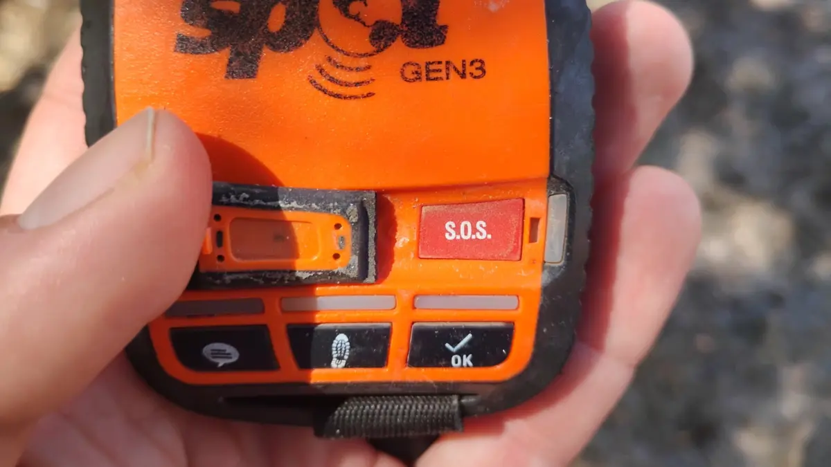
2. SPOT (Globalstar)
- Network: Globalstar (Commercial LEO constellation)
- Signal Path: User > Globalstar Satellites > FocusPoint International Response Center > Local Rescue Network
- Messaging Capabilities: High on advanced models (SPOT X features two-way text with coordinators and personal contacts). Older or basic units (like the Gen4) are limited to one-way distress signaling. No photo messaging.
- Operational Profile: SPOT relies on a third-party emergency response center managed by FocusPoint International rather than an in-house team. Newer devices provide robust tracking updates (every 2.5 to 5 minutes), but users operating legacy one-way devices must rely entirely on faith that their signal was received, as they will receive no incoming confirmation texts.
3. Ocean Signal (Personal Locator Beacons)
- Network: Cospas-Sarsat (406 MHz government-backed network) plus 121.5 MHz homing signals
- Signal Path: User > Cospas-Sarsat Satellites > Mission Control/Coordination Center > Local Rescue Network
- Messaging Capabilities: Very minimal. Distress and location transmission only. Features Return Link Service (RLS) to confirm the distress alert was received by the network, but text or voice messaging is entirely absent. No photo messaging.
- Operational Profile: PLBs like the Ocean Signal rescueME bypass commercial subscription models and private dispatch centers entirely. Founded via an international treaty involving the US, Canada, France, and the Soviet Union in 1979, Cospas-Sarsat routes signals directly to government rescue coordination centers. While users cannot chat with dispatchers, PLBs excel in localization: units like the PLB3 continuously blast a 121.5 MHz radio homing signal for ground crews and an AIS (Automatic Identification System) broadcast for nearby marine vessels.
Official Responses: The Perspectives of Rescuers and Manufacturers
The widespread adoption of satellite communication devices has drawn mixed reactions from the professional search and rescue community. On one hand, SAR coordinators universally praise beacons for saving countless lives, dramatically shortening search grids, and providing exact coordinates that eliminate hours of guesswork in life-or-death scenarios.
However, emergency managers have voiced growing concerns regarding "alert fatigue" and the misuse of emergency features.
"We are seeing an influx of calls for situations that do not inherently require a life-or-death emergency response," notes a veteran county SAR coordinator from the Western United States. "People get tired, run out of water, or experience minor gear failures, and instead of self-rescuing or waiting out a storm, they hit the SOS button because the technology makes it easy to summon help. It ties up volunteer resources that might be needed elsewhere for critical trauma cases."
Manufacturers, meanwhile, defend their designs by pointing to education and user empowerment. Garmin and SPOT emphasize that their interface prompts users to carefully consider their situation before initiating an alert. Furthermore, the inclusion of two-way messaging on modern devices allows dispatchers to triage calls effectively—allowing responders to tell a shivering hiker to pitch a tent and wait out a squall rather than needlessly launching a dangerous nighttime helicopter flight.
Implications: The Future of Backcountry Independence
As satellite connectivity becomes a standard feature built directly into mainstream consumer smartphones and dedicated messengers alike, the cultural fabric of outdoor recreation is undergoing a profound shift.
The historical ethos of wilderness exploration—which valued self-reliance, rigorous route planning, and the psychological fortitude to accept isolation—is increasingly colliding with an era of instant digital tethering. The safety net is finer, stronger, and more accessible than ever before.
Yet, this convenience introduces complex ethical and financial questions. Who bears the cost of these rescues? While many jurisdictions in North America and Europe do not charge victims for search and rescue operations, the mounting frequency of preventable call-outs strains volunteer-run organizations, burns out unpaid community searchers, and increases risks for aviation crews navigating hazardous mountain weather.
Ultimately, the SOS button is a marvel of modern engineering that bridges the gap between tragedy and survival. But as the flashing beacons continue to multiply across trails, peaks, and oceans, the outdoor community is reminded of a sobering reality: technology can summon a rescue team, but it cannot replace the sound judgment, preparation, and respect for nature required to stay alive in the wild in the first place.
