

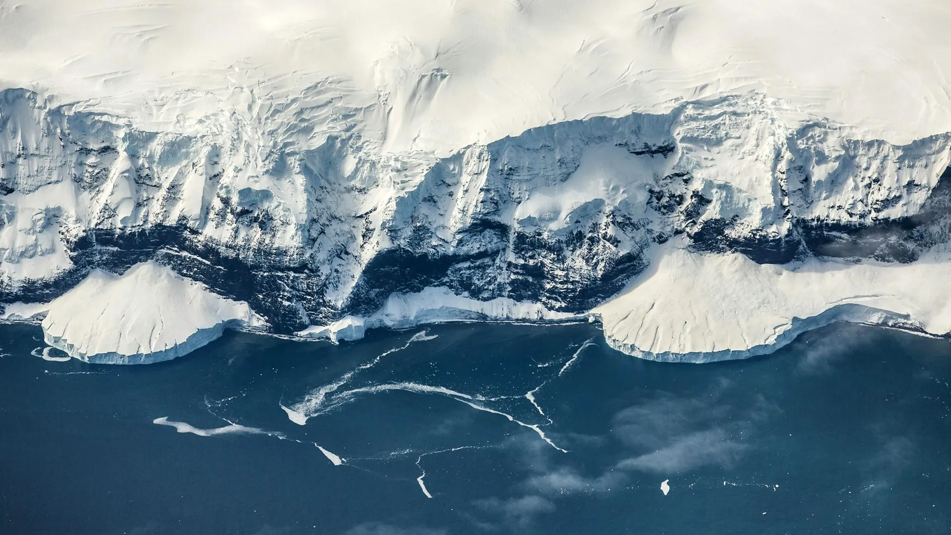
LONDON — For decades, paleoclimatologists have wrestled with one of the most confounding paradoxes in Earth’s history: How did Antarctica manage to develop a colossal, continent-spanning ice sheet roughly 34 million years ago during an epoch when global temperatures were an estimated 5°C warmer than they are today?
Conventional climate models relying solely on atmospheric carbon dioxide fluctuations have struggled to fully reconcile this timing, particularly given that the Arctic remained largely ice-free for tens of millions of years longer. Now, an international team of geoscientists has unlocked the mystery, pointing away from the skies and instead looking deep beneath the Earth’s crust.
According to groundbreaking research published in the prestigious journal Science, the key to Antarctica’s premature freeze lies in a slow-motion geological makeover. Driven by deep mantle dynamics that began in the wake of continental breakup, parts of East Antarctica were thrust high into the atmosphere over a span of more than 100 million years. This dramatic topographical uplift pushed the land into frigid, high-altitude zones, allowing permanent snow and ice to gain a crucial foothold long before global cooling could achieve the feat on its own.
The study was spearheaded by researchers at the University of Southampton, who collaborated with a multidisciplinary roster of institutions, including Durham University in the UK, the GFZ Helmholtz Centre for Geosciences and the University of Potsdam in Germany, Utrecht University in the Netherlands, and the University of Florence in Italy. The research was made possible through the generous support of the WoodNext Foundation.
Main Facts: Rewriting the Timeline of Planetary Glaciation
The new study fundamentally shifts how scientists view the interplay between solid Earth geology and atmospheric climate science.
At the center of the discovery is the East Antarctic Ice Sheet (EAIS), which stands today as the single largest body of ice on the planet. Containing enough locked-up fresh water to cause global sea levels to rise by approximately 52 meters (170 feet) should it ever completely melt, the EAIS is a critical regulator of modern ocean dynamics and coastal stability.
However, its origins have long puzzled researchers. While falling concentrations of atmospheric carbon dioxide ($CO_2$) are widely recognized as a primary driver of global cooling, dropping $CO_2$ levels alone cannot account for the profound chronological asymmetry between the two polar regions. Antarctica became heavily glaciated approximately 34 million years ago, at the Eocene-Oligocene transition, whereas the Northern Hemisphere did not develop substantial, permanent ice sheets until roughly the past five million years.
The missing variable, researchers found, was topography.
As tectonic forces elevated massive plateaus, coastal escarpments, and inland mountain ranges—most notably the Gamburtsev Mountain Province—temperatures dropped precipitously due to adiabatic lapse rates, which dictate that air cools as altitude increases. By crossing a critical threshold of roughly two kilometers in elevation, parts of East Antarctica bypassed the warmth of the surrounding Eocene oceans. Once established, this high-altitude ice sparked powerful climate feedback loops, locking the continent into a permanent deepfreeze and cascading the cooling effect across the Southern Hemisphere.
Chronology: A 100-Million-Year Geological Engine
To retrace how Antarctica transformed from a temperate, vegetated landscape into a frozen wasteland, the research team deployed advanced computational models capable of simulating 100 million years of surface evolution.
The Jurassic Rift and the Awakening of Mantle Waves
The story begins during the Jurassic Period, roughly between 201 and 143 million years ago, when the ancient supercontinent of Gondwana began to break apart. Antarctica and Africa initiated their historic geological divorce, tearing apart the Earth’s lithosphere.
According to the study, this violent continental fragmentation triggered a lesser-known geological phenomenon recently identified by lead author Professor Thomas Gernon’s research group: mantle waves. These slow-moving thermal and mechanical pulses propagate through the upper mantle beneath continents long after tectonic plates begin to separate. While previously linked to explosive events like diamond-bearing volcanic eruptions and cryptic regional uplifts, their role in sculpting polar landscapes had never been demonstrated on this scale.
The Rise of the Plateau
Over the subsequent 100 million years, these mantle waves migrated beneath East Antarctica. As they passed, they imparted an immense, buoyant uplift to the continental crust. A vast high-terrain system gradually emerged, featuring a steep coastal escarpment, an elevated interior plateau, and the ragged peaks of the Gamburtsev Mountains.
By approximately 45 million years ago, the simulations reveal, large swaths of East Antarctica had successfully climbed past the critical two-kilometer altitude mark. This elevation was high enough for mountain glaciers to form, persist through seasonal thaws, and slowly expand. Over the next ten million years, these isolated glaciers coalesced, eventually drowning the landscape beneath the burgeoning mass of the East Antarctic Ice Sheet.
Supporting Data: The Physics of Polar Freezing
The mechanics behind the transition rely heavily on well-established thermodynamic principles, supercharged by regional topography and powerful feedback loops.
- The Altitude-Temperature Gradient: Dr. Guy Paxman of Durham University, a co-author of the study, notes the unforgiving physics of height: "Topography is fundamentally important for glaciation. Air temperatures can drop by up to 1°C for every 100 meters of altitude gained."
- The Gamburtsev Evolution: Prior to 50 million years ago, the majority of the Gamburtsev Mountains sat at modest elevations below 1.5 kilometers. By 34 million years ago, tectonic uplift had forced nearly half of the range above the critical two-kilometer threshold, instantly transforming mild alpine zones into permanent snow traps.
- The Ice-Albedo Feedback: Once the ice caps began to take root, they triggered what climate physicists call the ice-albedo effect. Dr. Philip Goodwin, a climate physicist at the University of Southampton and study co-author, explains that as the pristine, white ice sheet expanded, it began reflecting a significantly greater proportion of incoming solar radiation back out into space rather than absorbing it.
- Global Cooling Impact: The research team estimates that the ice-albedo effect alone shaved an additional 1°C off global temperatures.
- Atmospheric Dehumidification: As the region cooled, local air lost its capacity to hold water vapor. Because water vapor acts as a natural greenhouse gas—effectively serving as an insulating blanket for the planet—a drier atmosphere weakened this insulation, allowing temperatures to plummet even further and enabling the ice to march relentlessly from the mountains down to the coast.
Official Responses and Expert Perspectives
The international collaboration behind the study has drawn widespread praise within the geosciences community for bridging the gap between deep-Earth geology and surface-level climatology.
Professor Thomas Gernon, lead author and Professor of Earth Science at the University of Southampton, emphasized the paradigm-shifting nature of the findings:
"Antarctica’s land surface was gradually lifted to the point where ice could gain a permanent foothold, even while the surrounding polar oceans as well as global temperatures remained surprisingly warm. If falling levels of $CO_2$ acted alone, you would expect the poles to respond more symmetrically. Instead, Antarctica gained a major head start because geological processes had raised land to higher elevations, making it colder."
Dr. Thea Hincks, Senior Research Fellow at the University of Southampton and co-lead of the research, highlighted the fidelity of the predictive models:
"We found that our models can realistically capture the evolution of the two-kilometer-high coastal escarpment, elevated plateau and inland mountains, eventually seeding the East Antarctic Ice Sheet."
Dr. Goodwin underscored the systemic nature of the transition:
"As the ice sheet expanded, its bright surface reflected more sunlight back into space, cooling the region further. Together, these feedbacks allowed the Antarctic ice sheet to spread from the mountains across the continent, eventually reaching the coast."
Broader Implications: Rethinking Earth’s Climate Tipping Points
The implications of this research extend far beyond the historical reconstruction of ancient Antarctica. For decades, climate science has occasionally treated solid-Earth geology and atmospheric dynamics as separate entities operating on vastly different timescales. This study demonstrates that the interior of the Earth acts as an active architect of climate history.
By revealing that tectonic processes can "precondition" a landscape for glaciation, the findings offer a fresh lens through which to evaluate major climate transitions across deep time. Understanding how tectonic uplift lowers regional temperatures independently of atmospheric gas concentrations provides a more holistic framework for ancient ice ages.
Furthermore, as modern scientists race to understand future tipping points in Earth’s rapidly warming climate system, the research serves as a stark reminder of the complex, interconnected nature of the planet. While human-driven greenhouse gas emissions remain the primary driver of contemporary climate change, the study underscores how regional topography, planetary heat dynamics, and surface albedo feedbacks interact in delicate, powerful ways to shape the destiny of the world’s ice.
