

Main Facts
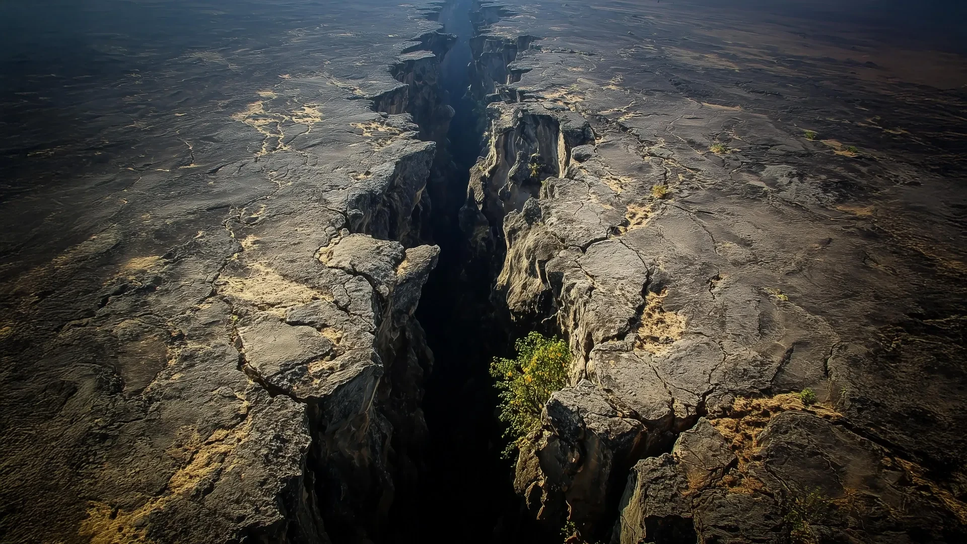
Deep beneath the crust of the African continent, a colossal geological engine is reshaping the surface of the Earth. A new wave of computer modeling and over a decade of high-precision GPS data have finally explained a long-standing geophysical puzzle within the East African Rift System (EARS)—the largest active continental rift on our planet.
For years, scientists observed that parts of the vast rift region were moving in an unexpected direction: parallel to the rift itself, rather than strictly perpendicular to it as standard geological models predicted. Recent findings published in the Journal of Geophysical Research point directly to the African Superplume—a massive upwelling of scorching mantle material originating deep inside the Earth—as the primary culprit behind this anomalous motion and its corresponding seismic patterns.
The research reveals a multi-layered tectonic reality. While conventional forces like shallow lithospheric buoyancy drive the familiar east-west stretching and cracking of the crust, a deep, northward-flowing river of molten rock in the mantle is exerting powerful traction forces. This dynamic interaction creates complex patterns of deformation and seismic anisotropy, where seismic waves travel differently depending on their orientation through aligned subterranean minerals.
By bridging the gap between millimeter-scale surface measurements and processes occurring thousands of kilometers underground, this study offers unprecedented clarity on how continents slowly tear themselves apart.
Chronology of Discovery: Tracking the Invisible Movement
The journey toward solving the East African Rift mystery spans more than a decade of meticulous data collection, hypothesis testing, and computational breakthroughs.
Phase 1: High-Precision GPS Observations (The 2010s)
The story truly begins when geophysicist D. Sarah Stamps, then a postdoctoral researcher and now an associate professor in the Department of Geosciences at Virginia Tech, deployed and monitored GPS stations across East Africa. Using signals from over 30 satellites orbiting 25,000 kilometers above the Earth, Stamps and her colleagues achieved millimeter-scale precision in tracking surface movements.
Standard geological expectations dictated that as the continent pulled apart, the crust should deform perpendicularly to the rift axis. However, after analyzing more than 12 years of continuous data, Stamps discovered an undeniable anomaly: certain segments of the region were sliding in a direction parallel to the rift layout. Shallow buoyancy forces alone could not account for this sideways motion, leaving researchers with a profound mystery.
Phase 2: Testing Dual Forces (The 2021 Breakthrough)
Seeking to understand the mechanical interplay beneath the surface, Stamps’s research team—including former Ph.D. student Tahiry Rajaonarison—turned to advanced 3D computational simulations. In a pivotal 2021 study, the team tested how lithospheric buoyancy forces (driven by variations in elevation and density near the surface) and mantle traction forces (driven by deeper flow) interacted.
The 2021 models confirmed that shallow buoyancy forces successfully explained the standard, perpendicular rifting behavior. Yet, the anomalous rift-parallel motion stubbornly refused to appear in the simulations. The researchers realized they needed to isolate and model the deeper mantle dynamics with far greater specificity.
Phase 3: The Superplume Simulations (Recent Findings)
In the latest study, Rajaonarison—now a postdoctoral researcher at New Mexico Tech—utilized sophisticated 3D thermomechanical models focused explicitly on the unexplained rift-parallel deformation. By simulating the vast thermodynamics of the Earth’s interior, the team successfully reproduced both the unusual surface motion and the subsurface seismic anisotropy. The results provided the missing puzzle piece: a direct link between the northward flow of the African Superplume and the eccentric surface deformation observed a decade prior.
Supporting Data and Scientific Mechanisms
To comprehend how deep-mantle plumes influence surface geology, geophysicists rely on a combination of analog comparisons, satellite telemetry, and computational physics.
The "Silly Putty" Rheology of Earth
To explain how the Earth’s outer shell—the lithosphere (comprising the crust and uppermost mantle)—can behave in seemingly contradictory ways, Stamps employs a familiar analogy: Silly Putty.
"If you hit Silly Putty with a hammer, it can actually crack and break," D. Sarah Stamps explains. "But if you slowly pull it apart, the Silly Putty stretches. So on different time scales, Earth’s lithosphere behaves in different ways."
Near the brittle surface, rocks fracture under high stress, generating faults, earthquakes, and deep chasms. Deeper down, where temperatures soar, rocks lose their brittleness, flowing and deforming gradually over millions of years.
Dissecting the Two Driving Forces
Geologists have long debated the primary drivers behind the East African Rift System, narrowing down the possibilities to two main phenomena:
- Lithospheric Buoyancy Forces: Operating relatively close to the surface, these forces are dictated by lateral differences in crustal thickness, elevation, and density. A prime example in the region is the African Superswell, a broad expanse of unusually high topography. These forces primarily govern the familiar, perpendicular stretching of the continent.
- Mantle Traction Forces: Originating deep within the Earth, these forces stem from the viscous flow of hot mantle material beneath the tectonic plates. As the mantle moves, it exerts frictional drag (traction) on the rigid lithosphere above.
Decoding Seismic Anisotropy
The 3D thermomechanical models did more than just match surface GPS data; they also successfully replicated seismic anisotropy beneath the rift. Seismic anisotropy occurs when earthquake waves travel at different speeds depending on their directional trajectory through subsurface rock.
This directional preference arises when intense mantle flow or localized melting aligns mineral crystals (such as olivine) in a specific orientation. Under the East African Rift, the orientation of these aligned minerals mirrors the northward trajectory of the African Superplume. This alignment serves as an independent geophysical fingerprint, confirming that deep mantle currents are actively sculpting the region.
Official Responses and Expert Perspectives
The integration of surface geodesy with deep-Earth numerical modeling has generated considerable excitement within the global geosciences community.
Dr. D. Sarah Stamps emphasized that the research fundamentally refines, rather than completely overturns, established theories of continental breakup. The findings show that mantle flow is not responsible for the primary east-west tearing of the continent, but rather acts as a secondary engine driving anomalous northward movements.
Lead author Tahiry Rajaonarison highlighted the cooperative nature of bridging surface observations with deep-mantle physics:
"We are saying that the mantle flow is not driving the east-west, rift-perpendicular direction of some of the deformations, but that it may be causing the anomalous northward deformation parallel to the rift," Tahiry Rajaonarison stated. "We confirmed previous ideas that lithospheric buoyancy forces are driving the rift, but we’re bringing new insight that anomalous deformation can happen in East Africa."
Reflecting on the broader significance of the computational breakthroughs, Stamps added:
"We’re excited about this result from Dr. Rajaonarison’s numerical modeling because it provides new information about the complex processes that shape the Earth’s surface through continental rifting."
Independent seismologists and tectonic modelers have praised the study for demonstrating how 3D thermomechanical simulations can untangle multi-scale geological problems—proving that surface tectonics cannot be fully understood without looking deep into the planet’s interior.
Implications for Geology and Continental Breakup
The East African Rift System serves as Earth’s premier natural laboratory for observing how a continent transitions from stretching to complete tectonic failure—the process that eventually births new ocean basins.
For decades, geologists attempted to frame continental rifting through simplistic, single-cause models, assuming either shallow buoyancy or deep mantle plumes were solely responsible. The work led by Stamps and Rajaonarison shatters this binary paradigm, establishing a more complex, multi-force framework.
By demonstrating that shallow buoyancy forces and deep mantle tractions can operate simultaneously to produce divergent deformation patterns, the study alters how scientists analyze tectonic evolution across the globe. Understanding these intricate subsurface mechanics is not merely an academic exercise; it enhances hazard assessment for earthquake-prone rift zones and refines our understanding of ancient supercontinent breakups throughout Earth’s deep history.
As computational power grows and observational networks expand, geophysicists are moving closer to a complete, unified timeline of how the Earth’s internal heat engine ultimately transforms the very ground beneath our feet.
