

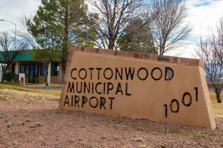
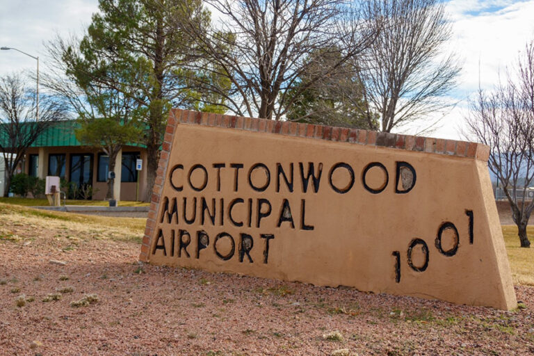
COTTONWOOD, AZ — In an effort to address the evolving challenges of airspace safety, regional growth, and community noise concerns, officials at Cottonwood Municipal Airport (P52) have released a comprehensive update to their pilot guides. The newly revised documents outline standardized operating procedures (SOPs) and voluntary noise abatement practices tailored specifically for both fixed-wing aircraft and helicopter pilots operating within the Verde Valley.
The update comes at a critical juncture for the municipal airport, which has seen a steady rise in operations ranging from recreational flying and flight training to critical emergency medical services (EMS) and regional tourism. Airport management is urging all home-based and transient pilots to thoroughly review the updated guidelines before their next flight to ensure a safe, courteous, and highly standardized operating environment.
Main Facts: The Core Updates at Cottonwood Municipal Airport
The newly published pilot guidelines are designed to establish clear, predictable traffic patterns and operational parameters. By formalizing these procedures, the airport aims to mitigate the risk of mid-air conflicts in a highly diverse airspace while simultaneously minimizing the acoustic footprint of aviation activities on the surrounding residential communities of Cottonwood, Clarkdale, and the wider Verde Valley.
The guidelines are split into two primary operational categories—fixed-wing aircraft and helicopters—while also establishing universal standard procedures for all pilots utilizing the airfield.
Key Operational Rules and Safety Cautions:
- The "Lights On" Policy: To maximize visual collision avoidance, all aircraft are requested to maintain operational landing and taxi lights at all times within the airport traffic area.
- The Calm-Wind Runway: Runway 32 has been officially designated as the preferred runway during calm-wind conditions. However, pilots are warned to use extreme caution when utilizing this runway due to the diverse mix of airspace users.
- Mixed-Use Airspace Hazards: Pilots must maintain active vigilance for non-standard aviation activities, including skydivers, hang gliders, paragliders, and ultralight aircraft operating in the immediate vicinity of the airport.
- Helicopter and Training Conflicts: High-volume medical helicopter traffic servicing the nearby Verde Valley Medical Center heliport, combined with commercial aerial tour operators and intensive flight training maneuvers, requires constant radio communication and visual scanning.
Chronology: The Evolution of Verde Valley Airspace
The need for updated pilot guides at Cottonwood Municipal Airport is the result of decades of gradual transition from a quiet rural airstrip to a bustling multi-use aviation hub.
[1970s-1990s: Primarily Recreational Airstrip]
       │
       ▼
[2000s: Growth of Verde Valley Medical Center & EMS Heliport]
       │
       ▼
[2010s: Surge in Phoenix-area Flight Training Overspill]
       │
       ▼
[2020-2025: Rapid Residential Expansion & Rising Noise Complaints]
       │
       ▼
[Late 2026: Implementation of Updated SOPs & Noise Abatement Guides]
1. The Early Years (Primary Recreational Use)
For much of the late 20th century, Cottonwood Municipal Airport served primarily local recreational pilots, agricultural operators, and occasional transient aircraft. The airspace was quiet, and informal "gentlemen’s agreements" were sufficient to manage the low traffic volume.
2. The Medical and Tourism Boom (2000s–2010s)
As the Verde Valley’s population expanded and Sedona became a global tourism destination, the airspace grew increasingly complex. The expansion of the Verde Valley Medical Center—located just south of the runway—led to a significant increase in life-saving emergency medical helicopter flights. Simultaneously, helicopter and fixed-wing air tour operators began utilizing the corridor more frequently to transport tourists over the red rocks of Sedona and the historic mining town of Jerome.
3. The Flight Training Surge (2015–Present)
With Phoenix-area airports (such as Deer Valley and Falcon Field) reaching near-capacity limits, flight schools increasingly utilized Cottonwood Municipal Airport for cross-country training, touch-and-go practice, and mountain flying instruction. The local airspace began experiencing a mix of high-speed turbine aircraft, slower training planes, and highly vulnerable unpowered aircraft like paragliders and hang gliders.
4. The Catalyst for the 2026 Update
The immediate catalyst for the current revision was a rise in noise complaints from newer residential developments bordering the airport, coupled with several close-call reports filed through the Aviation Safety Reporting System (ASRS) regarding traffic pattern conflicts. Airport administrators, in consultation with the Federal Aviation Administration (FAA) and local pilot associations, initiated a systematic review of airport operations, culminating in the release of these updated guides.
Supporting Data: Deciphering the Flight Procedures and Altitudes
The updated guidelines rely on precise vertical and lateral separation to keep different classes of aircraft from conflicting with one another. Because Cottonwood Municipal Airport sits at an official field elevation of 3,560 feet above mean sea level (MSL), the pattern altitudes have been carefully calculated to provide safety margins while respecting the surrounding terrain.
Traffic Pattern Altitudes (TPA) By Aircraft Type
| Aircraft Category | Altitude (MSL) | Altitude (AGL) | Operational Rationale |
|---|---|---|---|
| Helicopters | 4,060 feet | 500 feet | Keeps low-speed rotorcraft below fixed-wing traffic; facilitates quick descent to helipads. |
| Single-Engine Aircraft | 4,360 feet | 800 feet | Standard light aircraft pattern; optimizes glide distance to the runway in case of engine failure. |
| Multi-Engine Aircraft | 4,560 feet | 1,000 feet | Provides vertical separation from slower single-engine traffic; accommodates higher approach speeds. |
| Turbine Aircraft | 5,060 feet | 1,500 feet | Keeps fast-moving jets and turboprops clear of piston traffic until final approach; reduces noise footprint. |
Traffic Pattern Geometry and Wind Runway Rules
To prevent head-on conflicts and manage noise distribution, the airport has established strict traffic pattern directions:
- Runway 14 (South-Southeast departures/arrivals): Uses a standard left-hand rectangular pattern. This keeps the traffic pattern flow primarily to the east of the airport, away from the more densely populated areas to the west.
- Runway 32 (North-Northwest departures/arrivals): Uses a right-hand rectangular pattern. This asymmetrical design ensures that aircraft flying the pattern for either runway remain on the same geographical side of the airport, preventing mid-air conflicts over the runway centerline.
       [Runway 32 Right-Hand Pattern]
     ┌─────────────────────────────────┐
     │                                 │
     ▼                                 │
[Runway 32] ◄──────────────────────────┘ (Calm Wind Runway)
========================================
[Runway 14] ───────────────────────────►
     ▲                                 │
     │                                 │
     └─────────────────────────────────┘
       [Runway 14 Left-Hand Pattern]
The designation of Runway 32 as the calm-wind runway is a critical safety measure. In the high-desert environment of Arizona, wind shifts can be sudden, but when winds are under five knots, standardized use of Runway 32 prevents "opposite direction" traffic conflicts, which are a leading cause of mid-air collisions at non-towered airports.
Official Responses: Balancing Civic Growth with Aviation Demands
The release of the updated guides has drawn widespread commentary from city officials, aviation safety advocates, and local neighborhood coalitions.
Airport Administration and City Leadership
In a statement accompanying the release, Cottonwood airport officials emphasized the voluntary yet critical nature of the noise abatement guidelines:
"Our goal is to remain an economic engine and a vital safety asset for the Verde Valley while being the best possible neighbor to the residents of Cottonwood. These updated guidelines are not about restricting flight; they are about fostering a culture of safety, predictability, and mutual respect between pilots and the community on the ground."
The Aviation Community
Local flight instructors and hangar tenants have expressed strong support for the clarified guidelines. A representative from a regional pilots’ association noted:
"At a non-towered airport like Cottonwood, situational awareness is everything. Having clear, explicit altitudes for different aircraft types—especially with the high volume of helicopter medical flights and student pilots—gives everyone a shared sheet of music to play from. The ‘Lights On’ policy is a simple, highly effective way to spot traffic against the bright Arizona desert backdrop."
Neighborhood Advocacy Groups
Residents living under the approach paths, particularly in the nearby communities of Clarkdale and Verde Santa Fe, have cautiously welcomed the update. A spokesperson for a local quiet-skies advocacy group commented:
"We recognize the vital role the airport plays, especially for emergency medical evacuations. However, the constant drone of touch-and-go flight training on weekend mornings has been a growing quality-of-life issue. We are hopeful that the new noise abatement practices and the encouragement of higher turbine pattern altitudes will bring some noticeable relief."
Implications: The Future of Cottonwood’s Airspace and Regional Development
The implementation of these updated guidelines carries significant implications for the future of the Verde Valley’s economy, safety infrastructure, and real estate landscape.
1. Safety in a High-Risk, Multi-Use Airspace
By explicitly warning pilots about the presence of unpowered aircraft (such as hang gliders and paragliders) and skydiving operations, the airport is addressing a unique safety challenge. Unpowered aircraft often do not carry transponders or aviation radios, making visual scanning the primary defense against collisions. The strict enforcement of pattern altitudes and the "Lights On" policy will directly reduce the risk of catastrophic mid-air encounters.
2. Safeguarding Critical Medical Operations
With the Verde Valley Medical Center acting as the primary trauma center for a large portion of northern Arizona, keeping the low-altitude airspace clear for medical helicopters is a literal matter of life and death. The designated helicopter pattern altitude of 4,060 feet MSL (500 feet AGL) ensures that emergency medical flights can transition quickly and safely to and from the hospital heliport without disrupting the flow of fixed-wing traffic.
3. Mitigating Municipal Liability and Noise Complaints
As residential areas continue to encroach on the boundaries of Cottonwood Municipal Airport, proactive noise abatement is essential to prevent costly legal battles and political pressure to restrict airport operations. By establishing clear guidelines, the City of Cottonwood is demonstrating a proactive approach to noise management, which helps preserve the airport’s federal funding eligibility through the FAA’s Airport Improvement Program (AIP).
4. Educational Impact on Regional Flight Schools
As one of the premier flight training regions in the United States due to its near-perfect year-round flying weather, Northern Arizona attracts student pilots from around the globe. The updated Cottonwood guides will serve as an important educational tool, teaching the next generation of professional pilots that flying safely involves not just mastering the physics of flight, but also respecting the communities over which they fly.
Pilots planning to operate at Cottonwood Municipal Airport are strongly encouraged to download the complete, detailed guides directly from the official city portal at cottonwoodaz.gov/369/Airport.
