

Main Facts: The Unseen Upheaval 2,200 Kilometers Beneath Our Feet
Deep beneath the crust of our planet, hidden roughly 2,200 kilometers (1,370 miles) below the surface, a vast sea of liquid iron flows in near-total darkness. For decades, scientists mapping the planet’s magnetic field held a relatively steady consensus: the churning, electrically conducting fluids within Earth’s outer core followed a predominantly westward path. This colossal subterranean engine, operating on planetary scales, was viewed as a sluggish, highly stable system that evolved over centuries or millennia.
That long-held scientific assumption has been dramatically upended.
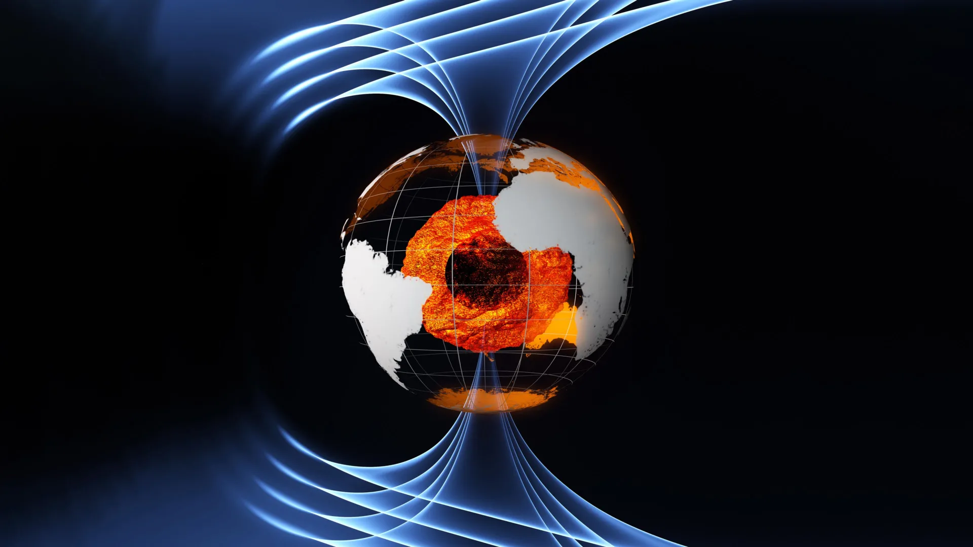
A comprehensive new study published in the Journal of Studies of Earth’s Deep Interior reveals that a massive, broad flow of molten material situated deep beneath the equatorial Pacific Ocean abruptly changed direction in 2010. Shifting away from its traditional westward creep, this colossal river of liquid iron began driving strongly eastward. The discovery was made possible by combining nearly three decades of ground-based observations with high-precision satellite data collected between 1997 and 2025, utilizing missions overseen by the European Space Agency (ESA) and international partners.
The finding fundamentally challenges the traditional view of core dynamics. Rather than a slow-moving, predictable conveyor belt, the outer core has proven to be capable of sudden, turbulent shifts that materialize over the span of a mere decade. Furthermore, researchers suggest that these dynamic surface changes in the outer core may be intrinsically linked to activity occurring even deeper within the planet, potentially connecting fluid movements in the outer core to behavioral shifts in Earth’s solid inner core.
While these subterranean events pose no direct physical threat to human life or surface climate stability, they offer vital clues regarding the origin and evolution of Earth’s magnetic field—the invisible shield that protects the planet from deadly solar radiation.
Chronology of Discovery: Tracking the Subterranean Shift
To understand how scientists managed to "see" thousands of kilometers beneath the Earth’s surface without drilling a single hole, researchers had to piece together a multi-decade timeline of magnetic observations.
1997–2009: The Long Baseline of Quiet Variations
For generations, scientists relied heavily on ground-based magnetic observatories scattered across the globe to monitor minuscule variations in Earth’s geomagnetic field. Because the magnetic field is generated by the geodynamo—the churning movement of molten iron around the solid inner core—these surface measurements act as a proxy for what is happening deep below.
Beginning in the late 1990s, space agencies began deploying dedicated magnetic-monitoring satellites to refine these observations. Data from Denmark’s Ørsted mission (launched in 1999) and Germany’s CHAMP mission (launched in 2000) provided unprecedented global coverage. During this baseline period (1997 through the late 2000s), analytical models confirmed that large-scale circulation near the core-mantle boundary was characterized by a weak, stable westward flow, particularly beneath the Pacific basin.
2010: The Turning Point Beneath the Pacific
The steady baseline shattered around 2010. Advanced data modeling by researchers at the University of Edinburgh’s School of Geosciences revealed that the weak westward flow beneath the equatorial Pacific abruptly stalled and reversed. A broad, high-volume region of iron-rich fluid pivoted, initiating a powerful eastward migration.
Because the change occurred deep within the planet, it took years of high-resolution data processing to isolate the signal from "noise" generated by Earth’s crust, oceans, ionosphere, and magnetosphere.
2013–Present: The Swarm Era and the 2017 Geomagnetic Jerk
In November 2013, the European Space Agency launched its trio of Swarm satellites. Placed into carefully coordinated polar orbits, the Swarm constellation was specifically designed to untangle the complex web of magnetic signals originating from Earth’s core, crust, and upper atmosphere with unprecedented precision.
Although Swarm launched shortly after the 2010 reversal event took place, its continuous, high-precision global coverage allowed researchers to track the downstream consequences of the shift. The satellite data successfully identified abrupt structural changes linked not only to the Pacific reversal but also to the so-called "geomagnetic jerk" of 2017—a sudden, sharp change in the acceleration of Earth’s magnetic field.
2020–2025: Weakening Flows and New Questions
According to the latest research models stretching through 2025, the dramatic eastward flow beneath the Pacific has not maintained its peak intensity. Scientists have observed that the current has begun to weaken since 2020. This recent deceleration has opened up a compelling debate: Was the 2010 reversal a short-lived fluctuation, the peak of a repeating natural oscillation, or the establishment of a new stable equilibrium for core circulation?
Supporting Data: The Technological Marvel of Core-Sensing Satellites
Peering into the Earth’s interior requires overcoming monumental scientific hurdles. Seismic waves from earthquakes help map solid structures, but liquid iron absorbs or scatters seismic energy differently, making fluid dynamics in the outer core largely invisible to seismology. Instead, researchers must track the magnetic fields generated by these moving conductors.
This is where orbital infrastructure becomes indispensable.
The ESA Swarm Constellation
The Swarm mission consists of three identical satellites: Alpha and Bravo flying side-by-side at a lower altitude, and Charlie flying in a slightly higher orbit. Equipped with highly sensitive scalar and vector magnetometers, the constellation maps the spatial distribution and temporal evolution of Earth’s magnetic field down to incredible margins of error.
By comparing measurements across the constellation, scientists can mathematically separate the internal magnetic field (generated by the core) from external magnetic fields (driven by solar wind and atmospheric currents). This spatial filtering enabled researchers to reconstruct changing flow patterns precisely at the core-mantle boundary, approximately 2,880 kilometers down.
Multimission Synergy
The research published in the Journal of Studies of Earth’s Deep Interior did not rely on a single satellite generation. By synthesizing datasets spanning nearly thirty years—incorporating the Ørsted, CHAMP, and CryoSat missions alongside Swarm and decades of ground-station logs—the research team constructed a remarkably robust timeline. CryoSat, primarily designed for ice monitoring, and other altimetry and geodetic platforms contributed auxiliary data that helped refine models of Earth’s mass distribution and rotational dynamics.
Official Responses and Expert Perspectives
The unexpected findings have drawn commentary from leading geophysicists and space agency mission managers, highlighting the profound implications for Earth sciences.
Frederik Dahl Madsen, lead author of the study from the University of Edinburgh’s School of Geosciences, emphasized the mystery surrounding the event.
"The large-scale flow reversal beneath the Pacific raises new questions about the behavior of Earth’s deep interior," Madsen noted. "Scientists now want to understand whether the reversal represents a short-lived fluctuation, part of a repeating oscillation, or a new stable equilibrium for core circulation. Continued monitoring will be essential to determine how the flow evolves over the coming years."
Madsen also pointed out a fascinating temporal coincidence: the rise of the strong eastward flow in 2010 aligns closely with behavioral changes detected in Earth’s solid inner core via geodesy and seismology.
"We hypothesize that these changes in the deep interior are associated with the changes in flow beneath the Pacific," he added.
From the European Space Agency, mission leadership underscored the critical value of long-term Earth observation programs. Anja Stromme, ESA’s Swarm Mission Manager, pointed out that the mission’s longevity has transformed our understanding of planetary dynamics.
"Although Swarm was launched after the dramatic reversal event of 2010, it has provided high-precision data that tell us about Earth’s inner core in the period that followed," Stromme stated. "Importantly, Swarm provides continuous global coverage over many years, allowing scientists to track how core dynamics evolve over time rather than relying only on ground-based magnetic observatories."
Elisabetta Iorfida, ESA’s Swarm Mission Scientist, elaborated on how the discovery challenges orthodox geological models.
"This study shows that regional changes can emerge rapidly within just a decade," Iorfida explained. "The findings may also help scientists investigate possible interactions between Earth’s outer core, inner core, lower mantle and, therefore, give more insights into the core-mantle boundary, which is a critical region for deep Earth dynamics."
She concluded that ongoing satellite missions are shattering the illusion of a static underworld:
"This research raises intriguing questions about how Earth’s deepest layers are dynamically connected… revealing that Earth’s core may be far more variable and complex than once believed."
Implications: Why the Restless Core Matters to Life on Earth
While the roiling rivers of liquid iron 2,200 kilometers below the Pacific do not present a localized physical hazard—there are no volcanoes, earthquakes, or tsunamis directly triggered by this specific core flow—the broader mechanics of the outer core are vital to the survival of technological civilization.
The Planetary Shield
The primary function of the geodynamo is the generation of Earth’s geomagnetic field. As thermal and compositional convection drives liquid iron around the solid inner core, electrical currents are established, creating a colossal magnetic dipole field that extends thousands of kilometers into space.
This magnetic shield deflects the solar wind—a continuous stream of charged particles and high-energy radiation ejected by the Sun. Without this protective barrier, solar storms would gradually strip away Earth’s atmosphere, wither the ozone layer, and render surface life vulnerable to sterilizing radiation. Furthermore, intense solar radiation would routinely cripple global satellite networks, power grids, and communication infrastructures.
Navigation and Space Weather
Because the magnetic field is continuously shaped by the fluid movements in the outer core, the field itself is always drifting and evolving. Compasses shift, magnetic north migrates, and regional field intensities fluctuate.
Understanding the chaotic, variable nature of the core helps geophysicists improve predictive models of geomagnetic evolution. These models are essential for:
- Aviation and Maritime Navigation: Ensuring accurate compass calibration and inertial navigation backup systems.
- Satellite Operations: Anticipating orbital drag variations and radiation hazards during solar maximums.
- Space Weather Forecasting: Protecting high-voltage terrestrial power grids from unexpected geomagnetically induced currents (GICs).
A New Chapter in Deep Earth Science
Ultimately, the discovery that regional core flows can reverse in a decade opens a thrilling new chapter in geoscience. It bridges the gap between surface observations and the inscrutable physics of the deep mantle and core. As the ESA Swarm constellation and future satellite missions continue their vigil overhead, humanity is gaining an unprecedented, real-time window into the turbulent heart of our world—proving that even beneath our feet, the Earth remains a realm of profound, dynamic wonder.
