

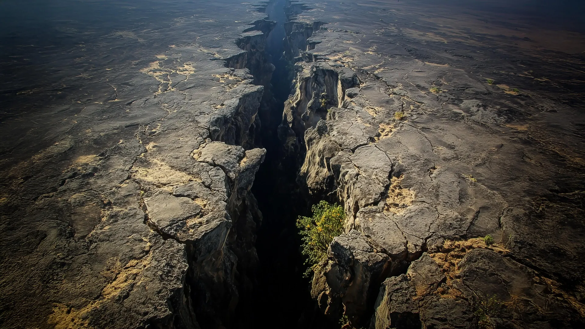
Main Facts: A Paradigm Shift in Understanding Continental Breakup
Deep beneath the surface of the African continent, a colossal geological engine is reshaping the Earth. Recent breakthroughs in high-powered 3D computer modeling have provided scientists with a compelling explanation for a long-standing geological riddle within the East African Rift System (EARS)—the largest active continental rift on the planet.
For over a decade, precision GPS measurements have tracked an unusual, baffling pattern of tectonic movement. While standard geological models dictate that continental rifting should cause the Earth’s crust to stretch exclusively outward and perpendicular to the axis of the fracture, researchers have discovered a parallel motion. Parts of East Africa are actively deforming in a direction running parallel to the rift itself, accompanied by a matching signature in the way seismic waves travel through the subterranean rock.
The culprit, according to a pivotal study published in the Journal of Geophysical Research, is the African Superplume. This massive upwelling of intensely hot mantle material originates deep within the Earth beneath southwestern Africa and ascends northeastward across the continent, becoming increasingly shallow as it rises.
Rather than viewing continental rifting as a simple, surface-level tearing of the Earth’s outer shell, the new findings illustrate a complex, multi-layered geological dance. The EARS is driven by a dual-force mechanism: shallower buoyancy forces pull the crust apart laterally, while deep-seated mantle traction forces from the African Superplume divert surface motion and align deep rock structures northward. This revelation transforms our fundamental understanding of how supercontinents fracture and split over millions of years.
Chronology: Unraveling a Decades-Long Geological Mystery
The discovery of anomalous rift-parallel motion was not an overnight breakthrough; it was the culmination of more than twelve years of painstaking fieldwork, technological advancement, and theoretical modeling.
Phase One: The GPS Revolution and Initial Anomalies (Early 2010s)
The journey began when geophysicist D. Sarah Stamps, then a postdoctoral researcher and now an associate professor in the Department of Geosciences at Virginia Tech, began analyzing data from a dense network of GPS stations deployed across East Africa. These stations tracked signals from over 30 satellites orbiting roughly 25,000 kilometers above the Earth.
Using this technology, Stamps and her colleagues achieved millimeter-scale precision in tracking surface deformation. Conventional wisdom and textbook models dictated that tectonic plates should pull apart cleanly, creating surface faults and earthquakes perpendicular to the rift. However, the data revealed a persistent, undeniable anomaly: parts of the crust were sliding parallel to the rift valley. This unexpected motion became the central fixation of Stamps’s research group at the Geodesy and Tectonophysics Lab.
Phase Two: Testing the Dual-Force Hypothesis (2020–2021)
For years, the scientific community debated the primary drivers behind the EARS. Hypotheses generally clustered around two major forces:
- Lithospheric buoyancy forces, which operate close to the surface and are governed by variations in elevation and density.
- Mantle traction forces, which originate deep within the Earth’s interior and are driven by the movement of flowing mantle beneath the rigid crustal plates.
In a milestone 2021 study, Stamps’s team deployed early 3D computational simulations to test how these forces might interact. Those models confirmed that lithospheric buoyancy forces successfully explained the standard, perpendicular stretching of the crust. However, they completely failed to replicate the anomalous, parallel movement. The mystery of the sideways motion remained unsolved, pushing the team to look deeper into the Earth.
Phase Three: Thermomechanical Modeling and the Superplume Discovery (Recent Study)
To crack the case, Tahiry Rajaonarison, a former Ph.D. student in Stamps’s lab who is now a postdoctoral researcher at New Mexico Tech, engineered advanced 3D thermomechanical models. Serving as the first author on the newer study, Rajaonarison focused intensely on the unexplained parallel deformation.
By simulating the thermal and mechanical properties of the Earth’s interior over vast geological timescales, the team successfully linked the surface anomalies to the northward migration of the African Superplume. Furthermore, the models accurately predicted rift-parallel seismic anisotropy—the specific directional alignment of subterranean rocks—providing the smoking gun that tied deep mantle dynamics directly to surface observations.
Supporting Data: The Mechanics of Silly Putty and Seismic Waves
To comprehend the complex forces at play within the East African Rift, geophysicists often rely on analogies that bridge the gap between microscopic material science and planetary-scale dynamics.
The Lithosphere as "Silly Putty"
The Earth’s outer shell—known as the lithosphere—includes both the brittle crust and the uppermost solid mantle. When tectonic stresses are applied, this shell exhibits viscoelastic properties that depend entirely on time and depth.
Dr. D. Sarah Stamps frequently compares the behavior of the lithosphere to a familiar toy: Silly Putty.
"If you hit Silly Putty with a hammer, it can actually crack and break," Stamps explains. "But if you slowly pull it apart, the Silly Putty stretches. So on different time scales, Earth’s lithosphere behaves in different ways."
Near the surface, where temperatures and pressures are relatively low, rocks behave rigidly; when stressed, they fracture, creating faults and generating earthquakes. Deeper down within the lithosphere, higher temperatures cause the rocks to soften, allowing them to deform gradually and plastically over thousands or millions of years.
Unpacking Seismic Anisotropy
A critical line of evidence supporting the African Superplume hypothesis comes from seismology, specifically the study of seismic anisotropy.
Seismic waves—generated by earthquakes or artificial sources—travel through the Earth in all directions. However, when subsurface rocks and minerals become structurally aligned due to intense directional stress or flowing mantle material, these waves travel faster in some directions than others.
Beneath the East African Rift, seismologists detected a distinct pattern: seismic waves moving parallel to the rift behave differently than those moving across it. Rajaonarison’s 3D thermomechanical models successfully reproduced this exact signature. The alignment of the subterranean minerals matches the trajectory of the northward mantle flow generated by the African Superplume, proving that deep mantle dynamics leave an indelible fingerprint on the upper crust.
Official Responses and Expert Insights
The implications of these findings have resonated deeply throughout the global geosciences community, challenging long-held assumptions about how continents break apart.
Refining the roles of surface versus deep-earth drivers, Tahiry Rajaonarison emphasized that the new research does not discard established theories, but rather expands upon them:
"We are saying that the mantle flow is not driving the east-west, rift-perpendicular direction of some of the deformations, but that it may be causing the anomalous northward deformation parallel to the rift," Rajaonarison noted. "We confirmed previous ideas that lithospheric buoyancy forces are driving the rift, but we’re bringing new insight that anomalous deformation can happen in East Africa."
Reflecting on the collaborative effort behind the breakthrough and the power of numerical modeling, Dr. D. Sarah Stamps shared her enthusiasm for the future of tectonic research:
"We’re excited about this result from Dr. Rajaonarison’s numerical modeling because it provides new information about the complex processes that shape the Earth’s surface through continental rifting," Stamps stated.
Geologists not directly involved in the study have praised the research for successfully bridging the gap between shallow surface geodesy and deep-earth geodynamics. By demonstrating that mantle plumes can induce complex, multi-directional surface strain, the study offers a robust framework that may eventually be applied to other complex rift systems around the world, such as the Baikal Rift in Russia or the West Antarctic Rift System.
Implications: A New Era for Continental Rifting Models
The East African Rift System is widely regarded by geologists as the world’s premier natural laboratory. Spanning thousands of kilometers through countries like Ethiopia, Kenya, Uganda, and Tanzania, the rift represents the early stages of continental breakup—a process that, over tens of millions of years, can eventually give birth to entirely new oceans and ocean basins (much like how the separation of Africa and South America formed the Atlantic Ocean).
However, the realization that continental rifting is governed by a complex interplay of shallow buoyancy forces and deep mantle traction fundamentally changes how scientists model these catastrophic planetary events.
1. Rewriting Textbook Tectonics
For decades, plate tectonics models often treated the lithosphere and the underlying asthenosphere as largely decoupled systems, or assumed that mantle forces operated uniformly. The EARS research proves that deep-seated mantle plumes can exert localized, directional traction that forces surface crust to slide in unexpected ways. Future tectonic models must account for these three-dimensional, multi-layered interactions to accurately predict how and where continents will fracture.
2. Enhanced Hazard Assessment and Resource Exploration
While continental rifting occurs on geological timescales spanning millions of years, the immediate consequences—volcanism, seismic activity, and rapid landscape evolution—pose direct hazards to millions of people living along the East African Rift. Understanding the precise mechanical forces driving faults and earthquakes helps seismologists better assess geological hazards in the region. Furthermore, mapping deep mantle plumes and crustal deformation patterns provides critical data for geothermal energy exploration and resource management in the East African Rift Valley.
3. The Broader Horizon
As researchers continue to refine their 3D thermomechanical models, the methodology pioneered by Stamps, Rajaonarison, and their colleagues sets a new gold standard for geodetic and geophysical research. By combining millimeter-scale GPS surface tracking with supercomputer-driven interior simulations, science is finally peering past the Earth’s crust to decode the complex, hidden machinery that continually reinvents our planet’s surface.
