

When outdoor enthusiasts whisper about trekking in "The Natural State," their minds invariably wander to remote and storied geographies. They envision the rugged, 223-mile-long Ouachita Trail winding through deep pine forests, the misty morning hollows of the Buffalo National River, or the challenging climbs along the Ozark Highlands Trail. Arkansas possesses a storied pedigree of wilderness adventure, but a major chapter of its outdoor story is routinely overlooked: its capital city.
Best known for its pivotal civil rights history, vibrant culinary scene, and striking juxtaposition of historic and modern architecture, Little Rock sits quietly amidst a staggering wealth of accessible wilderness. Following a summer exploration through the region, it becomes immediately clear that this metropolitan center deserves a prominent spot on any road trip itinerary as a legitimate, fully realized hiking basecamp. Within minutes of downtown, travelers can trade city streets for boulder-strewn bluffs, dense canopies, and panoramic river vistas.
Main Facts: A Capital Surrounding by Wilderness
Named La Petite Roche (the little rock) by French explorers who mapped the prominent rock outcropping and tall bluffs on the south bank of the Arkansas River, Little Rock serves as a geographic and cultural anchor for Central Arkansas. Yet, its true hidden value lies in its topography.
The city is surrounded by an extensive network of state parks, natural areas, and municipal green spaces that offer everything from technical, heart-pumping mountain summits to flat, family-friendly river walks. Best of all? Every major trail system within a 15-mile radius of the city center is entirely free to access and welcomes leashed dogs, making it one of the most inclusive and economically accessible outdoor hubs in the country.
Local hospitality often provides the best compass for unearthing these hidden gems. Guided by the insights of Jasmin Williams, general manager of a downtown hotel, a summer itinerary quickly filled with adventures ranging from scrambling over ancient rock formations to navigating tranquil valley singletracks—all without spending hours behind the wheel.

Chronology: A Weekend Itinerary of Sweat and Scenery
Day 1: Conquering the Pinnacle
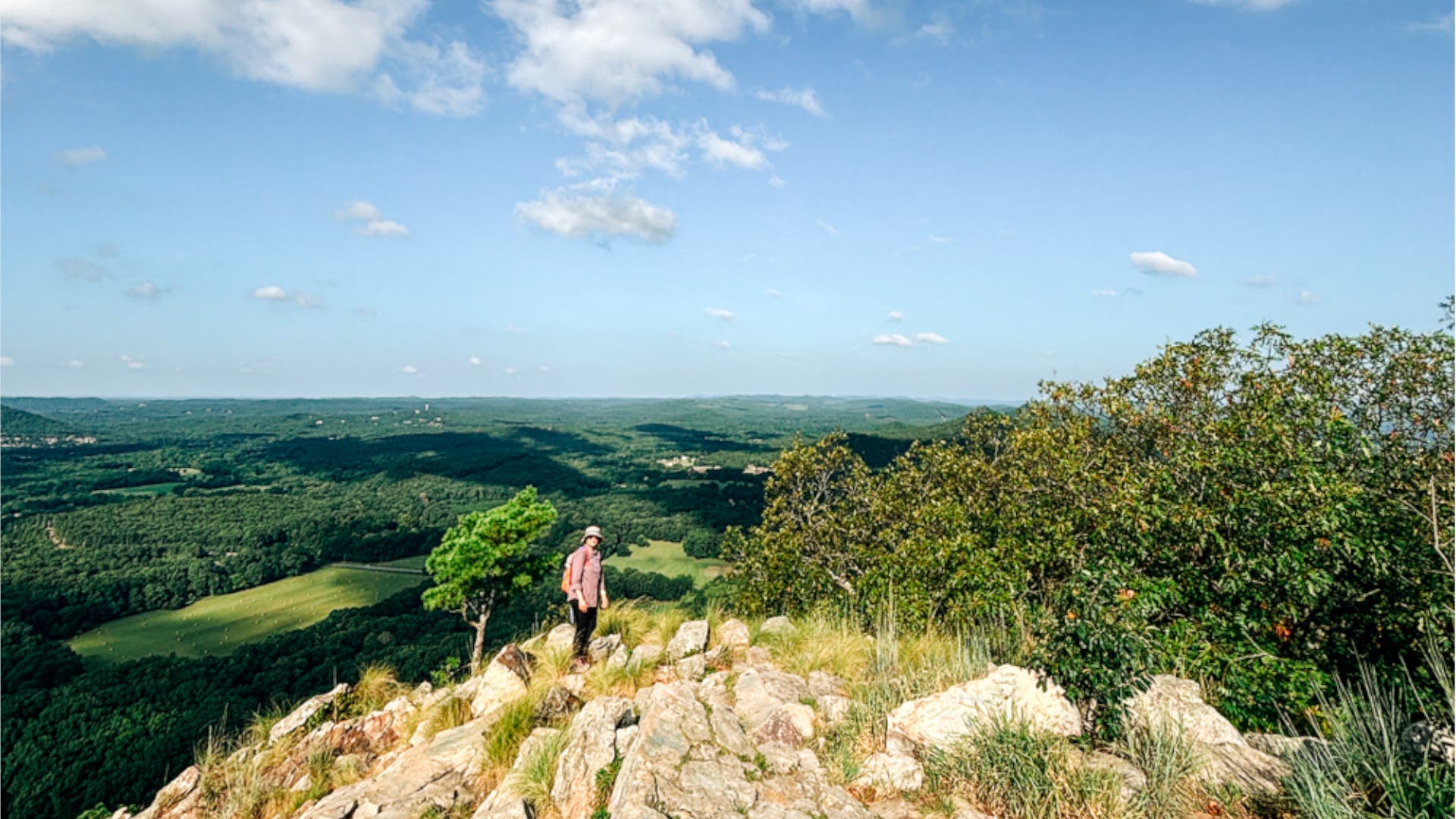
Located roughly 15 miles west of downtown, Pinnacle Mountain State Park serves as the definitive introduction to Central Arkansas geography. Spanning over 33 miles of diverse terrain, the park’s crown jewel is the 1,011-foot Pinnacle Mountain, a prominent peak visible for miles across the Arkansas River Valley.
The ascent began via the East Summit Trail, a grueling 0.75-mile route characterized by steep, technical boulder-scrambling. Requiring steady footing and hand-over-hand climbing, the trail rewards the effort with sweeping views of Lake Maumelle and the surrounding valley. For the descent, hikers can opt for the more forgiving West Summit Trail, a 1.3-mile path with a gentler grade that shares a trailhead with the flat, paved 0.5-mile Kingfisher Trail. This combination delivers an optimal balance of high-altitude exertion and recovery.
Day 2: Quarry Rims and Quiet Ridges
Crossing the Arkansas River into North Little Rock on the second morning brings visitors to Emerald Park. Tucked along the rim of the historic Big Rock Quarry, this park trades the towering heights of Pinnacle Mountain for dramatic industrial-meets-natural vistas. Trails wind past sheer limestone bluffs before dropping down singletrack sections toward the quarry floor, culminating in breathtaking sunset views of the river and the Little Rock skyline.
Later in the day, the journey shifts west to the Rattlesnake Ridge Natural Area. Spanning 373 acres of rugged terrain managed by The Nature Conservancy, this area offers a more solitary wilderness experience. Recommended specifically to avoid the heavier weekend crowds found on longer regional routes, Rattlesnake Ridge features exposed rock, technical singletrack, and distant views of the rising Ouachita Mountains, sharing its trails with local mountain bikers.
Day 3: Urban Escapes and Architectural Marvels
No hiking tour of Little Rock is complete without experiencing its seamless integration of urban infrastructure and natural preservation. Burns Park, situated in North Little Rock, stands as one of the largest municipal parks in the state. Roughly 15 miles of wooded, rolling trails wind through the property, occasionally intersecting with a local disc golf course and a BMX track just seven miles from the city center.
The grand finale unfolds along the Arkansas River Trail. While the total paved loop spans an ambitious 88 miles across both banks of the river and out toward Two Rivers Park, a short walk leads to the iconic Big Dam Bridge. As one of the longest pedestrian and bicycle bridges in the world, it offers a stunning vantage point of the locks, dams, and rolling waters that define the region’s geography.
Supporting Data: By the Numbers
To understand the sheer scale of Little Rock’s outdoor infrastructure, consider the following metrics:
- 33+ Miles: The trail network available at Pinnacle Mountain State Park alone.
- 1,011 Feet: The summit elevation of Pinnacle Mountain, offering unobstructed regional views.
- 373 Acres: The protected wilderness expanse of the Rattlesnake Ridge Natural Area.
- 88 Miles: The full perimeter of the interconnected Arkansas River Trail system.
- 15 Miles: The maximum distance from downtown Little Rock to any of the region’s major primary trailheads.
- $0: The admission cost across all state parks, natural areas, and municipal trails mentioned.
Official Responses and Perspectives
Local tourism boards and hospitality leaders have increasingly recognized the economic and cultural value of promoting Little Rock as an outdoor destination.
"For years, travelers viewed Little Rock strictly as a cultural stopover—a place to see historical landmarks and museums before driving off to the Ozarks or Ouachitas," notes regional tourism coordination officials. "What we are seeing now is a paradigm shift. Visitors realize they don’t have to sacrifice urban amenities to get world-class trail access. You can eat at a James Beard-nominated restaurant downtown at night and stand on a 1,000-foot peak by sunrise."
Hotel management echoed similar sentiments regarding guest behavior. "We regularly have guests check in asking where the closest gym is," says Jasmin Williams. "When we point them toward Pinnacle Mountain or Emerald Park—both just minutes away—their entire itinerary changes. They extend their stays to explore the green spaces."
Implications: The Future of Urban-Adjacent Adventure
The rise of Little Rock as a premier hiking basecamp highlights a broader national trend in outdoor recreation: the democratization of adventure. As travelers increasingly seek wellness-focused vacations that blend active outdoor pursuits with cultural immersion, cities that successfully bridge the gap between wilderness and metropolitan convenience gain a distinct advantage.
By preserving natural spaces like Rattlesnake Ridge and maintaining multi-use corridors like the Arkansas River Trail, Central Arkansas proves that economic development and environmental conservation can coexist. For road-trippers planning a journey through the South, Little Rock forces a rewrite of the conventional travel playbook—transforming a capital city from a place you pass through into a destination where your boots finally hit the dirt.
