

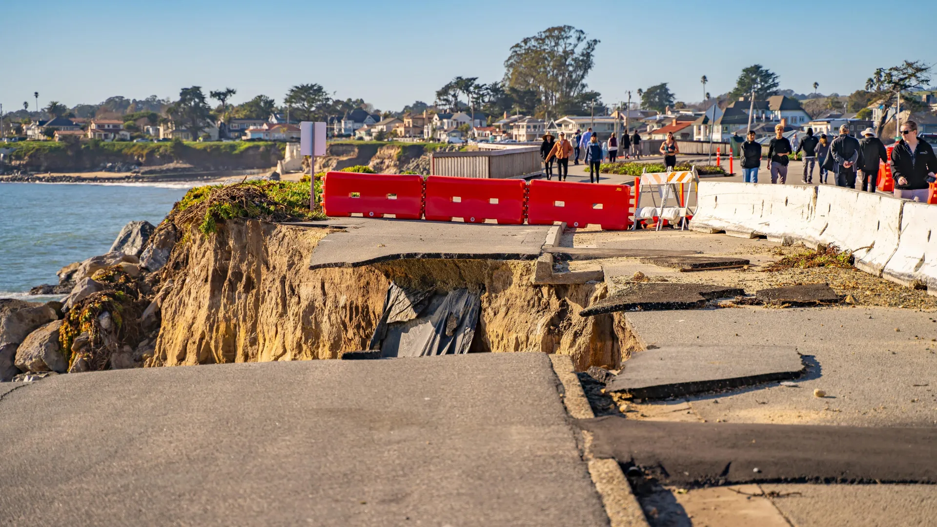
SAN FRANCISCO — For decades, seismologists studying the seismic hazards of the Western United States have treated the Pacific Northwest’s Cascadia Subduction Zone and California’s infamous San Andreas Fault as two distinct, albeit equally terrifying, geological threats. The Cascadia Subduction Zone, a massive 600-mile fault stretching from British Columbia to Northern California, is capable of producing a magnitude 9 or greater "megathrust" earthquake. Such an event would unleash cataclysmic ground shaking, towering tsunamis, and widespread landslides, rewriting the geography of the Pacific Northwest. Meanwhile, the San Andreas Fault—the slide-zone boundary slicing through California—periodically lets loose its own catastrophic tremors, such as the devastating 1906 San Francisco earthquake.
Yet, a landmark study published in the journal Geosphere suggests that these two tectonic powerhouses may not act independently. According to the research, a catastrophic "really big one" in the Pacific Northwest could act as a geological trigger, setting off a powerful, closely timed earthquake along the San Andreas Fault.
The findings fundamentally challenge how geologists assess seismic risk along the entire Western seaboard, transforming what was once considered a theoretical worst-case scenario into a scientifically plausible, multi-state catastrophe.
Main Facts: The Intersection of Two Tectonic Giants
The western edge of the United States sits atop one of the most geologically volatile regions on Earth. North of Cape Mendocino, California, the Juan de Fuca tectonic plate is relentlessly being forced beneath the North American plate, creating the Cascadia megathrust. South of Cape Mendocino, the tectonic regime shifts: the Pacific plate and the North American plate slide horizontally past one another along the San Andreas Fault system.
For years, scientists assumed these two massive tectonic systems operated under different mechanical controls and timeframes. However, the new Geosphere study indicates that the boundary where these systems meet—near the Mendocino Triple Junction—is far more porous and interconnected than previously understood.
- The Trigger: A magnitude 9 or greater earthquake originating in the Cascadia Subduction Zone.
- The Secondary Threat: A subsequent major rupture along California’s San Andreas Fault.
- The Timeline: Geological evidence suggests the second earthquake could follow the first within a terrifyingly short window—ranging from minutes and hours to a slightly extended sequence.
- The Discovery: The groundbreaking insight emerged entirely by accident during a 1999 marine research cruise.
"It’s kind of hard to exaggerate what a M9 earthquake would be like in the Pacific Northwest," says Dr. Chris Goldfinger, a paleoseismologist at Oregon State University and the lead author of the study. "And so the possibility that a San Andreas earthquake would follow, it’s movie territory."
Chronology: The Accidental Discovery That Changed Seismology
The realization that Cascadia and the San Andreas Fault might be seismically coupled did not stem from computer models or theoretical physics. It was born from a simple human error out on the open ocean.
1999: The Wrong Latitude
In 1999, a team of marine geologists embarked on a research cruise with a specific, narrow objective: to study ancient Cascadia earthquakes by collecting sediment cores from the seafloor off the coast of the Pacific Northwest. Their goal was to map the historical frequency of prehistoric megathrust events along the northern margin.
However, an overnight navigation blunder completely altered the trajectory of the study. A graduate student on watch duty mistakenly entered the wrong latitude coordinates into the ship’s navigation system. Over the course of the night, the research vessel drifted approximately 90 kilometers (about 56 miles) south of its intended target zone.
By morning, the ship had sailed out of the Cascadia region entirely and crossed into the waters off northern California—an area heavily influenced by the San Andreas Fault system.
"We wound up off northern California," recalls Dr. Goldfinger. "When I woke up, I was pretty hot. But, once we were there, I thought, ‘well, let’s take a core here.’"
The Noyo Canyon Breakthrough
That impromptu decision to drop coring equipment into Noyo Canyon, near Fort Bragg, California, changed the course of paleoseismology. As researchers analyzed the sediment samples hauled up from the seafloor, they discovered an extraordinary, unbroken geological archive stretching back roughly 3,000 years.
Embedded within the sediment layers were repeated sequences of turbidites—deposits left behind by underwater landslides, known as turbidity currents, that rush down the continental slope following major seismic shaking. Typically, a single turbidity event leaves behind a predictable, graded layer of sediment: heavier, coarse sand settles first at the bottom, followed progressively by finer silt and clay grains near the top.
Yet, as the team examined the Noyo Canyon cores alongside samples from Cascadia, they found something baffling: many of the deposits appeared in unnatural, upside-down pairs.
"There were these big, thick, sandy doublet events where it had a fine-grained element, and on top of it was a very coarse-grained sandy unit. And we were just scratching our heads," Goldfinger says.
Supporting Data: Decoding the Geological Fingerprints
To understand the meaning of these anomalous "doublet" sediment layers, the research team turned to advanced laboratory techniques and chronological dating.
Radiocarbon Dating and Shared Timelines
By subjecting the organic material trapped within the sediment layers to high-precision radiocarbon dating, the researchers reconstructed the timeline of when these deposits were laid down.
The results were startling. Many of the paired sediment deposits found north and south of Cape Mendocino had formed at virtually the exact same time, well within the margins of dating error. This tight synchronization across hundreds of miles of coastline strongly pointed to a shared, systemic cause rather than a series of isolated, coincidental local slides.
The Upside-Down Stratigraphy Hypothesis
After systematically ruling out alternative explanations—such as localized storms, tsunamis generated by distant storms, or isolated submarine slope failures—the researchers formulated a unifying hypothesis: each pair of sediment layers recorded two separate, tightly linked seismic events.
According to this model, the first layer of the doublet is laid down by a massive Cascadia megathrust earthquake. The intense shaking triggers a weaker, initial turbidity current near the San Andreas Fault zone. Shortly thereafter, the seismic stress transfer causes the San Andreas Fault itself to rupture, triggering a second, much heavier, coarse-grained sandy deposit that rushes down the canyon to cap the first layer.
"A lightbulb went on and we realized that the Noyo channel was probably recording Cascadia earthquakes, and that at a similar distance, Cascadia sites were probably recording San Andreas earthquakes," Goldfinger explains. "Well, what if? What if Cascadia went off and triggered a weak turbidity current near the San Andreas, and then the San Andreas went off some time later and triggered a very coarse, sandy deposit to come down? It would create this upside-down doublet stratigraphy."
Official Responses and Scientific Reception
The publication of the Geosphere study has sent ripples through the geological and emergency management communities. While the findings are based on robust paleoseismological data, they introduce complex questions regarding how hazard maps and structural building codes are formulated along the West Coast.
Rethinking Regional Hazard Models
Historically, federal and state agencies—including the U.S. Geological Survey (USGS)—have evaluated fault systems largely as isolated units. Emergency preparedness exercises, such as the famous "Great ShakeOut" drills, typically focus on a single catastrophic scenario: a standalone Cascadia quake or a major San Andreas event.
The new data suggests that emergency planners may need to account for compounding, multi-fault disaster scenarios. If a Cascadia mega-quake can prime or immediately trigger a San Andreas rupture, emergency response resources would be stretched simultaneously across Washington, Oregon, and California.
State geological surveys along the Pacific Coast are currently reviewing the Geosphere findings to determine whether multi-fault ruptures should be incorporated into future probabilistic seismic hazard assessments (PSHAs). These assessments dictate everything from municipal zoning laws and bridge reinforcement standards to hospital construction requirements and insurance rates.
Implications: Preparing for a Cascading West Coast Disaster
The prospect of a coupled Cascadia-San Andreas earthquake sequence carries profound implications for millions of residents living along the U.S. Pacific seaboard.
Strain on Emergency Infrastructure
Emergency response systems are fundamentally designed to operate under the assumption of regional localization. Following a major disaster, unaffected neighboring states and federal agencies rush personnel, medical supplies, and search-and-rescue teams into the impact zone.
However, a cascading earthquake sequence spanning over a thousand miles of coastline would shatter this paradigm. If major urban centers in Washington, Oregon, and Northern California—including Seattle, Portland, and the San Francisco Bay Area—are severely damaged at the same time, mutual aid would become virtually impossible. Hospitals would be overwhelmed, major interstate highways and bridges severed, and telecommunications networks crippled across multiple jurisdictions simultaneously.
Personal Preparedness and Regional Migration
For scientists intimately familiar with the data, the psychological weight of the findings is palpable. Dr. Goldfinger, who grew up in the San Francisco Bay Area, notes that the research has fundamentally shaped his own perspective on regional risk.
"I’m from the Bay Area originally," Goldfinger says. "If I were in my hometown of Palo Alto, and Cascadia went off, I think I would drive east. There looks to me like a very high risk the San Andreas would go off next."
While abandoning the West Coast is not a practical solution for the tens of millions of people who call it home, the study underscores the urgent need for advanced earthquake early warning systems, aggressive structural retrofitting of unreinforced masonry buildings, and heightened personal preparedness. Systems like ShakeAlert, which provide seconds of warning before severe shaking arrives, could save countless lives, even in a compounding disaster scenario.
Ultimately, the accidental discovery in Noyo Canyon serves as a sobering reminder of the planet’s dynamic complexity. Beneath the scenic coastlines of the American West, the earth’s crust is bound together in ways science is only beginning to fully comprehend—proving that when it comes to tectonic forces, what happens in the Pacific Northwest may not stay in the Pacific Northwest.
